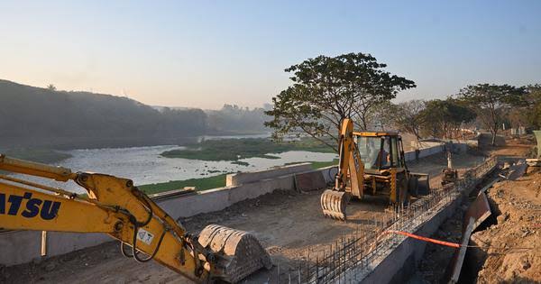
Pune Riverfront Project Draws Scrutiny Over Flood Safety
Pune: The city’s Mula-Mutha riverfront project is facing renewed scrutiny over whether its engineering approach adequately accounts for flood risk, river capacity and changing rainfall patterns. The concerns are significant because the ₹3,000-crore-class project covers about 44 km of river corridor and is explicitly intended, among other objectives, to reduce flooding while reshaping parts of the river channel. EEnvironment Clearance+1
The Pune riverfront project has been examined through environmental proceedings, technical assessments and government correspondence over several years. The central dispute is not simply about landscaping or public spaces. It concerns how much water the altered river system can safely carry during extreme events and whether the modelling reflects conditions across the wider catchment. A key issue raised by river researchers is the treatment of flood flows. The Mula-Mutha system is influenced by releases from upstream reservoirs as well as rainfall and runoff entering the rivers downstream of dams. Three major confluence zones also affect water movement. In a flood, these interactions can create backwater conditions, where rising water at one point slows drainage upstream. That matters as Pune experiences more intense rainfall events. A flood model that relies on limited flow scenarios could produce different outcomes from one that incorporates simultaneous reservoir releases, intense local rainfall and runoff from the intervening catchment. Recent proceedings before the National Green Tribunal show that authorities have disputed some of the technical objections, while official submissions state that the Central Water and Power Research Station reviewed the project’s hydrology and hydraulics. IIndian Kanoon+1
River geometry is another point of contention. Project documents submitted during the environmental approval process describe remodelling the existing channel to a more uniform section, with land created behind the river edges. The original project assessment also envisaged roads, promenades, parks and public facilities along the corridor. EEnvironment Clearance The environmental regulatory history adds another layer. The project received its original clearance in 2019, but subsequent proceedings led to additional scrutiny and revised conditions. In January 2024, the state environmental authority deferred a clearance decision while seeking further compliance and asking for specific assessment of whether channelisation could increase flooding in Pune. A revised clearance was subsequently issued in November 2024. TThe Indian Express+1
For residents, the test is ultimately measurable: whether riverfront construction improves public access without reducing the river’s ability to absorb extreme flows. As Pune expands, flood resilience needs to be assessed across the entire basin rather than only within the landscaped project boundary. Independent hydraulic review, transparent flood modelling and continuous monitoring after construction will be important if the river corridor is to become safer without transferring risk to neighbouring communities.