


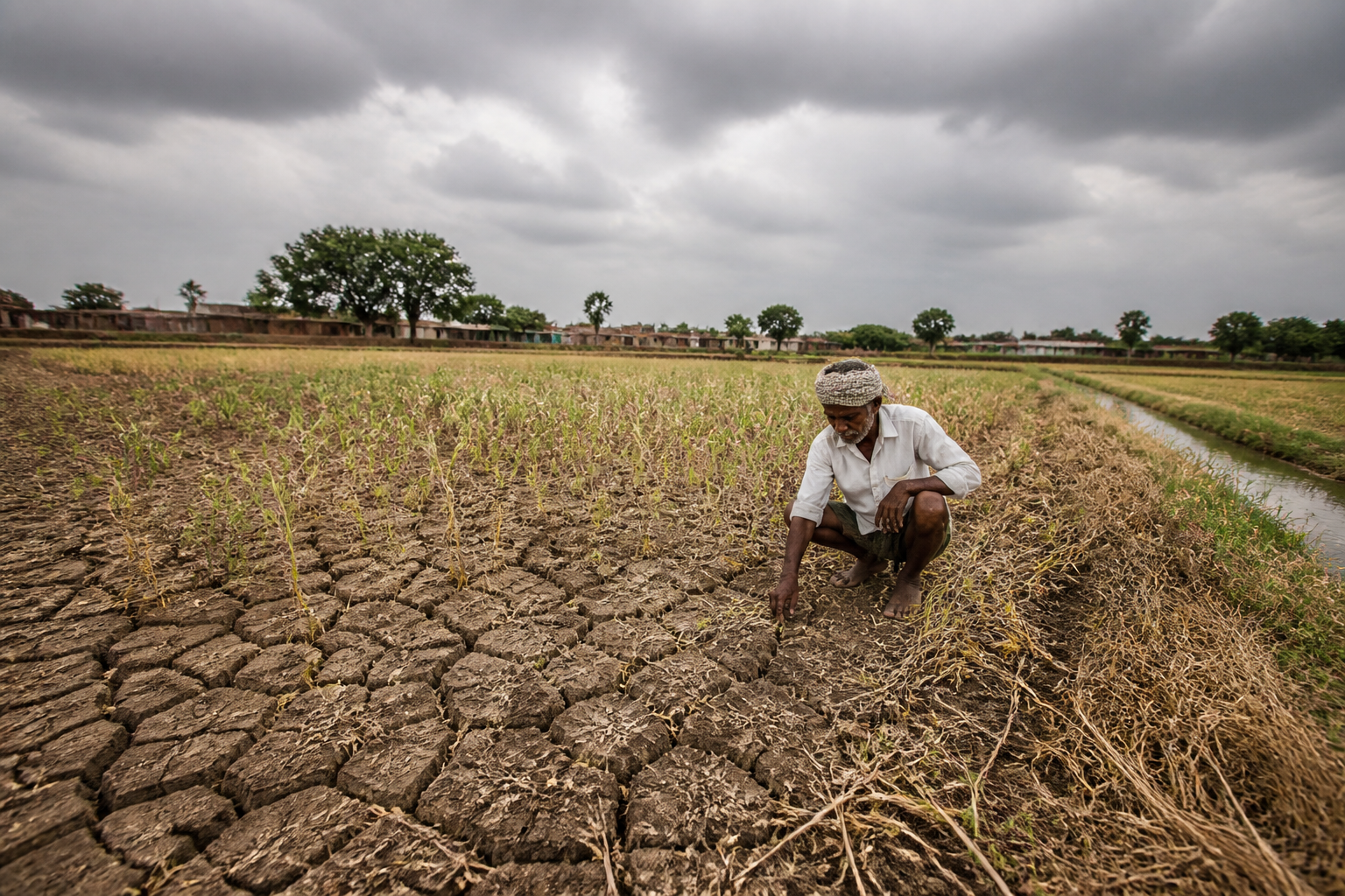
India’s drought exposure has widened to 53.2% of its landmass, according to the India Drought Monitor developed by IIT Gandhinagar’s Water and Climate Lab. The expansion, reported as the southwest monsoon enters its final weeks, raises immediate concerns for standing kharif crops and the soil moisture required for winter sowing. It also exposes how a weak and uneven monsoon can turn an agricultural weather event into a wider food-system and livelihood challenge.
The drought monitor’s estimate is significant because it does not describe a single regional pocket of rainfall failure. It indicates that more than half of India’s land area is experiencing some degree of drought, with the affected share rising from about 46% a week earlier. Within the national total, 33.4% of the country is reported to be under moderate drought or worse, 15.4% under severe drought or worse, and 3.8% under extreme drought. Exceptional drought affects another 0.1%.
These categories matter because drought is not a binary condition. The monitor’s classification presents a range of stress, from areas where rainfall and moisture deficits are beginning to affect conditions to locations facing more intense and persistent pressures. The reported increase over one week suggests that the drought footprint is still changing as the monsoon season approaches its end.
The immediate concern is the condition of crops already standing in the fields. Kharif cultivation depends on the southwest monsoon, and the Economic Times report states that El Niño-induced drought-like conditions are raising concerns about crop yields and soil moisture. The supplied report does not provide crop-wise production estimates or state-wise yield forecasts, so the precise scale of losses is not established. What it does establish is that the moisture situation has deteriorated at a point when farmers are still managing current-season crops and preparing for the next planting window.
## What the India drought data shows
The drought monitor’s 53.2% figure has to be read alongside rainfall data from the India Meteorological Department. India’s cumulative southwest monsoon rainfall was about 15% below normal, while 41% of the 734 districts monitored by the IMD were rainfall deficient and another 6% were classified as large deficient as of Tuesday, according to the report.
Together, these figures show two different ways of measuring the same national stress. The drought monitor assesses conditions across land areas and grades their severity. The IMD figures track rainfall performance across districts. Neither number alone describes the full impact on farms, reservoirs, groundwater or settlements. However, their combination indicates that rainfall deficiency is geographically broad and that the problem extends beyond a small number of isolated districts.
The distinction between land area and districts is important for interpreting the evidence. A large share of the country’s landmass under drought does not automatically translate into the same share of the population or cultivated area being affected. The supplied report does not provide those additional measurements. It also does not specify how much irrigated land, rain-fed farmland, forest area or urban land falls within each drought category. Those gaps limit any precise assessment of the human and economic impact.
Even with those limitations, the timing is consequential. The monsoon is in its final weeks, while winter sowing is approaching. Soil moisture carried into the next planting season can influence whether farmers are able to begin sowing on time and whether additional irrigation is needed. The report identifies this risk but does not provide state-level soil-moisture readings, groundwater data or official sowing projections. The concern should therefore be understood as a seasonal warning rather than a confirmed forecast of winter crop failure.
Maharashtra is described as particularly hard hit, with extreme drought affecting a large part of its agricultural areas. The report also notes varying levels of drought in other major agricultural states. It does not list the affected states individually or provide comparable percentages for them. That makes it difficult to rank regional exposure from the available evidence, but it confirms that the issue is not confined to one agricultural belt.
## Why the seasonal transition matters
The shift from the kharif season to winter sowing is more than a change in the agricultural calendar. It is a test of whether the land retains enough moisture after an underperforming monsoon. Where rainfall is deficient, farmers may have to rely more heavily on irrigation, delay sowing, change crops or reduce the area planted. Which of these responses occurs depends on local water access, crop requirements and farm-level decisions, none of which are detailed in the supplied report.
That uncertainty is itself important for public administration. A national drought percentage can communicate the scale of the problem, but implementation depends on information at district and sub-district levels. Farmers, state departments and water managers need to know not only whether an area is classified as drought-affected, but also how the condition is distributed across cultivated land, water sources and crop stages.
The report’s reference to the India Drought Monitor points to the growing importance of near-real-time assessment. A monitoring system that records changes over a weekly period can help establish whether drought is intensifying, stabilising or receding. But the report does not explain the monitor’s methodology, the data inputs used for the September 9 assessment or how its classifications are connected to government relief and response mechanisms. Those institutional links remain to be established.
The IMD’s district-level rainfall data provides another layer of administrative visibility. With 734 districts monitored, a deficiency classification can support more targeted assessment than a single national rainfall figure. Yet rainfall deficiency does not by itself measure crop damage. The same rainfall shortfall can have different consequences depending on when the rain failed, the crop being grown, the availability of irrigation and the condition of local soils.
## The urban connection is indirect but material
The reported drought is primarily an agricultural story, but its consequences do not stop at the edge of rural settlements. Cities are connected to agricultural regions through food supply chains, wholesale markets, transport networks, household budgets and migrant livelihoods. The supplied report does not state that food prices have risen, that urban supplies have been disrupted or that migration has increased. Those outcomes should not be assumed from the drought figures alone.
What can be established is that prolonged agricultural stress creates a governance requirement beyond rainfall monitoring. Urban and state authorities need to understand how rural production conditions interact with market arrivals and the purchasing power of households. The report does not provide data on prices, procurement, food stocks or urban consumption, so the scale of any such effect remains unmeasured in the available material.
The same applies to water planning. Drought classifications may cover agricultural land, but the report does not quantify reservoir storage, groundwater levels or municipal water availability. It would therefore be inaccurate to treat the 53.2% figure as a direct measure of urban water stress. The figure is better understood as a warning about the wider hydrological conditions in which both rural production and urban systems operate.
This distinction matters because public responses are often organised through separate departments. Meteorological agencies measure rainfall, drought monitors assess conditions, agriculture departments track crops, and water agencies manage supplies. The evidence in the report shows the need for these systems to be read together, but it does not establish whether such coordination is currently taking place or what decisions have been triggered.
## What remains uncertain
The most important unanswered question is how the drought categories will translate into actual crop outcomes. The report provides national percentages for drought severity and district-level rainfall deficiency, but not crop-wise damage assessments. It does not state how much kharif acreage is affected, whether standing crops have reached critical growth stages or how much soil moisture is available in the areas preparing for winter sowing.
There is also no quantified assessment of Maharashtra’s reported extreme drought exposure in the supplied material. The state is identified as particularly hard hit, but the affected agricultural area, crop mix and district distribution are not specified. Similar information is unavailable for the other agricultural states mentioned in the report.
The role of El Niño is also presented as part of the explanation for the drought-like conditions, but the material does not separate the contribution of the climate phenomenon from other factors such as the timing and distribution of rainfall. The central evidence remains the observed drought and rainfall data cited in the report, not a complete attribution study.
These limitations do not reduce the significance of the warning. They define what can responsibly be said at this stage. India is facing a broad drought footprint, below-normal cumulative monsoon rainfall and a substantial number of rainfall-deficient districts. The conditions are occurring while kharif crops remain in the fields and winter sowing approaches.
The next phase of the story will depend on more granular assessments: crop conditions, soil moisture, irrigation availability, district-level damage and the timing of winter sowing. Until those data are available, the evidence confirms a serious national moisture deficit and a heightened seasonal risk, but not the final size of crop losses or its eventual effects on cities and households.
