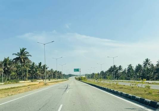
Road conditions on the Bengaluru–Kollur corridor remain uneven, with a recent 480-km journey highlighting a sharp contrast between well-maintained highways, rough diversions and difficult ghat sections. The route experience offers a useful snapshot of how road quality and last-mile connectivity can influence travel to Karnataka’s coastal and Western Ghats destinations, particularly during the monsoon.
The journey began from Chandapura at 5 am and followed the NICE Road before connecting with the highway towards Nelamangala and Channarayapatna. The four-lane section until the outskirts of Channarayapatna was reported to be in good condition, with relatively light early-morning traffic. Conditions became less consistent after the route moved towards Arsikere. Small potholes and uneven surfaces appeared initially, while sections of the highway towards Bhadravati alternated between good pavement and stretches affected by maintenance or reduced carriageway availability. Diversions around Birur and Tarikere were reported to be particularly uncomfortable, with poorer road surfaces slowing the journey. The contrast is important for a corridor connecting Bengaluru with the Western Ghats and coastal Karnataka. Long-distance road infrastructure may be strong across major highway sections, but weak links on secondary roads can substantially affect overall journey times and safety. The stretch between Bhadravati and Tirthahalli presented another mixed picture. The state highway initially had uneven surfaces before improving, with the surrounding landscape becoming increasingly forested. From Tirthahalli, navigation moved onto a narrower district road before reconnecting with NH766C near Nagara.This portion highlights a broader infrastructure challenge in Karnataka: improving connectivity does not necessarily mean widening every road. In ecologically sensitive landscapes, maintaining safe, reliable roads while limiting unnecessary construction can be a more sustainable approach.
Better signage, drainage, pavement maintenance and carefully managed road improvements can provide connectivity without significantly altering forested areas. The final approach towards Kollur exposed the most difficult section. NH766C was described as being in reasonable condition until the ghat and Kodachadri Reserve Forest area, where road quality deteriorated considerably. Rain during the journey further complicated driving conditions. The entire journey took nine hours and 35 minutes, covering approximately 480.7 km. For travellers, the experience underlines the importance of daylight travel on difficult mountain sections, especially during wet weather. From an infrastructure perspective, the route demonstrates why road quality should be assessed as a continuous network rather than by individual highways. A well-built four-lane corridor can still deliver an inconsistent travel experience if connecting roads, diversions and mountain approaches remain poorly maintained. For Karnataka’s tourism and regional economy, dependable road connectivity can support smaller towns and local businesses along the corridor. But that growth needs to be balanced with the ecological sensitivity of the Western Ghats.
The priority, therefore, is not simply faster travel. Consistent maintenance, safer junctions, clearer route information and climate-resilient drainage could make the Bengaluru–Kollur connection more reliable while limiting unnecessary pressure on one of Karnataka’s most environmentally sensitive landscapes.