


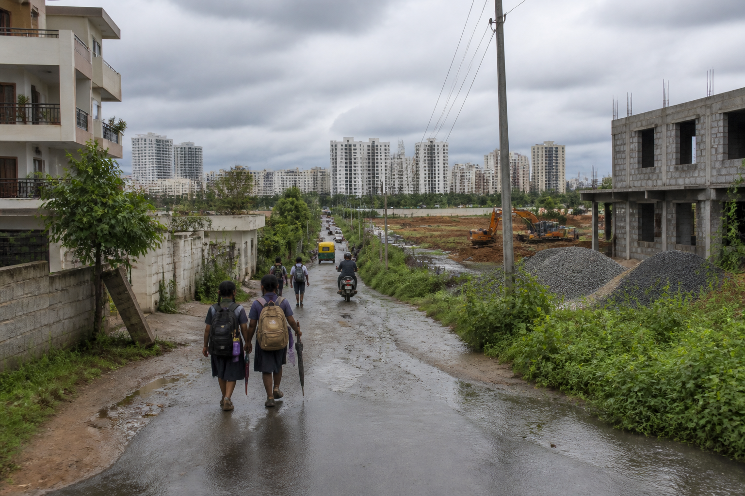
The stalled Kogilu–Sampigehalli Main Road has become a test of whether North Bengaluru’s planned infrastructure can keep pace with its residential expansion. Residents say land acquisition began in January 2025, but authorities have not provided a clear construction schedule, completion timeline or definitive update on the proposed alignment.
The proposed road is intended to connect Kogilu Main Road near the Nayara petrol pump to Sampigehalli through Gasthikempanahalli. It was included in the Revised Master Plan 2015, according to a petition submitted by residents to the Government of Karnataka, the Greater Bengaluru Authority, Bengaluru Smart Infrastructure Limited (B-SMILE) and other departments.
The dispute is not only about a missing road. It concerns how a road shown in a statutory planning document becomes an operational public asset, how land acquisition is communicated to affected communities, and what obligations public agencies have to residents who bought property in areas where infrastructure was expected to follow development.
Residents say the proposed road has acquired greater urgency because neighbourhoods around Kogilu, Sampigehalli and Gasthikempanahalli have expanded rapidly. The petition refers to several residential communities, including Adarsh Greens, Total Environment developments, Bren communities, Vidhana Soudha Layout and surrounding neighbourhoods. Existing routes, residents say, are narrow, poorly maintained or unpaved, producing longer travel times and bottlenecks.
The evidence in the petition points to a familiar sequencing problem in Bengaluru’s peripheral growth areas: housing becomes operational before the wider street network does. Residents say many property buyers invested in the area on the basis of promised infrastructure and have paid stamp duty, property tax, cess, TDS and other statutory charges. Those payments, however, do not by themselves establish a legal guarantee that a particular planned road will be completed on a fixed schedule. The unresolved issue is whether public agencies have communicated what stage the project has reached and what remains before construction can begin.
A Form-I notification issued by the then Bruhat Bengaluru Mahanagara Palike on January 8, 2025, initiated the land acquisition process, according to the report. Nearly 20 months later, residents say they still do not know whether acquisition has been completed, whether compensation or objections remain under consideration, or when a construction tender and work order could follow. The supplied material does not establish the current status of each acquisition parcel or whether construction contracts have been issued.
That gap between a formal notification and visible work is central to the residents’ frustration. Land acquisition is often the point at which a road project moves from planning intent to an administrative and financial commitment. It can also be the stage at which alignments face objections, ownership disputes, compensation negotiations or changes in implementing responsibility. In this case, residents allege that some landowners are attempting to alter the approved alignment. They also say no official communication has clarified whether the alignment will remain unchanged.
The project has since been taken over by B-SMILE under its Buffer Road initiative. That transfer creates a second layer of institutional accountability. Residents are seeking clarity not only from the department that began acquisition but also from the agency now associated with implementation. Without a public project timeline, it remains difficult for residents to determine which authority is responsible for acquisition, design approval, construction, supervision and public updates.
The demand to retain the original alignment approved under Revised Master Plan 2015 reflects a broader planning concern. A master-plan road is intended to provide continuity across individual layouts and developments. If its alignment is altered parcel by parcel without a transparent process, the road’s network function can weaken even if some sections are eventually built. At the same time, any change to an approved alignment would need to be explained through the relevant planning and administrative process, particularly where it affects landowners, residents and access to public facilities.
The road’s value is also measured by what it connects. Residents say it would improve access to Jakkur Lake and First Steps School, which serves children from different parts of North Bengaluru. They have identified schoolchildren, senior citizens and daily commuters as groups affected by the present road conditions. They also say emergency vehicles face difficulty reaching neighbourhoods where access routes are narrow or incomplete.
These claims describe a practical urban cost that project documents can obscure. A road is not only a traffic corridor between two points. Its absence can increase the time needed to reach a school, lake, neighbourhood or medical facility; force vehicles through already congested routes; and make local trips dependent on a small number of vulnerable links. The report states that road conditions worsen during the monsoon, but it does not provide traffic counts, travel-time measurements, emergency response data or an engineering assessment of the existing network. Those figures would be needed to quantify the project’s current impact.
The planned connection also has a relationship with public transport. Residents believe the road would improve access to the upcoming Kogilu/Yelahanka Metro station, reduce travel distances and encourage public transport use. The supplied report does not provide the station’s opening schedule, the final access plan or a ridership assessment. It does, however, show why the timing and design of feeder roads matter: a metro station’s effective catchment depends not only on the rail line but also on whether surrounding streets allow people, buses, two-wheelers, cars and emergency services to reach it safely.
This is where the project moves beyond a local demand for road construction. Bengaluru’s peripheral areas are often developed through multiple agencies and private layouts, while major connectivity links remain dependent on public acquisition and interdepartmental execution. The result can be a landscape in which property development advances in identifiable phases, but the public network that should connect those phases remains uncertain.
The institutional chain in the Kogilu case includes the Government of Karnataka, the Greater Bengaluru Authority, B-SMILE and other concerned departments. The area falls under the Byatarayanapura Assembly constituency, represented by Bengaluru Development Minister Krishna Byre Gowda. Residents have asked for regular updates, transparency in land acquisition and a clear implementation schedule. These requests are administrative rather than merely political: they seek information that would allow affected households and landowners to understand the project’s legal and operational status.
The available evidence does not establish that the road has been cancelled, nor does it confirm that the alignment has been officially changed. It establishes that residents say the project remains unclear after the land acquisition process began, and that they are asking authorities to restart or advance construction without further delay. It also establishes that the project is now associated with B-SMILE’s Buffer Road initiative. Whether that institutional transition has accelerated the project, delayed it or changed its scope is not stated in the supplied material.
The Kogilu–Sampigehalli road therefore illustrates the difference between planning a network and delivering one. The Revised Master Plan 2015 provides the planning reference cited by residents. The Form-I notification provides evidence of a later acquisition step. The B-SMILE transfer indicates a change in implementation context. What is missing is the connective information between those milestones: the acquisition status, approved design, funding position, tender stage, construction start date and completion schedule.
Those details will determine whether the road becomes a functioning link or remains a reservation referenced in planning documents and property decisions. For North Bengaluru residents, the next meaningful development is not another general assurance but an official statement identifying the responsible agency, confirming the alignment, reporting the status of land acquisition and setting out the next project milestone. Until then, the road’s public value is clear, while its delivery remains unresolved.
