


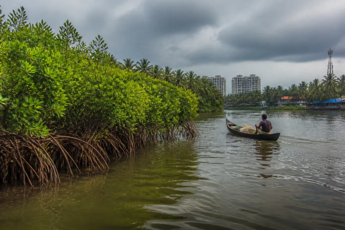
Kerala’s mangroves appear to be expanding after decades of severe decline, offering a rare sign of recovery along a coastline increasingly exposed to climate and development pressures. A study presented at an international ocean symposium found that mangrove cover in the state’s coastal districts increased between 2017 and 2024 after satellite images from the two years were analysed.
The finding is important not simply because it records more green cover. Mangroves occupy the difficult boundary between land and water, where cities, villages, fisheries, ports, tourism infrastructure and natural systems compete for space. Their condition is therefore also a measure of how Kerala manages its coast. The reported increase suggests that restoration and protection efforts may be producing results, but it does not erase the damage accumulated over the previous five decades or settle the question of whether the remaining habitats are secure.
The study was presented at an international ocean symposium jointly organised by the Trevor Platt Science Foundation, the Department of Chemical Oceanography at Cochin University of Science and Technology, the Central Marine Fisheries Research Institute and the Marine Biological Association of India. The report attributes the assessment of changing mangrove extent to an analysis of satellite imagery from 2017 and 2024. It says mangrove area has increased across Kerala’s coastal districts during that period.
That evidence marks a shift from a long-established narrative of loss. Kerala is reported to have lost nearly 90 per cent of its mangroves over five decades. Urbanisation, encroachment and climate change are identified as major causes of the damage. In a state where settlements and infrastructure are closely tied to backwaters, estuaries and the Arabian Sea, the disappearance of mangroves is not only an ecological problem. It also reduces the natural systems that help absorb the effects of coastal hazards.
The source identifies three linked functions of mangroves. They are important breeding and nursery grounds for fish, provide a natural barrier against cyclones and storm surges, and play a major role in absorbing carbon from the atmosphere. These functions connect coastal ecology directly to livelihoods, disaster resilience and climate policy. A mangrove patch beside an urbanising waterfront is therefore not vacant land waiting for conversion; it is part of a wider protective and productive system.
The climate pressure facing that system is also increasing. A study presented at the symposium by Shahjalal University in Bangladesh reported that more than 100 marine heatwaves occurred in the Bay of Bengal between 1982 and 2023. The report says warming seas threaten marine ecosystems, while mangroves provide a protective buffer against those pressures. The supplied material does not establish how Kerala’s mangroves have performed during individual heatwaves, but it places the state’s recovery within a larger regional change in ocean conditions.
Kerala is reported to have 38 mangrove species, although only one species is found across all districts. The largest concentrations are recorded in Kasaragod, Kannur, Kozhikode, Ernakulam, Kottayam, Alappuzha and Kollam, while Thiruvananthapuram has three species. Globally, the report puts the number of mangrove species at 82. The distribution within Kerala matters for governance because recovery is unlikely to be uniform across the state. A statewide increase in area can coexist with local losses, fragmented habitats or declining ecological quality in particular locations.
The figures cited for individual districts illustrate this uneven geography. Kannur is reported to have 226 hectares of mangroves, while Kasaragod has 54.695 hectares. The smallest area listed is 3.3853 hectares at Orumanayoor in Thrissur. These numbers should not be read as a complete measure of ecological health: area alone does not show whether a habitat is connected, naturally regenerated, species-rich or exposed to continuing encroachment. But they do show why coastal conservation cannot be administered as a single uniform programme.
The institutional response is beginning to reflect that need for protection. The Kerala government began steps last year to bring additional mangrove areas into the protected forest framework. The source names mangrove areas at Puthuvype in Ernakulam; Venmanad in Thrissur; Cheruvannur, Kadalundi, Vallikkunnu and Iringal in Kozhikode; and Erinjoli in Kannur among the sites for which reserve-related notifications were issued. The notification process is described as the first step towards declaring the areas protected forests.
The legal basis cited for declaring ecologically important mangroves and poramboke land as reserve forests is the Kerala Forest Act, 1961. This is significant because the future of a mangrove is determined not only by ecological recovery but also by land records, administrative classification and enforcement. Satellite imagery can show that vegetation has expanded. Legal protection determines whether that vegetation can survive the next road project, construction proposal, reclamation attempt or change in land use.
The report’s account also exposes the administrative complexity of coastal conservation. Mangroves are linked to forests, fisheries, climate resilience, local government, land administration and urban planning, but these responsibilities do not necessarily sit within one institution. Fish nurseries serve fishing communities; coastal vegetation reduces exposure to storm impacts; and protected status involves the forest administration. A recovery strategy that treats mangroves only as plantation sites may therefore miss the governance arrangements that determine whether they remain intact.
The seven-year comparison between 2017 and 2024 is encouraging, but it is not enough to establish a permanent reversal of the historical decline. The supplied material does not provide the total mangrove area in both years, the percentage increase, the methods used to distinguish mangroves from other coastal vegetation, or the condition of individual sites. It also does not show whether the increase came from natural regeneration, government-supported planting, reduced pressure, improved mapping or a combination of factors. Those details will matter when the finding is used to guide policy.
There is a similar limitation in interpreting the protected-area process. A notification is an important administrative step, but it is not the same as completed protection, regular monitoring or effective enforcement. The source describes the identified notifications as the first stage towards protected-forest status. The next stages, including final legal designation and management on the ground, will determine whether the change is durable.
For Kerala’s coastal cities and settlements, the larger question is whether mangrove recovery can be made part of ordinary urban decision-making. The state’s coastal districts contain dense settlements and economically important waterfronts, while the same areas face sea-related hazards and ecological stress. If mangrove patches are treated as isolated environmental assets, their role in protecting connected waterways and communities may be underestimated. If they are recognised as infrastructure provided by nature, their protection becomes relevant to land-use planning, disaster management and public investment.
The evidence currently confirms three things: Kerala suffered extensive mangrove loss over several decades; satellite analysis cited at the symposium indicates an increase between 2017 and 2024; and the state has begun steps to strengthen legal protection at several locations. It does not yet establish that the recovery is uniform, permanent or sufficient to offset historical losses. The next evidence to watch is the publication of detailed area comparisons, site-level ecological assessments and the completion of the legal protection process. Kerala’s mangrove recovery is a positive signal, but its lasting value will depend on whether the state can convert that signal into enforceable coastal governance.

