


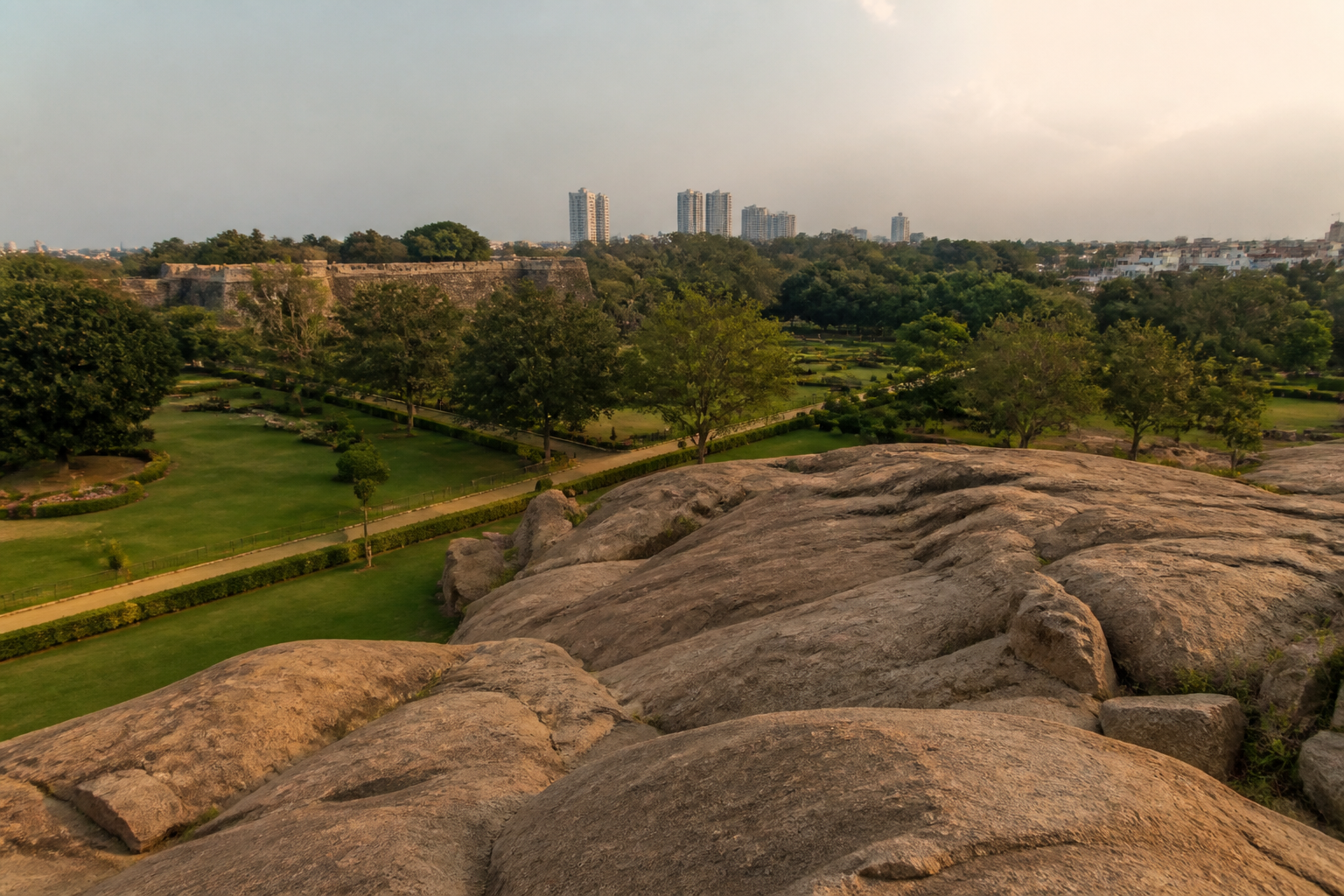
A proposed tunnel road in Bengaluru has become a test of how the city balances transport infrastructure with geological heritage and groundwater protection. According to a report attributed to the Geological Survey of India (GSI), routing the project beneath or near Lalbagh could create risks for an ancient rock formation, the historic Kempegowda watchtower and the groundwater system around Lalbagh Lake.
The warning was contained in a 27-page report submitted to the Karnataka High Court in connection with a public interest litigation filed by social activist Prakash Belawadi, Vijay Karnataka reported. The project is proposed to run from Hebbal Esteem Mall to Central Silk Board over a length of 16.75 kilometres. The proposal also includes an exit route inside Lalbagh.
The immediate question is not simply whether Bengaluru needs another road connection. It is whether the route, its depth and its construction method can be designed without disturbing a landscape whose value is both historical and geological. The GSI’s reported observations place that question before the court while the tunnel remains at the planning and design stage.
According to the report, the tunnel would be about 40 metres below ground. At that depth, construction could encounter hard granite, potentially requiring extensive excavation and the use of explosives. Even if a tunnel boring machine is used, the GSI has warned that construction-related forces could create new cracks in the rock or enlarge existing fractures.
That concern is significant because Lalbagh’s exposed rock is not merely a scenic feature. The formation is estimated to be about 3,000 million years old and was declared a national geological monument by the GSI in 1975. Its protected status means that the underground alignment must be considered in relation to the integrity of the rock formation, not only in terms of the space occupied by the road itself.
The proposed route also raises a structural concern involving the Kempegowda watchtower. The tower is identified by the Karnataka government’s tourism website as a 16th-century structure built by Kempegowda I, although historical records cited in the report differ on whether it was constructed in 1537 or 1606. The GSI has warned that vibration generated during tunnelling could affect the structure.
The warning does not establish that damage will occur. It identifies a risk that must be assessed before detailed design and construction-preparatory activity begin. The GSI has reportedly recommended maximising the distance between the tunnel alignment and the protected geological monument. That recommendation directly links the engineering design of the road to the conservation requirements of Lalbagh’s rock and historic assets.
Groundwater is the second major issue identified in the reported submission. The proposed tunnel would pass near Lalbagh Lake. The GSI has warned that construction-related dewatering and the permanent drainage system required for the tunnel could alter groundwater levels. Water movement through fractures in the rock could also change as a result of excavation and the tunnel’s long-term presence.
For an underground road, drainage is not a secondary engineering matter. Water entering the excavation must be removed during construction, while the completed tunnel needs a permanent system to manage seepage and runoff. In a fractured rocky setting, those interventions can influence how water moves below ground. The supplied report does not quantify the likely change in groundwater levels, but it identifies groundwater alteration as a design risk requiring attention.
The GSI has also reportedly cautioned that the exposed rock at Lalbagh is hard while inner layers may be less stable. That difference matters because a surface formation can appear structurally robust while subsurface conditions along a tunnel alignment vary. The report warns that weaker internal layers could create a risk of collapse during construction.
This distinction illustrates why the project cannot be evaluated only through its length, traffic function or proposed access points. The 16.75-kilometre alignment must also be assessed through the geology beneath each section. A tunnel route that is technically feasible in one underground zone may carry different risks where it passes below an ancient rock formation, a lake or a heritage structure.
The court proceedings bring these questions into a formal public process. The reported GSI submission followed the public interest litigation filed by Belawadi, making the geological agency’s assessment part of the material before the Karnataka High Court. The supplied report does not state what final direction the court has issued, nor does it provide a response from the state government, the project authority or the implementing agency.
That absence is important. The GSI’s warning is an expert assessment, not a final judicial finding that the tunnel must be cancelled or relocated. It also does not, on the material available, amount to a complete environmental or structural impact assessment. The next stage therefore depends on how the authorities respond to the geological concerns and whether the alignment is revised before detailed designs are completed.
The project’s proposed exit inside Lalbagh adds another layer to the planning question. An exit is not only a point where vehicles enter or leave the tunnel. It requires supporting structures, access arrangements and construction activity at or near the garden. The supplied report does not provide details of the proposed exit’s footprint, but its inclusion makes the relationship between the road project and the protected public landscape especially direct.
Bengaluru’s tunnel proposal therefore brings together three forms of urban infrastructure that are often planned separately: mobility, water and heritage conservation. The road is intended to provide an underground transport connection between Hebbal and Central Silk Board. Its construction could interact with groundwater flows. Its alignment could also affect a geological monument and a historic watchtower. The planning challenge is to assess all three systems together rather than treating the tunnel as an isolated traffic project.
The available evidence confirms that the risks have been formally raised by the GSI and placed before the High Court. It does not yet establish the final alignment, the construction method, the distance between the tunnel and the monument, the expected groundwater impact or the government’s decision on the recommendations. Those details will determine whether the concerns can be addressed through redesign and safeguards or whether the proposed route requires a more fundamental review.
For now, the most consequential milestone is the completion of detailed design and pre-construction assessment. The GSI has specifically recommended maximising the separation between the tunnel and the protected geological monument before those activities begin. The court proceedings and the authorities’ response will indicate how Bengaluru intends to reconcile a major underground road project with the ancient rock, groundwater system and historic structure at Lalbagh.
