


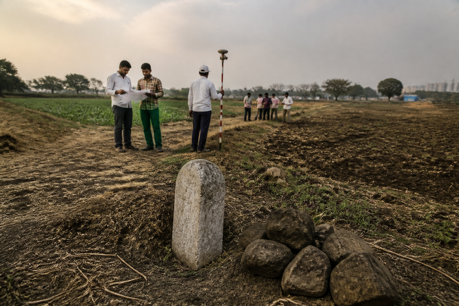
A six-decade Telangana land dispute involving nearly 600 acres on the boundary of Ankireddypalli and Ramalingampalli has revived a difficult question for the state’s land administration: what happens when village maps, survey numbers, district boundaries and ownership records no longer point to the same piece of land? The answer, in this case, is a property claim estimated at ₹3,000 crore that remains unsettled despite repeated official interventions and a survey ordered by the Telangana High Court.
The disputed parcels lie between Ankireddypalli village in Keesara mandal of Medchal Malkajgiri district and Ramalingampalli village in Yadadri Bhuvanagiri district. The dispute is not simply between private parties. Villagers say substantial portions are government and ceiling land that have been encroached upon. Private landowners and Salvo Industries Private Ltd, formerly known as Salve Explosives and Chemicals Ltd, maintain that the land is patta property acquired and held lawfully. Both positions depend on how the land is identified, numbered and assigned across official records.
That makes the dispute a test of the land administration system as much as a contest over ownership. If the same physical parcel is represented under different survey numbers in different village records, a revenue record may establish a claim on paper without resolving the question of where the paper boundary actually lies on the ground. Until the boundary is fixed and the land’s legal classification is determined, ownership claims, government-land claims and ceiling-land claims can continue to coexist.
The history cited by residents goes back to a formal survey conducted in January 1965. N Saraswathi, an Ankireddypalli resident who has pursued the issue, said committees were constituted to resolve the boundary dispute and that the survey clearly demarcated the boundaries. She said the disputed land was officially allocated to Ankireddypalli in 1966, after which the then Nalgonda district collector confirmed the report and raised no objection to handing the land over to the erstwhile Rangareddy district.
According to Saraswathi, the implementation of the Land Ceiling Act created another layer in the record. She said portions of the land were allotted to eligible farmers in 1975 and that land revenue was collected from beneficiaries. Villagers now claim that approximately 324 acres are government land and another 200 acres are ceiling land. These figures are part of the villagers’ claims reported in the source and have not been presented as a final adjudication by the revenue authorities.
The specific survey numbers illustrate how the disagreement became administratively complex. Villagers identify nearly 295 acres in Survey No. 918, 20 acres in Survey No. 886 and 10 acres in Survey No. 887 of Ankireddypalli as part of the disputed area. They also allege that Survey No. 312 of Ramalingampalli, along with several sub-survey numbers, was later created over the same land. Their contention is that overlapping records enabled competing claims and alleged encroachments.
Salvo Industries disputes that interpretation. Its chairperson, A Jayaram Reddy, said Ankireddypalli Survey Nos. 918, 886 and 887 and Ramalingampalli Survey No. 312 refer to the same parcel. He described the dispute as one involving overlapping or renumbered survey boundaries rather than encroachment. According to Reddy, Survey No. 312 has been recorded as patta land in revenue records for more than five decades and is supported by village maps.
The company has denied allegations that it occupied government land. Reddy said the company, established in 1995, obtained the necessary permissions and clearances from authorities. He also said the allegations were incorrect and subject to the final decision of the court. The company’s position is that the conflict arises from inconsistent survey numbering and boundary identification, and that it has approached the High Court seeking appropriate relief and clarification.
The High Court has directed the authorities to conduct a survey and determine whether the disputed land falls within Medchal Malkajgiri or Yadadri Bhuvanagiri district, as well as establish the nature of the land. A field survey was conducted by the revenue divisional officer in June 2022. However, the report had not been finalised or made public, according to the account. That leaves the central administrative task incomplete: converting field measurements and historical records into a final, accessible determination.
Revenue officials have indicated one possible route. Government sources said the regional deputy director of survey and land records wrote to the collectors of both districts in June 2022, recommending that recognised traverse data from Keesara village be adopted as the common boundary. The official also suggested that the boundaries be finalised under Sections 90 and 91 of the Telangana Land Revenue Act. The recommendation shows that the state has identified a technical and legal mechanism, but a recommendation is not the same as a completed demarcation.
This distinction is important in land administration. A survey can collect measurements; a boundary order can assign administrative jurisdiction; and a revenue decision can determine the classification and status of land. These steps are related but not interchangeable. The dispute has continued because the process appears to have stopped between field-level examination and a final, publicly available decision. Until that gap is closed, the parties can continue to rely on different historical documents and interpretations.
The dispute has also exposed the institutional fragmentation built into boundary questions. The land is associated with two villages in two districts, while survey and land-record departments, district collectors, revenue divisional officers and the courts each have distinct roles. A village-level record may not settle a district-level boundary question. Similarly, a court direction to survey does not itself replace the administrative act of demarcation, classification or correction of records.
The source places the dispute within Telangana’s wider re-survey of land records across more than 2,200 villages. That programme gives the case significance beyond the two villages. A re-survey is intended to refresh or reconcile information about land parcels, but the process can also bring dormant conflicts to the surface. When old boundaries, new survey numbers and existing ownership claims do not align, updated measurement may reveal rather than immediately resolve the underlying problem.
The Ankireddypalli–Ramalingampalli case shows why a re-survey cannot be assessed only by the number of villages covered. Its effectiveness also depends on whether the resulting records are reconciled with historic maps, ceiling proceedings, land-allotment records, tax collections, village registers and court directions. The source does not establish how Telangana’s broader re-survey is handling such conflicts, but this case demonstrates the type of institutional coordination required where records overlap.
The financial value of the land raises the stakes. The disputed area is estimated at ₹3,000 crore, although the valuation is presented in the source as an estimate rather than an independently established assessment. At that scale, an unresolved boundary is not a minor clerical discrepancy. It can affect the ability of public agencies to protect government land, the security of private titles, the legitimacy of past allotments and the legal exposure of companies and individuals operating on the land.
For residents who claim that portions were allotted to eligible farmers, the unresolved status also concerns the credibility of earlier land reforms and revenue collection. If land was treated as ceiling land and allotted, beneficiaries would expect the state’s records to preserve and enforce that status. If the land was patta property, private claimants would expect their title and village maps to be recognised. The competing claims cannot be settled by assertion alone; they require a final record-based determination supported by ground demarcation.
The case further shows how the absence of public closure can prolong conflict. According to the report, the June 2022 field survey was neither finalised nor made public. Without access to the report and the reasons for accepting or rejecting its recommendations, affected residents and claimants remain dependent on partial records and competing explanations. Transparency does not decide title by itself, but it allows parties to understand the evidence and challenge an administrative decision through defined legal channels.
Malkajgiri collector M Manu Choudary said he was unaware of the details of the issue and would examine the matter and take steps to resolve it. That response indicates that the matter remains active within the district administration, but it also confirms that the final resolution has not yet been reached. The company, meanwhile, said it had been pursuing the matter with the survey and land records department and the Chief Commissioner of Land Administration for an early resolution, while maintaining that it remained pending at the district level.
The larger urban question is how fast-growing areas manage land whose administrative identity is uncertain. The disputed villages are located across districts in the Hyderabad-region metropolitan context, where land values and development pressures can make old record inconsistencies more consequential. The supplied material does not establish that a specific development project is blocked by the dispute, but it does show that unresolved land status can leave a large area in prolonged legal and administrative uncertainty.
The evidence currently confirms three things. First, the dispute has persisted for roughly six decades and involves overlapping claims over nearly 600 acres. Second, the High Court-directed survey process has not yet produced a publicly available final resolution. Third, the parties disagree fundamentally over whether the issue is government-land encroachment or a conflict caused by survey numbering and boundary records. What remains to be established is the authoritative boundary between the villages, the legal classification of each disputed parcel and the validity of the competing claims.
The next decisive step is therefore not another allegation but a final, disclosed administrative determination based on the survey evidence, historical records and applicable law. Until the collectors and land-record authorities complete that process, the ₹3,000-crore land claim will remain an example of how an unresolved line on a map can become a long-running failure of certainty in the urban land system.
