


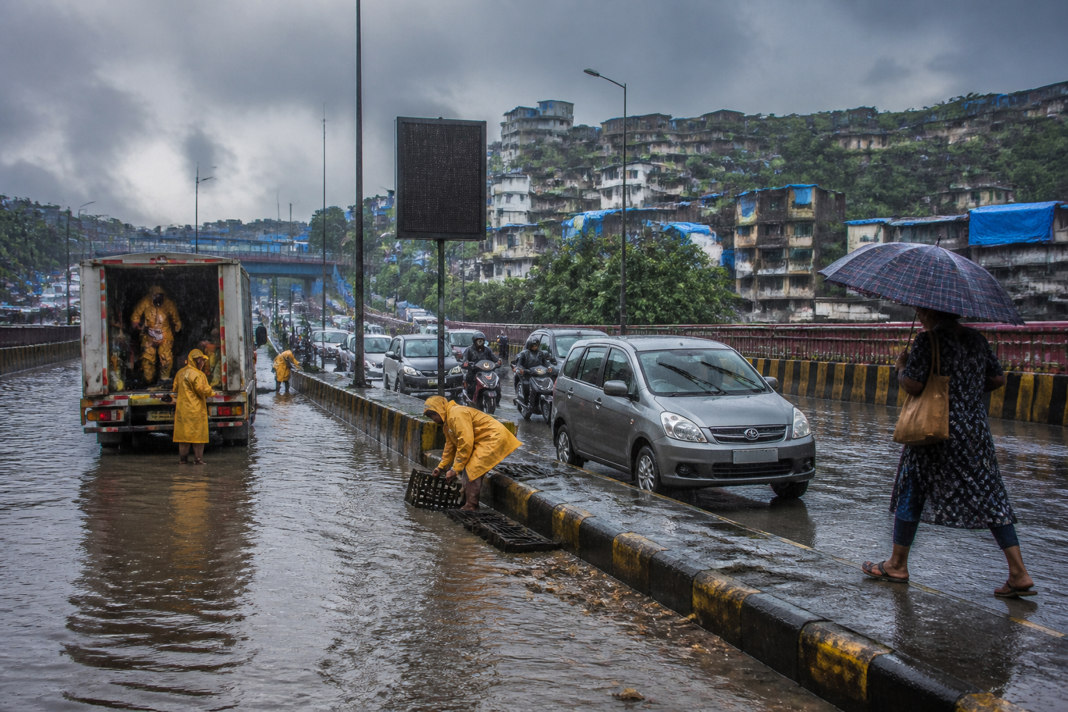
Mumbai flood management is moving from a monsoon-response issue towards a broader disaster-resilience challenge, as the Brihanmumbai Municipal Corporation presents the city’s preparedness measures against rising temperatures, extreme rainfall, landslides and coastal exposure at an international forum.
The BMC’s additional municipal commissioner for projects, Abhijit Bangar, represented Mumbai at the sixth International Disaster Resilience Leadership Forum held in Incheon, South Korea, on 7 and 8 September. According to the report presented at the forum, Mumbai is dealing with overlapping risks rather than a single flood problem: heavier rainfall, a warming trend, 249 landslide-prone areas and dense settlements along the coast.
The presentation is significant because it places urban flooding within the city’s wider risk geography. Flooding in Mumbai is not confined to water accumulating on roads during intense rain. The municipal account described a city where rainfall, topography, hillside settlements, coastal exposure and population concentration intersect. That makes preparedness dependent not only on drains and pumping capacity, but also on early warning, land-use management, emergency coordination and the ability of residents to receive and act on information.
Bangar told the forum that Mumbai recorded an average rise of 0.25 degrees Celsius in annual temperature in every decade between 1973 and 2020. The presentation also stated that the city receives more than 100 millimetres of rain on around 16 days each year. These figures, as reported by Loksatta, indicate the scale of the conditions the municipal administration is planning for, although the available report does not provide a detailed breakdown of rainfall by ward, the trend in extreme events, or the precise methodology used to calculate the temperature change.
The city’s physical exposure adds another layer of difficulty. Mumbai has 249 areas identified as prone to landslides, according to the municipal presentation. The report does not identify the individual locations of these areas or state how many are occupied, monitored or covered by mitigation works. However, the figure shows that flood resilience cannot be planned separately from slope safety. Intense rainfall can create simultaneous pressure on low-lying roads, drainage networks, hillsides and transport routes, complicating the municipal response.
The BMC presentation also stated that approximately 35 per cent of Mumbai’s total population lives within 250 metres of flood-prone areas. This is a measure of proximity rather than a direct count of people who will be flooded during every major rainfall event. Even so, it points to the scale of the city’s exposure. When a large share of residents lives close to locations identified as flood-prone, the effectiveness of warning systems, evacuation arrangements and local response becomes as important as the construction and maintenance of physical infrastructure.
The coastal dimension is similarly substantial. More than 50 densely populated settlements along Mumbai’s coastline were cited as increasing the city’s disaster risk. The available account does not specify whether these settlements face risks from storm surges, tidal flooding, coastal erosion, heavy rainfall or a combination of factors. That missing detail matters for planning because different hazards require different forms of protection and different emergency procedures. Nevertheless, the municipal presentation connects coastal density directly with the city’s disaster-resilience challenge.
The forum’s focus on municipal-level coordination is relevant to how such risks are managed. The session in which Bangar spoke was described as a metropolitan contact and communication programme. That emphasis suggests that disaster resilience is being treated as an institutional and information challenge alongside an engineering problem. The report says the BMC presented its flood-control plan and an AI-based early warning system, but it does not provide details on the system’s data sources, alert thresholds, areas covered, responsible agencies or whether it is already operational across the city.
Those unanswered questions are central to assessing the system’s public value. An early warning mechanism can only reduce risk if it converts reliable information into timely action. For Mumbai, that would involve more than detecting intense rain. A useful system would need to communicate the likely location and severity of flooding, identify potentially affected roads or settlements, coordinate with emergency services and reach residents in forms they can understand and use. The supplied report confirms that the BMC discussed an AI-based warning system, but does not establish how these operational steps are being handled.
The same distinction applies to the flood-management plan. Presenting a plan at an international forum demonstrates that Mumbai is seeking to position its municipal response within a global disaster-resilience conversation. It does not, by itself, establish the plan’s funding, delivery timetable, performance indicators or implementation status. The source report does not list new drainage works, pumping stations, detention infrastructure, coastal barriers, hillside stabilisation projects or specific maintenance targets. It therefore supports an assessment of the risks identified by the BMC, but not a complete evaluation of the city’s flood-control capacity.
The institutional setting is nevertheless important. The forum was jointly organised by the Incheon Metropolitan City, the United Nations Office for Disaster Risk Reduction’s Northeast Asia office and the Incheon Institute. Representatives from more than 30 countries, international organisations and experts participated, according to the report. Mumbai’s participation gave the BMC an opportunity to explain its local risk profile to an audience concerned with urban resilience. It also reflects the fact that municipal corporations are increasingly expected to manage risks that extend across departments and infrastructure systems.
For Mumbai, the challenge is especially difficult because the reported risks are geographically connected. A rainfall event can affect flood-prone areas, congested coastal settlements and landslide-prone slopes at the same time. The 35 per cent population figure cited by the BMC indicates that exposure is not limited to isolated infrastructure assets. The presence of dense settlements near the coast means that emergency planning must account for households, access routes and communication channels, not only for the protection of roads and public facilities.
The figures presented at Incheon also show why annual preparedness cannot be reduced to short-term monsoon operations. A city experiencing around 16 days of rainfall above 100 millimetres each year, as stated in the presentation, faces repeated stress on its urban systems. The source does not say whether this number is increasing, or how many such events produce serious flooding. It does, however, establish that intense rainfall is a recurring planning condition rather than an exceptional possibility. That requires municipal systems to be ready before each event and to learn from their performance afterwards.
The temperature trend adds a longer-term climate dimension. The reported average decadal increase of 0.25 degrees Celsius between 1973 and 2020 does not by itself explain changes in rainfall intensity, tide levels or drainage performance. Nor does it prove that any individual flood was caused by warming. It does indicate that the BMC is presenting flood risk as part of a changing environmental context. A resilience plan based only on historical rainfall patterns may not address the full range of conditions a growing coastal city could face, although the available report does not provide the BMC’s design assumptions or planning scenarios.
The presentation therefore raises a larger question about what counts as flood management in Mumbai. If the city’s exposed population, coastline and landslide-prone areas are considered together, resilience becomes a chain extending from risk identification to public warning and emergency action. A weakness at any point can reduce the value of the others. A drain may remove water from one location, but residents still need accurate warnings if roads become unsafe. A warning may be issued, but it will have limited effect if evacuation routes are blocked or if local agencies do not share the same information.
The available information does not establish whether Mumbai’s AI early warning system has been tested during a defined number of events, whether it has produced measurable improvements, or how its alerts are evaluated. It also does not state how the BMC’s flood-control plan is coordinated with agencies responsible for transport, land management, coastal areas or slope safety. These are not minor technical details; they determine whether a citywide resilience strategy can function beyond a presentation setting.
What the Incheon forum confirms is that the BMC has formally presented Mumbai’s flood and disaster-preparedness challenge as an international urban-resilience issue. The reported evidence points to four measurable pressures: a temperature increase reported across the 1973-2020 period, around 16 days of annual rainfall above 100 millimetres, 249 landslide-prone areas and roughly 35 per cent of the population living within 250 metres of flood-prone zones. More than 50 dense coastal settlements add to the exposure described by the municipal administration.
The next stage will be to establish how these risks translate into projects, operating procedures and publicly measurable outcomes. Details on the AI warning system, the flood-management plan, the areas covered and the authority responsible for implementation were not included in the supplied report. Those are the developments that will determine whether Mumbai’s international resilience narrative becomes a demonstrable improvement in how the city prepares for and responds to extreme weather.
