


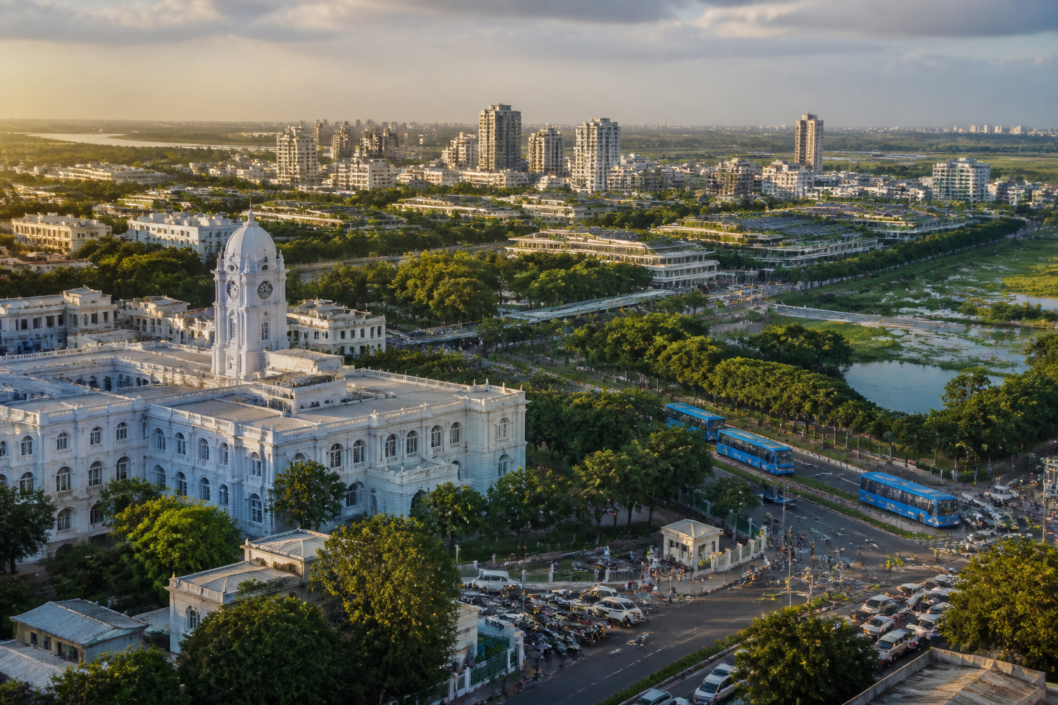
The debate over relocating Tamil Nadu’s secretariat is being framed as a question of choosing a new site. The larger issue is whether the state wants to reproduce Chennai’s existing pattern of congested, infrastructure-stressed growth or use a major administrative institution to build a different urban model. A proposal published by The Times of India argues that the secretariat should remain at Fort St George unless relocation becomes unavoidable, in which case it should anchor a compact, vertical and climate-resilient satellite city near Chennai.
The argument comes after nearly 25 years of attempts by successive governments to move the secretariat. According to the article, earlier proposals generated controversy and were abandoned. One completed complex was eventually repurposed as a multi-speciality hospital. That history makes the current question more than a construction project. It raises questions about administrative continuity, public access, land value, transport planning and the political difficulty of creating new urban centres.
Fort St George has recognised drawbacks, particularly congestion. But the case for retaining the secretariat rests on its central location, transport connectivity and proximity to the principal government directorates. Separating the secretariat from those departments could make coordination harder and inconvenience officials and citizens, the article argues. It also points to nearly four centuries of administrative continuity at the site, suggesting that relocation would involve an institutional shift rather than merely a change of address.
If a new complex is pursued inside Chennai’s already congested core, the likely pressure points are familiar: traffic, pollution, land demand and overstretched infrastructure. Placing it on the periphery would avoid some of those pressures but could create a different problem—an isolated administrative enclave without the housing, services, transport and employment needed to function as part of a city. The proposed alternative is therefore not a stand-alone secretariat but an administrative anchor for a planned satellite city.
That distinction is central to the urban argument. A secretariat building by itself would add an office complex. A secretariat integrated with the legislative assembly and key government departments could become the first major institution in a new urban settlement. The source describes this as institutional seeding: using a large public function to generate an economic base and support the early development of a planned city.
The proposal also connects relocation with Chennai’s land-use pressures. Government offices and public housing occupy valuable beachfront parcels, and their release could enable commercial and civic redevelopment, according to the article. Such redevelopment is presented as a possible source of funding for infrastructure in the satellite city. However, this relationship would require careful public planning because the value of coastal land, its civic role and the future of public housing are not simply real-estate questions. The source does not establish that any such land transfer or redevelopment plan has been approved.
The suggested satellite city would need strong links with Chennai rather than functioning as a disconnected settlement. Fast shuttle services every 15 minutes are proposed as one connection. The broader transport model would prioritise walking, cycling and public transport, with dedicated bus rapid transit lanes and light rail or metro where warranted. Private vehicles would be restricted, subject to essential exceptions. These features are presented as design principles rather than confirmed government plans.
The planning case is built around compactness. The article explains that Floor Space Index, or FSI, measures the total built-up area across all floors in relation to plot area. It argues that narrow roads and weak civic infrastructure keep average FSI between 1 and 2 in most Indian cities. When cities cannot accommodate more residents vertically, they expand horizontally into adjoining municipalities, town panchayats and villages. Those peripheral areas often have even narrower roads and weaker infrastructure, creating a cycle of sprawl.
The source uses a hypothetical comparison to illustrate the potential effect of higher density. A parent city of one crore people occupying 500 square kilometres at an average FSI of 1.2 could, in theory, accommodate the same population within 100 square kilometres at an average FSI of 6. The calculation is not a project estimate for Chennai. It is a planning illustration of how compact development could reduce the geographical spread—and potentially the infrastructure length—of a new settlement.
The case against unmanaged horizontal expansion is broader than commuting time. Sprawl increases the distance over which roads, water supply, sewage networks and other civic services must be provided. It also places pressure on farmland, wetlands, floodplains and groundwater-recharge areas as impervious surfaces spread. The article links this pattern to traffic congestion, air pollution, greenhouse-gas emissions and recurrent flooding. These are presented as connected outcomes of the same urban form rather than isolated service failures.
The proposal’s climate-resilience agenda is similarly integrated. At least 25% of the satellite city’s land is suggested for greenery and 8% for public open spaces. Existing lakes, wetlands and natural drainage channels would be preserved. Urban forests, constructed wetlands, neighbourhood parks, avenue trees, green medians, bioswales, green roofs and green walls are proposed as part of the city’s basic infrastructure.
These measures would serve several functions at once. Vegetation and wetlands can support drainage, reduce heat, recharge groundwater, improve air quality and provide public space. The source also proposes treating all wastewater for reuse in construction, landscaping and other non-potable applications. Organic waste could be converted into compost or biogas, while construction debris, glass and metals could be recovered as reusable inputs. The proposed city is therefore conceived as a circular urban system rather than a conventional collection of buildings and roads.
Energy performance forms another part of the model. The article refers to low-embodied-carbon construction materials, energy-efficient appliances, natural lighting and passive cooling through courtyards, atriums and breezeways. Rooftop and façade-mounted solar panels are suggested as part of a net-zero energy ambition, drawing inspiration from energy-positive neighbourhoods in Freiburg, Germany. The source does not provide a cost, delivery schedule or technical assessment for these measures, so their feasibility remains an open planning question.
The proposal also recognises that land acquisition could become the most contentious part of a satellite-city project. The article refers to the controversy surrounding land acquisition for the proposed Parandur airport and argues that assembling a larger area for a new city could be socially disruptive and politically difficult. It suggests transparent land pooling as an alternative to relying primarily on compulsory acquisition.
Under land pooling, fragmented holdings are consolidated for planned development. Land is reserved for roads, public transport, utilities, green spaces and other infrastructure, while the remaining area is returned as reconstituted, development-ready plots. The argument is that these plots could become more valuable because of improved access, civic infrastructure, higher FSI and development rights. The model would give participating landowners an ongoing stake in the new city instead of limiting them to one-time compensation. The article identifies precedents in Gujarat, Delhi, Andhra Pradesh and Maharashtra, while also proposing that compulsory acquisition be used only as a last resort.
The institutional question remains unresolved. A new secretariat would require decisions on which departments move, how the legislative assembly is integrated, how citizens access services, who manages the new city and how transport and utilities are financed. The source argues that the secretariat should not be separated from key government departments, but it does not provide a proposed administrative structure or implementation authority. Without that clarity, the idea risks remaining an urban vision rather than a deliverable programme.
The article places this debate within India’s wider urban transition. It cites the 2011 Census figure that 31% of India’s population was urban, while noting that the country already had the world’s second-largest urban population. It also states that Demographia identified 66 urban areas with populations above one million in 2025 and that the United Nations recognised five megacities with populations above one crore, including Chennai. These figures are used to argue that the demands on Indian cities will continue to grow even as existing urban systems struggle with water scarcity, air pollution, flooding, inadequate sewage treatment and the loss of open space.
The larger question is whether a new administrative centre can be used to correct the failures that conventional urban expansion has produced. A compact satellite city could, in principle, coordinate land use, transport, density, drainage, waste and energy from the beginning. But that outcome would depend on governance, land arrangements, public participation, financing and enforcement—not only on the design of the secretariat or the width of its roads.
For Chennai, the immediate debate remains between retaining Fort St George and creating a new administrative complex elsewhere. The evidence supplied does not establish that the state has approved a relocation, selected a site or adopted a satellite-city plan. What it does establish is that any secretariat move would carry consequences far beyond office space. It would affect the relationship between government institutions and citizens, the future use of valuable urban land and the direction of Chennai’s expansion. The next meaningful milestones would therefore be an official decision on relocation, the identification of any proposed site and the publication of a transparent plan for transport, land, infrastructure and environmental safeguards.
