


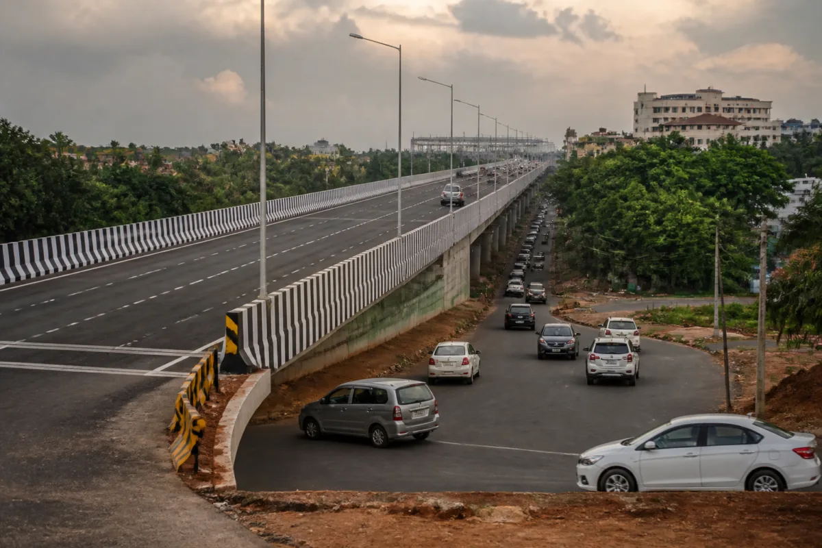
The Porvorim elevated corridor was built to improve movement through one of Goa’s busiest urban stretches, but the project has instead exposed a basic failure in transport planning: a six-lane structure opened without all the ramps and access arrangements needed to make it function safely. The state government is now preparing a detailed project report to seek additional funding from the Union ministry of road transport and highways for at least two ramps, even as the corridor’s entry and exit points remain under review.
The problem is not limited to an unfinished addition. The Rs 641 crore corridor was planned for more than a decade, constructed over three years by Rajasthan-based RRSM Infra, and opened to traffic on September 11 after prolonged diversions, dust and disruption. Yet soon after its launch, an accident resulting in two deaths brought attention to the design of its entry and exit points. The immediate administrative response was to close all access points, sending traffic back to the surface roads and creating congestion from Guirim to Atal Setu, with queues extending towards Merces junction.
That sequence reveals the difference between constructing an elevated road and delivering a functioning urban transport corridor. A flyover can carry traffic above a congested road, but its performance depends on how vehicles enter, leave and merge with the structure. If ramps are absent, poorly placed or abruptly narrowed, the elevated section does not remove congestion; it can transfer risk and delay to the points where traffic streams meet.
The state’s latest proposal confirms that the access system was not settled when the corridor opened. Public works department officials are preparing a DPR for additional ramps and intend to submit it to MoRTH under a future annual plan as new works. One proposed ramp is on the Majestic side. The estimates have not yet been finalised, and officials said land availability must be verified before the DPR can be completed and sent for approval.
This means the cost of making the corridor operationally complete is still unknown. The original project value is reported at Rs 641 crore, but the government has not drawn up estimates for the new ramps. The funding request also introduces a second stage of public expenditure into a project whose central transport function was expected to be addressed through the original construction package. Whether the additional work reflects a design change, an omission from the original scope or a correction of an identified deficiency is not established in the supplied report. That distinction matters because each explanation points to a different accountability question.
The institutional response has now widened beyond the state PWD. An IIM Nagpur team and a MoRTH official inspected the site, while experts from IIT Kharagpur were consulted online. Their involvement indicates that the corridor’s problems are being examined as a technical and safety matter rather than treated only as an operational inconvenience. However, the report does not disclose the formal findings of these assessments or identify which specific recommendations led to the proposed ramps.
The most visible sign of the corridor’s unfinished design is the continuing closure of the Atal Setu entry for Porvorim residents. Officials have said that the entry will not open immediately because the review is still under way, and no timeline has been decided. The closure is particularly consequential because the corridor was presented as a much-needed convenience for the area. Instead, residents who were expected to benefit from direct access remain excluded from one of its crucial connections.
Other entry and exit points were reopened only after backlash, with rumblers installed as a safety measure. That sequence suggests that traffic management has been responding to problems after they emerged rather than through a fully resolved operating plan in place before opening. The proposed installation of four artificial-intelligence cameras at entry and exit points, funded by the state, is another part of this response. The report does not specify the camera system’s enforcement powers, monitoring arrangements or performance standards, so its likely effect cannot yet be assessed.
The corridor’s design concerns also extend beyond ramps. Architect and Porvorim resident Dean D’Cruz said that the widths of the six-lane flyover were compromised at certain points from the beginning. He identified the stretch near Majestic Hotel, where a two-lane section narrows to one, and argued that exit lanes should function as a third lane and be long enough to prevent vehicles from slowing on the corridor. He also pointed to varying road widths and missing lane markings on the roads below.
These observations place the access problem in a wider design context. Urban road capacity is not determined simply by the number of lanes announced in a project description. It is determined by the narrowest section, the quality of merging space, the visibility of lane changes, the management of turning movements and the continuity between the elevated road and the network beneath it. A corridor labelled six-lane can therefore operate like a much smaller facility if its critical points compress traffic into fewer lanes.
The Porvorim case also shows why project completion and transport-system readiness should not be treated as the same milestone. Construction may be considered complete when the main structure is built, but road users experience the project through its ramps, junctions, markings, barriers, speed controls and traffic-management systems. In this case, the main structure opened while access arrangements were subsequently closed, reopened or reconsidered. The result was a project that existed physically but had not achieved stable operational integration with the surrounding road network.
The funding route is equally important. The state plans to seek MoRTH support and propose the ramps as new works under the next annual plan. That places the next decision with both the state government and the Union ministry. Before funding can be sought, the DPR must establish the proposed locations, land requirements, engineering details and cost. The source report does not state whether MoRTH has agreed in principle to finance the additions.
Land availability is a particularly significant unresolved issue. A ramp cannot be added solely by modifying the elevated structure; it needs a workable connection with the ground-level road network and sufficient space for safe approach and merging. Officials have therefore said that land must be verified before the DPR is finalised. Until that process is complete, the proposed ramps remain a plan under preparation rather than an approved construction programme.
The sequence raises a structural question for future urban infrastructure projects in Goa and elsewhere: at what stage are safety reviews and access requirements formally closed? The report records inspections after the corridor’s opening, consultations with technical institutions and a new funding proposal after accident-related concerns. It does not establish whether comparable independent review was completed before the road was opened, or whether the missing ramps were identified during the original design and approval process.
That uncertainty is central to understanding the project. The issue is not simply whether two ramps will eventually be built. It is whether the process used to define the corridor’s scope adequately tested how residents would reach it, how traffic would merge and whether the surrounding roads could absorb the changed movement patterns. The accident, the closures and the resulting congestion have made those questions visible only after the infrastructure entered public use.
For residents, the immediate consequences are practical. Access to the corridor remains uneven, the Atal Setu entry is closed, and surface-level traffic has again become vulnerable to congestion. For the administration, the immediate tasks are to complete the technical review, install the proposed cameras, verify land availability and prepare a DPR with defensible cost estimates. For the funding authorities, the question will be whether the additional ramps constitute necessary new works and whether the proposal meets the requirements for central support.
The evidence currently confirms a costly corridor with unresolved access and safety arrangements, not a completed solution to Porvorim’s traffic problems. The next meaningful milestones are the completion of the DPR, the verification of land, the government’s submission to MoRTH, the installation of the four cameras and any decision on reopening the Atal Setu entry. Until those steps produce a settled design and operating plan, the Porvorim elevated corridor will remain an example of how infrastructure can be physically delivered before its urban connections are fully resolved.

