


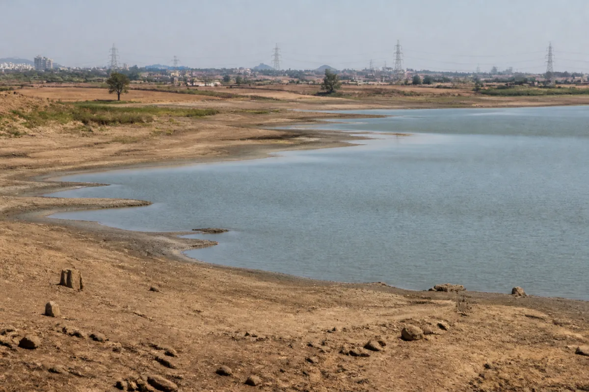
India’s weakest monsoon in a decade has moved the climate conversation beyond rainfall totals. The immediate concern is the reported 13 per cent national deficit between June and September, but the larger urban question is how water systems, food supply chains and heat-preparedness plans will absorb a season that has already left several regions under stress. A new Climate Trends report, cited by Jagran, says the risk of a powerful El Niño event between October and December 2026 is 83 per cent, raising the possibility of lower winter rainfall and an earlier onset of heat by February 2027.
The report does not describe a uniform national failure. Rainfall was close to normal in central and north-western India, while eastern and north-eastern India and the southern peninsula recorded significant deficits. That unevenness matters because water availability, agricultural output and heat exposure are organised regionally, while cities often depend on infrastructure and supply chains that extend far beyond their municipal boundaries.
The eastern and north-eastern regions recorded 1,017.1 millimetres of rainfall against a normal 1,367.3 millimetres, a deficit of 25.6 per cent. Climate Trends described this as the lowest rainfall for the region since 1901. Assam, Arunachal Pradesh, Meghalaya and Bihar were among the states reporting widespread shortfalls. In Assam, 22 of 35 districts had deficient rainfall; the corresponding figures were 12 of 16 districts in Arunachal Pradesh, 10 of 11 in Meghalaya and 33 of 38 in Bihar.
The southern peninsula recorded 542 millimetres against a normal 716 millimetres. Karnataka’s rainfall was down by 30 per cent, followed by Kerala at 28 per cent, Andhra Pradesh at 25 per cent and Tamil Nadu at 20 per cent, according to the report. Telangana, Karnataka, Andhra Pradesh, Rajasthan and Maharashtra have declared drought conditions, while Maharashtra was reported to have drought conditions across 75 per cent of its area.
These numbers reveal a water-management problem that cannot be reduced to the question of whether a city received rain. Cities rely on reservoirs, regional river systems, groundwater, tanker networks and inter-state or inter-district supply arrangements. When rainfall deficits are concentrated in catchments or agricultural regions, the impact can reach urban consumers through restrictions, higher extraction pressure, disrupted food supplies and increased competition among domestic, industrial and farm users.
The Central Water Commission’s reservoir data cited in the report provides an important measure of this pressure. On October 8, live storage in 178 reservoirs was 87.08 per cent of the normal level nationally. In the southern region, however, storage was only 47.22 per cent of normal. The national figure therefore conceals a sharp regional difference: adequate storage in one part of the country cannot automatically compensate for depleted reserves in another.
This is also why the reported El Niño risk matters for planning. Climate Trends estimates an 83 per cent probability that the October-December 2026 event could rank among the strongest since 1950. The report links that possibility to below-normal winter rainfall and higher temperatures. Climate scientist Roxy Mathew Koll said climate change does not create El Niño, but can intensify its effects. The distinction is significant for public administration: the event may be part of a natural climate cycle, but the severity of its consequences depends on exposure, preparedness and the resilience of existing systems.
The timing is particularly important for cities. If heat begins earlier, urban administrations may have less time to prepare cooling centres, drinking-water arrangements, public advisories and emergency responses. The supplied report does not establish how individual cities will be affected or identify specific municipal preparedness levels. It does, however, point to the need for early-warning systems and heat-response planning. Climate Trends director Aarti Khosla called for stronger early-warning systems and improved preparations to deal with heat.
The rainfall pattern also shows why flood and drought management must be considered together. The report says 14 low-pressure systems formed during the monsoon and remained active for 77 days. Skymet Weather vice-president Mahesh Palawat attributed episodes of excessive rainfall and cloudbursts to the prolonged persistence of these systems. A monsoon can therefore produce both shortage and destructive concentration: too little cumulative rain in one region, while intense events overwhelm drainage, slopes or local infrastructure in another.
This uneven distribution challenges the way seasonal performance is communicated. A national rainfall number can suggest relative stability even when individual states and districts face serious deficits. For municipal governments, the relevant indicators are often more local: reservoir levels supplying the city, groundwater conditions, the reliability of treatment and distribution networks, and the ability of drainage systems to handle sudden intense rain. The report supplies evidence of regional stress but does not provide city-level assessments, leaving an important information gap for local planning.
The agricultural data adds a second layer to the urban risk. According to the Agriculture Department figures cited by Jagran, the area under paddy cultivation was down by 1.556 million hectares as of October 5 compared with the previous year. The area under sugarcane and cotton also declined, while pulses and oilseeds expanded. These changes may influence food availability and prices, although the report does not provide a forecast of production, retail prices or procurement outcomes.
For urban residents, the connection between rainfall and food is usually indirect but substantial. Cities depend on rural production areas, transport networks, wholesale markets and storage systems. A change in the crop mix or a decline in cultivated area can affect what enters these networks, while water scarcity can increase pressure on both farming and urban supply. The available evidence establishes the change in cropped area, but not its final impact on consumers. That distinction is important: risk indicators should not be presented as confirmed shortages.
The response suggested by the agricultural experts quoted in the report is a shift towards shorter-duration pulses, oilseeds and millets, along with higher organic matter in soil. These are recommendations attributed to G. V. Ramanjaneyulu of the Centre for Sustainable Agriculture, not a documented government programme in the supplied material. Their relevance to urban policy lies in the way food resilience depends on decisions made outside city limits, including cropping choices, irrigation access and soil management.
The report also records a temperature signal. August 2026 was described as India’s hottest August since 1901, while September was the fifth hottest September. These findings, alongside the projected possibility of earlier heat in 2027, place greater importance on urban heat preparedness. Heat exposure is shaped not only by air temperature but also by housing conditions, access to water, work environments and neighbourhood-level cooling. The supplied report does not quantify these impacts, but it identifies the need for early preparation rather than a response only after severe heat arrives.
Institutionally, the picture is distributed across several authorities. The India Meteorological Department and former weather officials provide rainfall and weather interpretation. The Central Water Commission tracks reservoir storage. Agriculture departments monitor crop areas. Climate research groups assess seasonal risks and advise on preparedness. Municipal bodies are responsible for many of the services through which residents experience the consequences: water distribution, local emergency response, public health coordination and heat action measures. The evidence in the report does not indicate how these agencies are coordinating, which is itself a key issue for monitoring.
The data therefore points to three separate but connected pressures. The first is regional water stress, especially in the southern peninsula and parts of eastern and north-eastern India. The second is agricultural uncertainty, reflected in lower cropped areas for some water-intensive or major commercial crops and a rise in pulses and oilseeds. The third is heat exposure, with record or near-record recent temperatures and a reported possibility of warmer conditions extending into the next season.
None of these indicators alone proves an impending national crisis. The report’s El Niño assessment is a probability, not a certainty, and its consequences will vary by region. Reservoir storage is also not equivalent to accessible municipal supply, while a lower crop area does not automatically translate into lower food production. But taken together, the findings show why seasonal rainfall should be read as an infrastructure and governance issue rather than only a weather event.
What the evidence confirms is that India enters the post-monsoon period with a significant rainfall deficit, sharp regional disparities, low southern reservoir storage relative to normal, changes in crop coverage and heightened concern over future heat. What remains uncertain is the precise scale of the impact on individual cities, agricultural output, food prices and municipal water availability. The next milestones are the evolution of El Niño conditions, winter rainfall, reservoir levels and the preparedness measures adopted by state and local authorities before the expected February heat risk.

