


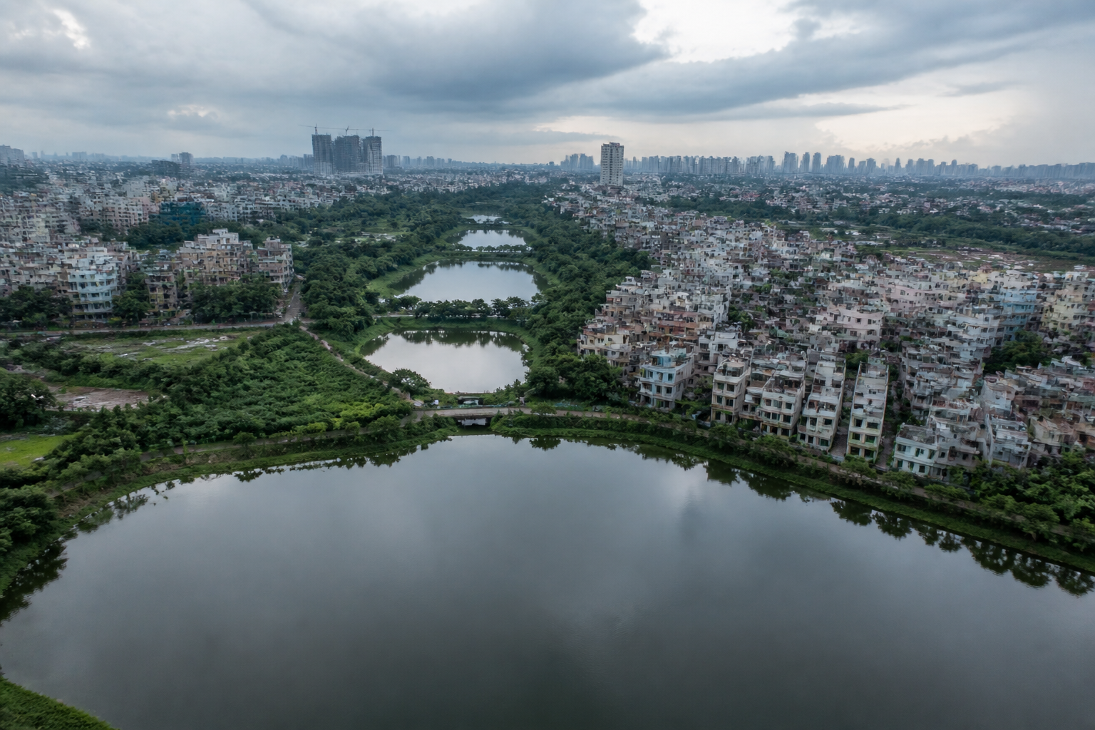
Bengaluru’s lakes were once more than scattered water bodies across a plateau. They formed an interconnected urban water system that moved runoff through tanks, supported groundwater and helped sustain a city that had no major river flowing through it. The system’s fragmentation offers a deeper explanation of how Bengaluru shifted from a decentralised water landscape to dependence on supplies transported from outside the city.
According to a Times of India account of Bengaluru’s history, the city and its surrounding plateau had about 560 lakes until around 1960. The number is significant not only because it represents the scale of the historical network, but because the lakes were connected through the terrain on which the city developed. Water could move from one lake to another along natural drainage routes, while the network helped replenish groundwater.
That arrangement reflected a basic planning response to Bengaluru’s geography. The city stands on an elevated plateau and does not have a major river flowing through it. In the absence of a large perennial river within the city, tanks and lakes became part of the infrastructure that captured, stored and redistributed water. Their function was therefore closer to that of a decentralised utility network than to a collection of scenic public spaces.
The origins of this system go back several centuries. About 500 years ago, when the settlement that later became Bengaluru was still a small fiefdom, around 80 water bodies were built around it. Their placement along natural drainage routes allowed water to flow through a chain of tanks and lakes. This relationship between topography and water management made the network dependent on continuity: individual lakes mattered, but the links between them were equally important.
That distinction is central to understanding Bengaluru’s later water stress. The loss or alteration of one water body could affect more than the area immediately surrounding it. When roads, buildings or other infrastructure interrupted a drainage path, the impact extended to the movement of water through the wider system. The historical account suggests that urbanisation weakened not merely the number of lakes, but the connections that allowed them to operate collectively.
### From a lake-based system to long-distance supply
Bengaluru’s urban expansion changed the scale at which water had to be managed. The city grew substantially after the British established their garrison in the early 19th century, producing two distinct urban parts: the older Pete and the Cantonment. The more decisive transformation, however, came in the 20th century, when the population and built-up area expanded rapidly.
The city’s population reached one million in 1970 and doubled to two million during the following decade, according to the Times of India account. This growth increased demand on the traditional system of lakes, tanks and local water sources. The urban footprint was no longer expanding within the same physical and hydrological limits as the older settlement.
The account also notes that Bengaluru still had a relatively strong water-supply system in the 1970s, including 24-hour supply. At that time, the city’s water arrangements were supported by its lakes and tanks as well as the Arkavathi and Kumudvati river systems. The description is important because it shows that the city’s older water infrastructure did not disappear immediately when its population began to grow. Instead, the relationship between local water systems and external supply changed gradually.
The Cauvery water supply scheme altered that relationship. As Bengaluru grew, long-distance water supply became increasingly important. Water was brought from outside the city to meet the needs of an expanding urban population, while the traditional network of tanks and lakes was progressively weakened by changes to the land through which water had once moved.
This was not simply a change in source. It was a change in the city’s infrastructure model. A lake-and-tank network distributed water management across the urban landscape and depended on local drainage, storage and groundwater recharge. A long-distance supply system concentrated greater importance in infrastructure that carried water into the city from elsewhere. The two systems could coexist, but the historical account indicates that the balance shifted towards external supply as Bengaluru expanded.
### What the city’s growth reveals
The scale of Bengaluru’s physical growth provides the clearest evidence of this shift. When the city’s population was around two million, it occupied approximately 150 square kilometres. By 2011, the population had increased to about 8.5 million and the city’s area had expanded to around 700 square kilometres.
That change in population and area transformed the relationship between the built environment and the water network. Open land was replaced by buildings, roads and other infrastructure. Natural drainage channels and valleys were altered, and the pathways that had connected lakes and tanks became increasingly fragmented.
The contrast is not only between a smaller city and a larger one. It is between two different ways of organising urban water. In the earlier system, water bodies were embedded in the city’s terrain and linked to one another. In the expanded city, the same terrain was increasingly covered or divided by urban development. The city grew outward and denser, but the hydrological network did not expand with it.
This helps explain why counting lakes alone can provide an incomplete account of Bengaluru’s water history. A water body may remain visible on a map while losing its connection to upstream or downstream parts of the system. Conversely, the disappearance of a lake may be only one visible sign of a broader breakdown involving drainage channels, catchments and groundwater recharge routes.
The historical account describes this as a movement from a city supported by interconnected water bodies to a water-stressed metropolis increasingly dependent on distant sources. The central issue is therefore not nostalgia for an earlier landscape. It is the loss of an integrated urban system whose functions were distributed across the plateau.
### The governance challenge behind the lakes
The story also raises an institutional question: who is responsible for maintaining a water system that extends beyond the boundary of any single lake? Managing an individual lake is different from protecting the drainage route that feeds it, the downstream lake that receives its overflow and the groundwater system supported by the wider network.
The supplied account does not identify a single agency or provide a current governance framework for Bengaluru’s lakes. It does, however, establish why fragmented management can be inadequate to the city’s historical geography. The network was designed by terrain and connected through flows of water, while modern urban administration often deals with roads, properties, infrastructure projects and water bodies as separate elements.
That separation can obscure the cumulative effect of urban expansion. A road may be treated as a transport project, a building as a construction activity and a lake as an environmental asset. But where each occupies or interrupts a drainage route, the combined outcome is a change to the city’s water infrastructure. The historical system worked precisely because these relationships were aligned with the landscape.
The shift towards Cauvery water also demonstrates that infrastructure decisions can reduce the immediate pressure to preserve local systems without eliminating the underlying need for them. External supply can serve a growing population, but it does not recreate the groundwater recharge, local storage and drainage functions that interconnected lakes provided. The account does not quantify the present contribution of either system, but it makes clear that the city moved towards greater reliance on water brought from outside.
### The bigger urban question
Bengaluru’s history presents a wider lesson for cities built without a major river: water security is not created by one large supply project alone. It depends on the interaction between local landscapes, storage, drainage, groundwater and networks that operate across neighbourhood boundaries.
The city’s growth from roughly 150 square kilometres and two million people to around 700 square kilometres and 8.5 million people by 2011 shows how quickly urban expansion can outpace the spatial logic of older infrastructure. The lake network was not merely left behind by growth; its operating conditions were changed as land cover, drainage routes and the built environment were transformed.
The evidence supplied here confirms the broad direction of that transformation: Bengaluru once relied on a connected system of lakes and tanks aligned with its plateau geography, while rapid urbanisation fragmented the network and increased dependence on distant sources. It does not establish the condition of every lake, the current performance of the city’s water systems or the precise contribution of each source. Those questions require further hydrological, administrative and infrastructure data.
What the history makes difficult to ignore is that Bengaluru’s water challenge is also a planning challenge. The city’s older landscape functioned as infrastructure because its parts were connected. Any assessment of its future water security must therefore look beyond individual lakes and examine the networks, drainage routes and urban decisions that determine whether those parts can work together.
