


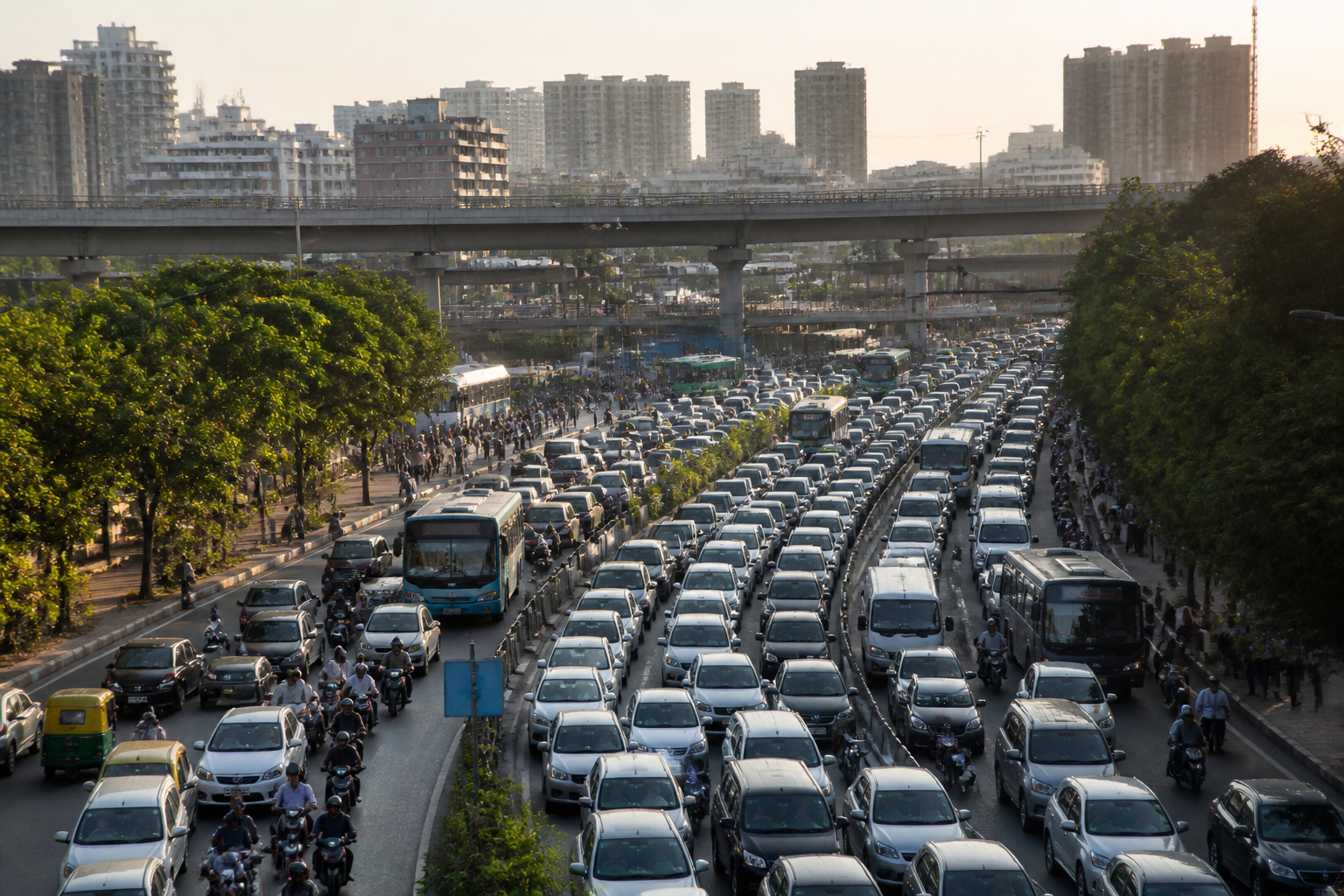
Bengaluru traffic police have proposed a new package of flyovers and underpasses at locations across the city, arguing that targeted grade separation is needed to ease congestion at major junctions and railway crossings. The proposal, submitted to the Greater Bengaluru Authority, comes as the city’s registered vehicle count approaches 1.50 crore and daily traffic pressure continues to rise despite metro expansion, road widening and additional public transport measures.
The proposal is more than a list of new structures. It is a snapshot of how Bengaluru’s mobility problem is being understood by the agencies managing traffic on the ground. The traffic police have identified high-density corridors, 246 heavily congested junctions and a series of locations where they believe signal-free movement could improve traffic flow. At the same time, the proposal includes measures involving lane markings, traffic signs, bus stops, drainage, pedestrian crossings and parking.
The report by Vijay Karnataka attributes the proposal to Bengaluru city traffic authorities and quotes Joint Commissioner of Police, Traffic, Karthik Reddy, as seeking directions from the Greater Bengaluru Authority to take action at the identified locations. The proposal covers flyovers and underpasses at railway crossings, junctions and arterial roads, including locations around Nagawara, K.R. Puram, Mahadevapura, Hebbal, Yelahanka, Peenya, Sarakki and Ibbaluru.
The central issue is the gap between infrastructure expansion and traffic outcomes. Bengaluru already has 42 flyovers and 28 underpasses, while work is under way at several other locations. The metro network has also been expanded, public transport has been increased and roads are being widened. Yet congestion remains persistent on routes such as Silk Board, Electronic City, Marathahalli, Whitefield, Hebbal, K.R. Puram, Bannerghatta Road, Tumakuru Road and Mysuru Road.
The supplied report links the continuing congestion to several overlapping conditions: a rising vehicle population, narrow roads, ongoing road works, inadequate parking and limited dependence on public transport. It says more than 2,000 new vehicles are being added every day. Vehicles from neighbouring districts and states also enter and leave the city daily, adding to the pressure on roads used by Bengaluru residents.
This combination creates a difficult planning problem. A flyover or underpass can separate conflicting traffic movements at a specific junction, but the wider road network still determines where vehicles go next. If congestion is shifted to the next junction, the intervention may improve one point without resolving the corridor-level problem. The proposal itself recognises that junction operations cannot be treated in isolation: it includes signal systems, road markings, bus-stop changes, skywalks, parking facilities and drainage interventions alongside grade-separated structures.
The locations identified by traffic police cover several types of bottlenecks. Railway underpasses have been proposed at Pottery Road, Lingarajapuram, K.R. Puram railway station and the Binnimill railway gate on Magadi Road. Junction-level interventions are proposed at Nagawara, Banaswadi’s Jayanthinagar, Bhattarahalli near K.R. Puram, Kundalahalli Road, Phoenix Mall Junction and Big Bazaar Junction in Mahadevapura. Other identified points include Hebbal, Yelahanka, Sadahalli Gate near Chikkajala, Indian City Junction in Hennur, Sarakki, J.D. Mara and Ibbaluru.
The report states that traffic police have classified Ballari Road, Old Madras Road, Old Airport Road, Sarjapur Road, Bannerghatta Road, Kanakapura Road, Mysuru Road, Magadi Road, Tumakuru Road, West of Chord Road and the Outer Ring Road as high-density corridors. It also identifies 246 junctions with particularly high traffic volumes. These figures indicate that the proposal is intended to address a network of pressure points rather than a single isolated traffic hotspot.
However, the supplied material does not establish the design, cost, land requirement, construction schedule or approval status for each proposed flyover or underpass. It also does not indicate whether feasibility studies, traffic modelling, environmental assessments or land-acquisition reviews have been completed. The proposal should therefore be understood as a request for action and prioritisation, not as confirmation that all the structures will be built.
The traffic package includes several measures that could be implemented without the scale of a major grade-separated project. The proposal seeks the installation of 2,340 traffic signs and thermoplastic lane markings at 707 locations. It also calls for the removal of scientifically inappropriate speed breakers, action at 137 waterlogging locations, the relocation of 103 bus stops and construction of 63 new bus bays. More than 100 skywalks and multilevel parking complexes at 66 locations have also been proposed.
These elements show that congestion is being treated as a road-space and street-management issue as well as a construction challenge. Poorly marked lanes can increase friction between vehicles. Bus stops placed in active traffic lanes can slow corridors. Waterlogging can reduce usable carriageway space, while unplanned parking can narrow roads further. The proposal’s breadth suggests that traffic police see these recurring operational problems as part of the same mobility system as flyovers and underpasses.
Signal management is another component. The report says adaptive traffic control systems have already been installed at 169 signals. A further 110 junctions have received administrative approval for adaptive signals, with an estimated cost of Rs 56.45 crore for implementation and five years of maintenance. The tender process for this work is under way, according to the report.
Adaptive signals are intended to adjust signal operations according to traffic conditions, but the supplied material does not provide performance data for the 169 existing installations. It is therefore not possible to determine from the report how much travel time, queue length or intersection delay has changed at those locations. That missing evidence will matter when the authorities assess whether additional signal coordination can reduce the need for physical grade separation at some junctions.
The proposed flyovers and underpasses also sit alongside a much larger elevated-road programme. The state government has approved 11 elevated corridors with a combined length of 75.60 kilometres and an estimated cost of Rs 13,262.70 crore. Tenders have reportedly been invited for elevated corridors on some roads. The relationship between this programme and the newly proposed structures is not explained in the supplied report, including whether the projects are complementary, overlapping or part of separate planning exercises.
That institutional question is important because the proposal has been sent to the Greater Bengaluru Authority, while traffic police, the state government, public transport agencies and road authorities each have different responsibilities. A citywide response will require these agencies to align junction priorities, road design, metro and bus operations, construction schedules and maintenance. Without that coordination, individual projects can create new bottlenecks during construction or transfer traffic pressure from one part of a corridor to another.
The evidence in the report confirms the scale of the pressure but does not yet establish which interventions will deliver the greatest benefit. Bengaluru has a large and growing vehicle population, extensive traffic congestion and multiple infrastructure programmes. It also has a mix of immediate street-level problems and longer-term network constraints. The proposed package reflects that complexity, but its effectiveness will depend on project selection, sequencing, design and implementation rather than the number of structures announced.
The next stage is therefore administrative and technical: the Greater Bengaluru Authority must examine the traffic police proposal, determine which locations should be prioritised and establish the status of individual projects. The adaptive-signal tender, the approved elevated-corridor programme and the proposed junction, bus-stop, drainage, parking and pedestrian measures will need to be tracked separately. Until those details are published, the proposal is best read as a broad infrastructure and traffic-management agenda rather than a confirmed construction schedule.
