


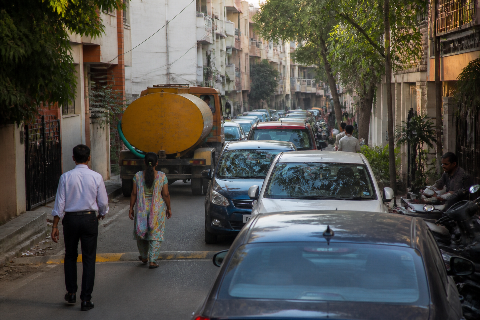
Subheadline: As vehicle numbers rise and navigation apps redirect traffic through local lanes, residents are turning to petitions, private barriers and informal monitoring to protect neighbourhoods.
Standfirst: Bengaluru’s traffic problem is no longer confined to arterial roads. A report from Deccan Herald describes how residential streets in Sahakaranagar, Kadubeesanahalli, Koramangala and Marathahalli are absorbing vehicles seeking to avoid congestion on larger roads. The consequences include frequent honking, speeding, accidents and safety concerns. The city had more than 1.2 crore vehicles as of March, while nearly 80,000 vehicles were registered in June alone, according to the report. This analysis examines what the reported experiences reveal about the redistribution of traffic, the role of navigation platforms, the limits of resident-led interventions and the institutional challenge of managing public roads that have become informal thoroughfares.
Bengaluru’s traffic is increasingly being experienced inside neighbourhoods that were designed, or at least understood, as residential spaces. Streets that residents describe as once quiet are now carrying vehicles diverted from congested main roads. The shift is visible not only in traffic volumes but also in the kinds of safety measures residents are seeking: road humps, signs, height barriers, traffic monitoring groups and repeated written complaints to public authorities.
The scale of the city’s vehicle growth provides the immediate context. Bengaluru had more than 1.2 crore vehicles as of March, while close to 80,000 vehicles were registered in June alone, according to the Deccan Herald report. The available material does not establish how many of these vehicles use residential streets or how traffic volumes have changed across the city over time. It does, however, show how the pressure created on major routes is being redistributed into smaller lanes.
At Shantivana 2nd Cross in Sahakaranagar, residents say a 30-foot lane has become an alternative route for vehicles trying to avoid main-road congestion. Swaroop Kalyani, a resident, said petitions were submitted to the traffic police and the Greater Bengaluru Authority in November, followed by further petitions in February and May. Road humps and a signboard were eventually installed to restrict heavy vehicles, but residents said the measures did not resolve the problem.
Swarnalatha T S, another resident, said residents had counted as many as 60 vehicles passing through the lane in a minute during peak hours. She also said there had been at least one accident a week. These figures are resident observations cited in the report, rather than an independently published traffic count. Their significance lies in the type of pressure they describe: a narrow residential road performing the function of a traffic distributor without the design, enforcement or safety systems normally associated with that role.
The response also exposes a difficult boundary between citizen action and public authority. After road humps and signs failed to deter heavy vehicles, residents pooled money to install iron barriers overnight. Authorities removed them. The action illustrates the legal and administrative limits on private interventions in public streets, even when residents believe official measures have failed.
Advocate R Harikrishnan, quoted in the report, said residents may organise, complain and make representations, but cannot independently declare a public road one-way or install permanent barricades, height barriers or traffic signs. Such actions may amount to obstruction of a public street under Section 92 of the Karnataka Police Act, 1963. The distinction is important: residents can document a problem and seek enforcement, but they cannot assume the powers required to redesign or regulate a public road.
The result is a governance gap. Residents experience the consequences immediately, while the authority to make durable changes remains with public agencies. Bengaluru North City Corporation Commissioner Pommala Sunil Kumar said the team was working to find a solution, but there was no clear timeline. For residents of Shantivana 2nd Cross, that absence of a timeline means that petitions, traffic observations and temporary measures continue without a defined implementation path.
Kadubeesanahalli presents a different version of the same pressure. Residents there have raised concerns about accidents involving water tankers. Chandrashekar, a resident, linked the increased tanker demand to the growth of technology parks and the spread of unauthorised paying guest accommodation. The report does not establish the total number of such facilities or provide a citywide tanker-accident dataset. It does record residents’ claim that tanker accidents continue to occur once every four or six months and that protests have been held over the issue.
This case connects traffic management to the wider urban pattern around employment clusters and housing. When workplaces expand and accommodation grows around them, the demand for water, deliveries and passenger movement also increases. If these activities are not matched by adequate regulation and road management, the effects can appear on streets that were not planned to handle them. In Kadubeesanahalli, the concern is not simply congestion but the interaction between land use, water supply, informal accommodation and heavy vehicles.
Navigation platforms add another layer to the problem. Suvarna Agarwal, vice president of the Koramangala 3rd Block Residents’ Welfare Association, said navigation apps frequently route traffic through inner residential lanes. This suggests that digital route optimisation can shift congestion rather than remove it. A route that is efficient for an individual driver may impose cumulative safety and noise costs on a neighbourhood, particularly when many vehicles are directed through the same narrow streets.
The report also describes examples where residents and authorities have worked together. In Koramangala 3rd Block, residents installed height barriers on four roads being used as thoroughfares. Agarwal said residents paid for the barriers and obtained the necessary permissions. The example differs from the unauthorised barriers installed in Sahakaranagar because it involved formal coordination and approval. It shows that resident participation can support traffic management when it operates within a recognised administrative process.
In and around Marathahalli, residents have created WhatsApp groups for individual traffic junctions. Four groups together have more than 900 members, according to the report. Representatives from the traffic police are included, and residents post updates that can prompt action. Some residents also volunteer to help clear traffic. These groups create a reporting network that is faster and more localised than a conventional complaint process, although the supplied material does not establish whether the arrangement has reduced accidents or traffic volumes.
The contrast between these neighbourhoods is revealing. Where residents have a channel to traffic police and permissions for physical interventions, local action appears more coordinated. Where repeated petitions have not produced a clear solution, residents have attempted measures themselves, only to have them removed. The underlying issue is not whether communities are willing to participate; the report shows that they are. It is whether participation is connected to decisions, enforcement and timelines controlled by the agencies responsible for public roads.
The legal route described by Harikrishnan reinforces the importance of documentation. Residents should submit written representations and maintain records of their complaints. They can use the Right to Information Act to track action and, in cases of continued inaction, approach the Karnataka High Court under Article 226 seeking directions to authorities to consider the complaint and act. These options do not create an immediate traffic solution, but they convert an informal grievance into a documented administrative issue.
Bengaluru’s residential-lane problem therefore has three linked dimensions. The first is demand: the city’s expanding vehicle population and activity around employment and housing areas are placing more pressure on the road network. The second is routing: congestion on main roads and directions from navigation platforms can push vehicles into smaller streets. The third is authority: residents can identify the danger but cannot legally impose permanent traffic controls without approval.
The available evidence does not show whether Bengaluru has a citywide policy for preventing navigation systems from directing through-traffic into residential lanes, nor does it provide a consolidated record of accidents, tanker movements or complaints across the affected neighbourhoods. Those gaps matter because isolated resident accounts can establish a local problem, but only systematic data can determine its scale and help authorities prioritise interventions.
What the reported cases do establish is that traffic management is becoming a neighbourhood-level governance challenge. The question is no longer limited to how quickly vehicles move on major corridors. It also concerns who bears the cost when those corridors fail, how residential streets are classified and protected, and whether public agencies can respond before residents resort to improvised measures.
The next stage for Bengaluru’s authorities is therefore visible in the issues raised by residents: provide clear decisions on repeated complaints, define the permitted use of local traffic-calming measures, address heavy-vehicle and tanker movement, and clarify how traffic police and civic agencies will respond to route diversion through residential areas. Until those responsibilities are connected, the city’s traffic problem will continue to appear not only on its main roads, but in the lanes behind them.
