


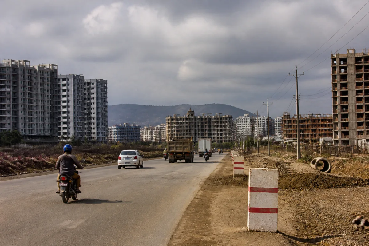
Pune’s revised development plan for nine villages is moving towards final approval after 143 changes to proposed roads, public reservations and civic facilities. The revisions show how the city’s formal planning system is being reshaped by a difficult ground reality: land has already been built upon, roads no longer fit the original alignments, and residents have challenged parts of the draft plan.
The revised plan was sent to the Maharashtra government for final approval on November 6, after the changes were published in the Maharashtra government gazette on November 5. The process is being carried out under Section 28(4) of the Maharashtra Regional and Town Planning Act. The maps and list of changes will be available for public inspection for 30 days before the next stage of approval under Section 30.
The immediate significance of the Pune development plan lies in the scale and distribution of the changes. Of the 143 modifications, 84 concern the road network, 28 relate to reservations and 30 affect facility areas. The changes include reducing road widths, shifting road alignments, cancelling reservations, changing the purpose of reserved land and moving public facilities to alternative sites.
This is not simply a technical revision to a planning map. A development plan determines where roads, schools, hospitals, parks, utilities, transport facilities and other public uses are expected to fit into a growing urban area. When those reservations change, the relationship between private development and public infrastructure changes as well. The supplied report does not establish the eventual financial or mobility impact of each modification, but it shows that the original plan has been substantially adjusted before receiving final approval.
The changes are spread across areas that have experienced rapid urban expansion. The villages were incorporated into the Pune Municipal Corporation in 2017, and the planning exercise has been awaiting progress for nine years. The areas covered include Lohgaon, Mundhwa-Keshavnagar, Hadapsar-Sadesataranali, Undri, Ambegaon Budruk, Ambegaon Khurd, Dhayari and Shivane, with Uttamnagar also appearing in the distribution of changes. The report describes these areas as being organised across eight sectors.
Lohgaon recorded the highest number of changes, with 31 modifications, accounting for 22 per cent of the total. Dhayari followed with 20 changes, or 14 per cent, while Undri had 19, or 13 per cent. Shivane and Uttamnagar together accounted for 18 changes, Ambegaon Budruk for 17, Mundhwa-Keshavnagar and Hadapsar-Sadesataranali for 15 each, and Ambegaon Khurd for seven.
The road revisions provide the clearest indication of how planned widths are being recalibrated. In Undri, the proposed width of State Highway 116 has been reduced from 60 metres to 45 metres. In Lohgaon, the Dhanori-Wagholi road is proposed to be reduced from 36 metres to 24 metres. In Mundhwa-Keshavnagar, some 36-metre roads have been reduced to between 18 and 24 metres. Other changes reduce 24-metre roads to 18 metres and 18-metre roads to 12 metres.
At the same time, the revisions are not uniformly about reducing road space. In parts of Hadapsar, a proposed 15-metre road has been increased to 18 metres. Some roads have also been shifted to alternative alignments because of existing construction and conditions on the ground. The contrasting changes suggest that the plan is being adjusted road by road rather than through a single citywide formula.
That distinction matters for how the plan should be understood. A narrower road may reduce the land required for acquisition or prevent conflict with existing structures, but it also changes the amount of space available for movement and services. A wider road may improve connectivity in one location while creating new land and implementation requirements. The source report does not provide traffic forecasts, acquisition estimates or engineering assessments, so the transport consequences of individual changes remain to be established.
The process also highlights the role of public objections in formal planning. According to the report, 70 to 75 per cent of the objections and suggestions received were considered positively, resulting in the 143 modifications. This indicates that the draft plan was not treated as a fixed technical document. It was revised in response to submissions from citizens and to the practical difficulties visible in the affected areas.
However, the report also links several changes to unauthorised construction. In some locations, existing unauthorised buildings made it difficult to retain the original reservations. Those reservations were therefore cancelled and the concerned land was proposed for residential use. This is one of the most consequential aspects of the revision because it shows how development that occurred before the plan was finalised can influence the final allocation of land.
The planning sequence creates an institutional tension. Development plans are intended to reserve land and establish infrastructure networks before urbanisation becomes difficult to manage. But when a plan takes years to reach final approval, the city may continue to build around, over or against the proposed network. The report does not identify responsibility for the delay or quantify the extent of construction affecting reservations. It does, however, document the result: the final plan is being altered to reflect conditions that emerged during the waiting period.
Public facility reservations have also been reworked. In Lohgaon, reservations for a playground, a municipal office, a water tank and certain urban spaces have been cancelled. In Ambegaon Budruk, changes have been made to reservations for playgrounds, a cultural hall and gardens. In Shivane, the proposed uses of reservations for a dispensary, a garden and a shopping centre have been changed.
These modifications are important because public facilities are not interchangeable in their effect on neighbourhoods. A water tank serves a utility function, a playground provides open space, a dispensary supports local healthcare access and a municipal office provides administrative capacity. The source does not specify the replacement arrangements for every cancelled or modified reservation, so the adequacy and distribution of the final public-facility network cannot yet be assessed.
Some changes involve moving facilities rather than removing them. The electricity distribution company’s reservation in Ambegaon Budruk has been shifted to Ambegaon Khurd. In Dhayari, a bus depot reservation is being divided, with one part proposed for a truck terminal. A police station is proposed on land earlier reserved for a public facility centre, while an alternative site has been identified for a waste-processing project.
The Dhayari changes illustrate how the plan is attempting to accommodate different forms of urban infrastructure within the same expanding area. A bus depot, truck terminal, police station and waste-processing facility serve different operational needs and may have different land, access and environmental requirements. The report confirms the proposed changes but does not provide the area of each site, the implementing agency, project budgets or construction timelines. Those details will be important in determining whether the revised reservations can be delivered after approval.
The larger policy question is whether the final development plan will function as a realistic implementation framework or remain primarily a land-use document. The process has now moved beyond the draft stage, but approval alone will not create roads, public facilities or utility networks. The next steps described in the report are procedural: public display of the maps and modification list for 30 days, completion of the final approval process under Section 30 and a decision by the state Urban Development Department.
For residents, the 30-day inspection period is the next formal opportunity to examine how their streets, plots and neighbourhood facilities have been treated. For the municipal corporation and the state government, the plan presents a consolidated set of decisions on roads, reservations and public uses across villages that entered the municipal boundary in 2017. The final test will be whether the approved map can guide infrastructure delivery while retaining enough public land and network capacity for the villages’ continuing urbanisation.
What the evidence confirms is that Pune’s nine-village plan has been materially rewritten before final approval, with road changes forming the largest component and public reservations undergoing significant cancellations, relocations and use changes. What remains unclear from the available information is how these revisions will affect traffic movement, open-space access, public-service coverage and the cost of implementation. Those questions will become central once the state government completes the approval process and the revised plan becomes the operative framework for development.

