


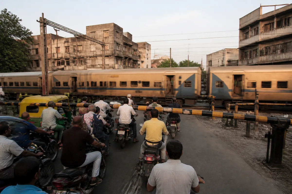
Ahmedabad’s plan to eliminate railway level crossings has encountered a problem that is common to established cities: the infrastructure needed to remove one obstruction can require more urban space than the city can provide. A report by Gujarat Samachar identifies nine crossings where overbridges or underbridges face difficulties because of narrow roads, inadequate space for approach routes, underground utility lines and existing metro corridors. The result is a safety and mobility programme that is technically desirable but difficult to fit into the built-up city.
The issue is not simply whether an overbridge can be constructed across a railway line. A grade-separation project also needs roads wide enough to carry traffic towards and away from the structure, land for ramps, clearance from other infrastructure and coordination between the agencies that own or control the surrounding space. In Ahmedabad, the report indicates that these conditions are not available uniformly across the nine locations.
That makes the city’s gate-free objective a test of urban retrofit rather than a straightforward railway construction programme. Level crossings can delay road users when trains pass and create safety risks where road and rail movements intersect. But replacing them with bridges or underpasses requires a redesign of the local transport system. Where the adjoining road network is narrow or already constrained by utilities and metro infrastructure, the crossing itself may be only one part of the problem.
The report says proposals for overbridges or underbridges have been sent by the railway to the Ahmedabad Municipal Corporation and other relevant authorities. The municipal corporation has raised objections or expressed difficulties at several locations. Its concerns include narrow town-planning roads and the lack of sufficient space to build approach roads. At some locations, underground water and sewage lines make an underbridge difficult, while a metro corridor above creates a separate constraint for an overbridge.
This is a familiar institutional pattern in large infrastructure projects. The railway may control the crossing and initiate a proposal, but the approaches, land requirements, road connections and local utilities fall within the responsibilities of other public agencies. A project can therefore remain technically proposed without reaching construction unless the agencies agree on design, land, relocation and approvals.
The Ahmedabad railway crossings identified in the report show how these constraints vary by location. The Maninagar crossing, identified as LC-308 on the Ahmedabad-Vadodara railway section, is described as one of the busiest locations because both train and vehicle movements are high. The Vatva-Vinzol crossing, identified as LC-305, also carries significant movement. At both sites, vehicles have to wait when the gates close for trains. The report says the railway’s Gati Shakti division has begun the process of developing overbridges at these two crossings, even though narrow roads and inadequate space remain concerns raised by the municipal corporation.
The significance of these two locations is that the need for intervention and the difficulty of intervention exist at the same time. High traffic and frequent train movements strengthen the case for grade separation. Yet the same urban intensity can reduce the availability of land for ramps and approaches. A bridge that solves the rail-road conflict at the tracks could create new bottlenecks if its connections are not integrated with the surrounding road network.
At Asarwa, the problem is more directly linked to the road geometry. The LC-1 crossing on the Ahmedabad-Himmatnagar railway section has been proposed for an overbridge, but the municipal corporation has reportedly stated that the town-planning road is narrow and there is not enough land for an approach road. The current position, according to the report, is to maintain the existing arrangement rather than move the bridge proposal forward.
The Naroda GIDC crossing, identified as LC-10, illustrates a different institutional barrier. The railway proposed an overbridge, but the proposal did not progress after GIDC did not accept it. This indicates that even where a railway crossing is recognised as a problem, implementation can depend on the consent of an industrial-area authority whose land, roads or operational requirements may be affected by the project.
Five other crossings are reported to face a combined infrastructure constraint. They are LC-8 at Vijaynagar, LC-9 near Sanghvi High School, LC-10 at Naranpura, LC-12 at Navrangpura and LC-18 at Bhudarpura, all on the Sabarmati-Botad railway section within Ahmedabad. Proposals for bridges have reportedly been sent, but have not advanced because of inadequate responses and the physical limitations at the sites.
The constraints at these five crossings are important because they show that the city’s underground and elevated systems are competing for the same limited corridor space. Narrow roads reduce the ability to create approaches. Underground water and sewage lines complicate excavation for an underbridge. Metro corridors above ground restrict the available vertical and horizontal geometry for an overbridge. Each individual constraint may be manageable, but their combination can make a standard bridge design impractical.
The evidence supplied in the report does not establish that alternative designs, land acquisition plans, utility-relocation packages or traffic-diversion arrangements have been finalised for these locations. It does establish that the railway has sent proposals, that several authorities have raised difficulties or not provided the required response, and that work has begun procedurally at Maninagar and Vatva-Vinzol. The distinction matters: a proposal, a feasibility process and an approved construction project are different stages of delivery.
### Why Ahmedabad railway crossings are difficult to retrofit
The gate-free objective is built around three public purposes: reducing interruptions to train operations, saving road users’ time and improving safety at railway crossings. These objectives are clear. The difficulty is that the replacement infrastructure must operate within a city that has already been built around existing roads, utilities, railways and metro lines.
In a newer peripheral area, a bridge approach can potentially be planned alongside a wider road reserve. In older or denser parts of Ahmedabad, the road reserve may already be fixed by buildings, commercial activity, institutional properties and underground services. The report does not provide land-acquisition figures or detailed engineering designs, but its location-specific account shows that the physical corridor is a decisive factor in whether a crossing can be removed.
The presence of a metro corridor adds another layer to the planning problem. Metro infrastructure is itself intended to provide high-capacity urban mobility, but its piers, alignments and clearances occupy valuable space along already constrained roads. At the five Sabarmati-Botad section crossings, the same transport network that expands mobility may also limit the options for removing railway gates. This is not necessarily a conflict between the two systems; it is evidence that transport projects need to be planned as a network rather than as separate corridors.
The utility issue is equally significant. An underbridge may avoid some of the visual and land constraints of an overbridge, but excavation near water and sewage lines introduces relocation, service-continuity and construction risks. The report identifies underground utilities as a reason why underbridges are difficult at several sites. It does not specify which lines would need relocation or how much that work would cost, so the scale of the challenge remains unquantified in the supplied material.
### The institutional question behind the bridge proposals
Ahmedabad’s case also raises a question about who is responsible for converting a railway safety objective into a functioning urban project. The railway can propose a bridge and its Gati Shakti division can begin a process, but municipal roads, town-planning reservations, utilities, industrial land and metro infrastructure involve other authorities. Progress therefore depends on a chain of decisions rather than on a single approval.
The report’s account of Naroda GIDC demonstrates how this chain can stop a proposal. At the other locations, the reported absence of suitable responses or the municipal corporation’s concerns have similarly prevented progress. The issue is not only administrative delay. It is also the absence, at least in the supplied evidence, of a publicly established framework for resolving conflicts over land, utilities, road width and design responsibility.
For residents and road users, the consequence is continued exposure to the existing crossing arrangements. When gates close, vehicles wait; when crossings remain at grade, road and rail traffic continue to share the same conflict point. Yet the report also shows why simply announcing a bridge cannot be treated as a solution. Without a workable approach-road plan and coordination with surrounding infrastructure, the bridge may remain a proposal on paper.
The immediate distinction between locations is therefore important. Maninagar and Vatva-Vinzol have entered a process through the railway’s Gati Shakti division. Asarwa and Naroda have not advanced under the conditions described. The five crossings affected by metro and underground utilities also remain constrained. These are not equivalent project stages, and treating all nine crossings as one uniform programme would conceal the different barriers that must be addressed.
Ahmedabad’s experience shows the limits of a gate-free strategy that is measured only by the number of crossings identified for replacement. The more difficult measure is whether each crossing has a viable corridor, an agreed institutional arrangement, a utility plan and a road network capable of absorbing the new structure. The supplied report confirms that these conditions are not yet in place at several locations.
The next developments to watch are the railway’s feasibility and approval process at Maninagar and Vatva-Vinzol, the response of the municipal corporation and other authorities to the remaining proposals, and whether a solution is developed for the narrow roads, underground services and metro interfaces. Until those steps produce approved and implementable designs, Ahmedabad’s gate-free plan remains an objective facing significant urban constraints rather than a citywide construction programme.

