


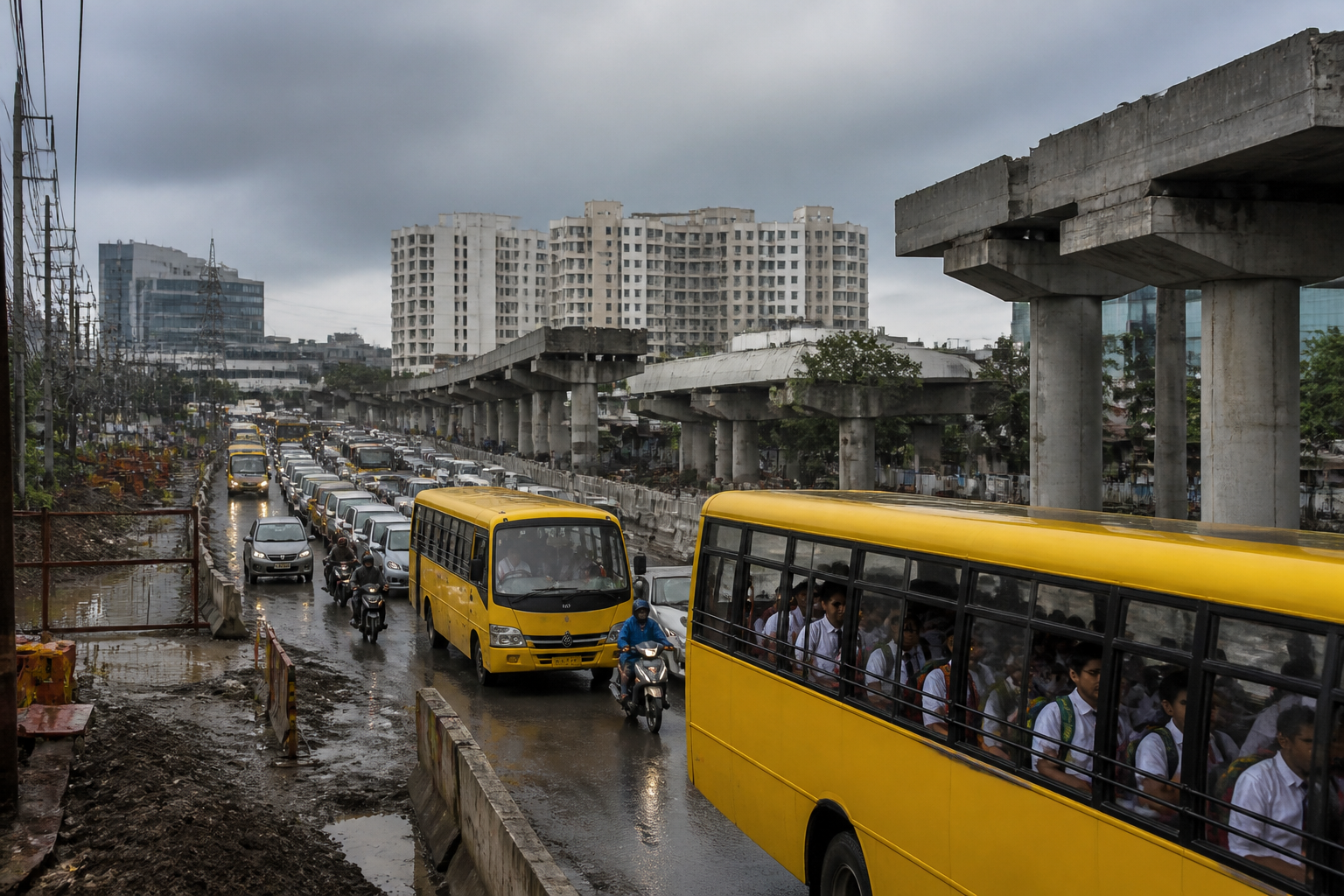
Bengaluru school bus traffic has reached a point where a 10km journey on the Whitefield–Sarjapur corridor takes up to 112 minutes a day, according to GPS data from 61 school buses operated for students of Inventure Academy near Dommasandra Circle. The figures show how road damage, diversions, unfinished infrastructure and poorly managed junctions are combining to turn a short east Bengaluru commute into a daily loss of time for children and families.
The average speed of the buses on the corridor is 9.2 kmph. On the slowest stretch, towards Prestige Lakeside Habitat and Palm Meadows, buses move at only 6.4 kmph—roughly the pace of a brisk walker. Routes towards Gran Carmen, Adarsh Palm Retreat and AECS Layout-Kundalahalli perform better, but even there the average speed is 11.3 kmph.
The problem is not simply that Bengaluru traffic is slow. The data indicates that school transport is being forced through a network where several local failures converge. The corridor serves a dense concentration of homes, offices and private schools, while road works, diversions and narrow junctions reduce the available capacity during the same morning and evening periods when school and workplace travel peaks.
According to the school’s mapping, the area has 42 private schools and more than 1,000 school buses, potentially affecting about 40,000 students travelling by school bus. Inventure Academy said 86% of its students use school buses. This makes the school journey a useful measure of how the wider road network is functioning: when buses are delayed, the disruption is experienced not only by individual families but also by schools, parents, drivers and workplaces that depend on predictable arrival times.
The GPS analysis shows that the 10km school commute has worsened from 92 minutes in 2024–25 to 112 minutes in 2026–27. Morning travel has increased from 39 to 47 minutes, while evening travel has risen from 53 to 65 minutes. The combined journey means students spend nearly two hours travelling on a school day. Across 200 school days, the analysis calculates 374 hours on the road, equivalent to nearly 53 school days.
The weekday pattern is uneven, pointing to the importance of traffic management rather than road width alone. The journey between Varthur Kodi and Inventure Academy averages 64 minutes on Monday, 59 minutes on Tuesday, 68 minutes on Wednesday, 76 minutes on Thursday and 60 minutes on Friday. Thursday is therefore the worst-performing day in the available data, with buses averaging only 8.4 kmph on the afternoon trip between the school and Varthur Kodi.
This variation matters because it suggests that congestion is shaped by the timing and interaction of trips, diversions and junction movements. A road can function differently from one weekday to another even when the physical infrastructure remains unchanged. The data does not establish that any single factor causes the Thursday peak, but it demonstrates that congestion is not evenly distributed across the week and that traffic operations may need to respond to demand patterns rather than rely on fixed arrangements.
The corridor’s bottlenecks are geographically specific. At Dommasandra Circle, broken roads, potholes and incomplete flyover work reduce usable road width and disrupt movement through the junction. Traffic heading towards Whitefield passes through Gunjur Temple and the Double Road diversion, while the temporary closure of Club Road has placed additional pressure on the existing route.
At Gunjur, high traffic volumes converge on narrow roads. Varthur Kodi faces narrow and encroached roads, diversions and conflicting traffic movements. On the VIBGYOR Road–Kundalahalli stretch, poor road conditions and waterlogging reduce usable space, particularly during and after rain. At Gran Carmen, damaged roads, weak signal management and the existing U-turn arrangement interrupt traffic flow.
These locations illustrate why a corridor-wide promise to improve traffic may not be enough. Each bottleneck has a different operational problem: road surface and unfinished works at one location, turning movements and diversion pressure at another, and drainage or signal timing elsewhere. The proposed responses in the school’s assessment are correspondingly location-specific, including road repairs, completion of priority flyover work, junction traffic plans, better management of turning movements, removal of obstructions, drainage improvements and changes to signal timing.
The institutional question is just as important as the engineering one. The available assessment calls for a defined intervention, a clear responsibility and a visible completion timeline for every hotspot. Without those three elements, a corridor can remain trapped between agencies responsible for roads, traffic enforcement, construction works, drainage and diversions. The supplied material does not identify a single authority responsible for delivering all the proposed measures, but the pattern of failures shows why fragmented responsibility can make everyday congestion difficult to resolve.
Immediate relief measures identified in the assessment include stronger traffic-police management, enforcement of heavy-vehicle restrictions, removal of urgent road obstructions and improved junction movement. It also calls for traffic-volume-based release cycles and turning arrangements instead of arbitrary manual intervals. Active roadworks could be scheduled at night, on weekends or during holidays where possible, while a shared response mechanism could address breakdowns, incidents and sudden congestion.
Protecting pedestrian crossings and school-bus movements is another part of the proposed response. This is significant because school transport is not only a vehicle-flow issue. Buses must enter and leave local roads, children must board and alight safely, and pedestrians must cross roads that are already operating under pressure. Measures that improve vehicle throughput but compromise those movements would not resolve the full mobility problem recorded by the school’s data.
The school has also raised the possibility of coordinating travel demand beyond the road itself. Inventure Academy founder Nooraine Fazal said schools were working to optimise school transport but that the government needed to ensure basic road infrastructure and more efficient traffic management. She also pointed to the consistent Thursday delays and asked whether more offices could allow employees to work from home on that day or stagger office timings so that schools and workplaces did not place all their vehicles on the road simultaneously.
That suggestion highlights the scale of the planning challenge. The Whitefield–Sarjapur corridor is not serving a single land use or a single travel purpose. School buses, office commuters, local residents, heavy vehicles and construction-related traffic are using overlapping routes. The road network is therefore being asked to absorb several peak periods and movement types at once, while some links remain damaged, diverted or incomplete.
The comparison with Bengaluru’s wider traffic conditions reinforces the severity of the school-bus experience. The TomTom Traffic Index put Bengaluru’s average rush-hour speed at 13.9 kmph in 2025, while the school buses on the Whitefield–Sarjapur road averaged 9.2 kmph. The comparison does not measure identical routes or conditions, but it places the school-bus data within the city’s broader congestion problem and shows that this corridor performs worse than the cited citywide rush-hour average.
The late-arrival figures also reveal the operational consequences. About 60% of trips arrive after their scheduled time, 15% are delayed by at least 30 minutes and 4% of buses run an hour late. For a school system, these are not occasional disruptions. They affect attendance, classroom scheduling, parental work routines and the ability of transport operators to complete later trips on time. The data supplied does not quantify those secondary effects, but the frequency of delays establishes that the issue is routine rather than exceptional.
The larger urban question is whether fast-growing corridors can be planned around land development without matching attention to daily movement systems. The Whitefield–Sarjapur road hosts major technology companies and a large residential and educational catchment. Yet the school-bus evidence shows that a short distance can become a two-hour daily journey when junction capacity, road maintenance, drainage, construction sequencing and traffic operations are not managed as one system.
The immediate facts are clear: school-bus speeds have fallen, journey times have risen, delays are widespread and several physical bottlenecks have been identified. What remains unresolved is which authority will take responsibility for each intervention, when the repairs and traffic changes will be completed, and whether the proposed measures will be evaluated against travel-time and delay data. Those milestones will determine whether the corridor’s school commute improves or whether the 112-minute journey becomes a permanent feature of east Bengaluru’s urban life.
