


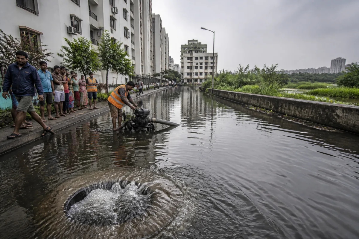
Velachery floods are not simply the result of too few stormwater drains. The Chennai neighbourhood has received ₹47.5 crore worth of drainage infrastructure covering 32.6 km of its 38 km road network, yet residents continue to report waterlogging, overflowing manholes and homes threatened by floodwater every monsoon. The gap between infrastructure coverage and flood protection exposes a larger problem: a drainage network can only work when its connected waterways, catch pits, sewage systems and storage areas function together.
With at least two lakh people living in and around Velachery, the consequences are not confined to a few flooded streets. Residents of AGS Colony, Bhuvaneswari Nagar and Ram Nagar have reported water stagnating at heights of two to three feet after heavy rain. The same neighbourhoods also experience sewage overflows during summer, suggesting that the system’s failure is not limited to short periods of intense rainfall. It is also a problem of capacity, maintenance and the mixing of sewage with stormwater infrastructure.
The first pressure point is the stormwater drain network itself. The underground pipelines in the area measure around 2×2 metres and are capable of carrying substantial volumes of rainwater, according to the report. But their effective capacity is reduced when sewage enters through illegal connections from high-rise apartments, residential buildings and commercial establishments. The sewage blocks silt catch pits and pipelines, restricting the movement of rainwater and causing backflow through manholes.
This distinction matters because expanding the physical network does not automatically expand usable drainage capacity. A drain that is blocked at a catch pit, filled with silt or receiving sewage is not operating at its designed capacity. In Velachery, the reported 90% coverage of the road network therefore describes the spread of infrastructure, not its performance during a storm.
The accounts from residents point to this operational failure at street level. Geetha Ganesh, secretary of the AGS Colony Residents Welfare Association, said water rose to two to three feet in some areas after heavy rain on the previous Sunday. She also said sewage overflowed from manholes and silt catch pits even during summer, and called for coordination between the Greater Chennai Corporation and Metro Water.
That coordination is central to the problem. Stormwater management is treated as a drainage responsibility, while sewage connections and wastewater management involve other institutional functions. When sewage enters stormwater infrastructure, the issue is no longer only whether the corporation has built enough drains. It becomes an interdepartmental governance problem involving inspection, enforcement, maintenance and the separation of two systems that are meant to perform different functions.
The second pressure point is Veerangal Odai, a 3.8-km natural waterway that carries runoff from Velachery, Adambakkam, Puzhuthivakkam and Madipakkam towards Pallikaranai marsh. From there, the flow moves through Okkiyam Maduvu to Buckingham Canal. The waterway is therefore not an isolated local drain. It is part of a wider chain that moves water from several neighbourhoods towards larger wetland and canal systems.
That chain is weakened by garbage, silt and encroachments. The report says only around 1.5 km of Veerangal Odai has been properly desilted. If the channel and its connecting culverts cannot carry runoff, water can back up into streets even where local drains have been installed. The flood problem is consequently basin-wide: water entering Velachery may originate in surrounding areas, while the ability to discharge it depends on infrastructure and natural channels beyond a single road or ward.
Balakrishnan, general secretary of the TANSI Nagar Residents Welfare Association, said encroachments along the six-vent canal near Vijayanagar bus terminus and Perungudi railway station had restricted water flow. He also said a proposed pond near the canal did not have sluice gates to regulate movement of water. These details point to a second institutional weakness: storage and flow-control structures must be designed as part of the drainage system, rather than treated as standalone projects.
The third pressure point is Velachery lake. The lake once covered more than 150 acres but has been reduced to around 55 acres because of encroachments, according to the report. Its shrinking area has reduced the amount of water that can be temporarily stored during heavy rain. Water hyacinth and sewage pollution further compromise its function as a natural reservoir.
The lake’s role also extends beyond flood control. The report says restored storage could support non-potable uses after treatment. That possibility, however, depends on water quality and the lake’s physical capacity. A polluted or partially encroached lake cannot provide the same storage function as a protected water body with clear inflow and outflow arrangements.
Taken together, the three problems show why Velachery’s flood risk cannot be measured by drain length alone. The neighbourhood has a substantial engineered network, but its performance depends on four connected conditions: stormwater drains must remain clear, sewage must stay out of them, downstream waterways must retain carrying capacity, and lakes and other storage areas must remain available. Failure at any one point can affect the entire chain.
S Naveen Kumar, an urban planner quoted in the report, said making Velachery flood-resilient required more than adding drains. He called for restoration of the complete drainage chain, removal of encroachments, desilting of Veerangal Odai and its connecting culverts, prevention of sewage inflow and restoration of the lake’s storage capacity. He also said the area needed a basin-wide plan with clear departmental accountability and regular maintenance.
The planner’s assessment places the local flooding problem within the way Chennai’s urban drainage has evolved. Natural waterways, wetlands, lakes, canals and man-made drains operate as a connected system. When urban development reduces storage areas or narrows channels, the remaining infrastructure must carry more water. When sewage and solid waste enter that infrastructure, its capacity is reduced further. The result is a system that may appear extensive on a map but remains vulnerable at the point of use.
The Greater Chennai Corporation has identified poor natural drainage and dependence on Veerangal Odai as key reasons for water stagnation in low-lying areas including Chokalingam Nagar, Kalki Nagar, Kuberan Nagar and Srinivasa Nagar. Commissioner G S Sameeran said the corporation had deployed five 100-horsepower motors and nine tractor-mounted motors, with two to three workers stationed in each affected street.
The corporation has also raised the height of Veerangal Odai by one metre on either side along a 3.6-km stretch to improve its carrying capacity. It said desilting of drains and culverts was under way and that planned drainage projects were expected to improve water flow towards the sea. These measures indicate that the immediate response is combining mechanical pumping with channel modification and desilting.
Pumping can remove water from affected streets, but it does not resolve the reasons water accumulated there. The report does not establish how the five high-capacity motors and nine tractor-mounted motors will perform across different rainfall events, nor does it provide a maintenance schedule for the wider network. Similarly, the stated improvement to Veerangal Odai addresses carrying capacity along a defined stretch, while the larger drainage chain includes upstream runoff, connecting culverts, the Pallikaranai marsh, Okkiyam Maduvu and Buckingham Canal.
The available evidence therefore confirms a mismatch between project coverage and system resilience. Velachery has received significant drainage investment, but recurring flooding remains linked to blocked infrastructure, sewage inflow, degraded waterways, encroachments and reduced lake storage. The central administrative question is not only how many kilometres of drains have been built, but which agency is accountable for each connection in the chain and how performance is monitored after construction.
For residents, this distinction is visible as the difference between a drain that exists and a street that stays passable. For the city, it is a question of whether flood management is organised around isolated projects or around the movement and storage of water across a basin. The corporation’s ongoing desilting, pumping and Veerangal Odai works are the next documented steps. Their effectiveness will depend on whether they are accompanied by action on sewage inflow, encroachments, lake capacity and the full network of downstream connections.

