


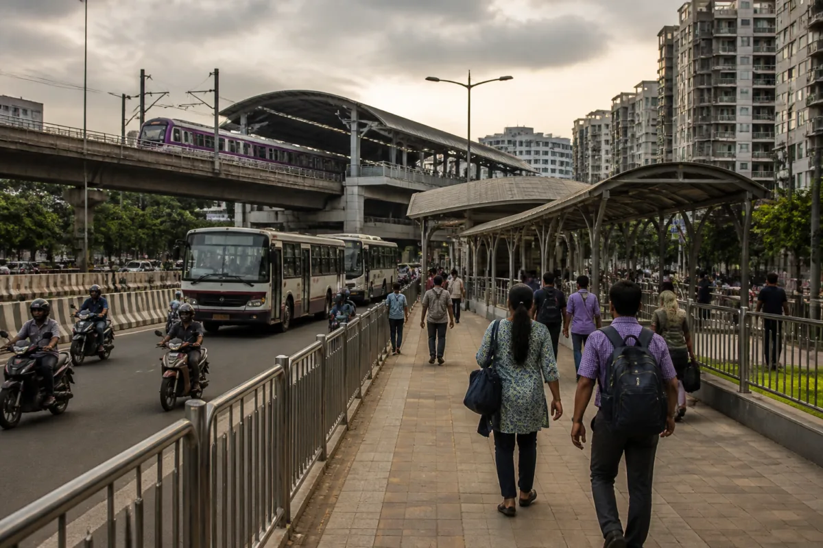
The proposed Pune Metro feeder bus plan places a basic fact about urban transport at the centre of the Man-Hinjawadi-Shivajinagar corridor: a metro line is only as useful as the network that takes passengers to and from its stations. The recommendations put forward by MLA Shankar Jagtap include scheduled feeder buses, common ticketing, safer walking routes, station parking and a digital platform combining information across transport modes. Together, they point to a wider challenge for Pune and Pimpri-Chinchwad—connecting a regionally important rapid transit service with the neighbourhoods, workplaces and residential areas around it.
Jagtap made the proposals after travelling on the metro service and interacting with passengers about the difficulties they face while using the corridor. He subsequently discussed the issues with metro representatives and Pimpri-Chinchwad Municipal Corporation officials. The focus of these discussions was not only the operation of the metro itself, but the gaps between stations and the places commuters need to reach.
That distinction is important. A station can be completed and trains can operate regularly, yet the service may remain inconvenient for passengers who have no reliable way to cover the first or last part of their journey. The proposal therefore treats metro access as a public transport and street-design problem rather than as a matter confined to railway infrastructure.
The central recommendation is to introduce regular feeder bus services within a radius of about 10 km from stations along the route. Wakad station has been identified as a possible interchange point for services connecting Pimpri, Chinchwad, Pimple Saudagar, Sangvi, Nigdi, Ravet and Alandi. These areas are spread across Pimpri-Chinchwad and neighbouring parts of the wider urban region, making the proposed network broader than a simple station shuttle.
A feeder service of this kind would perform two functions. It could bring passengers from areas that are not directly served by the metro to a station, and it could give existing bus users a more structured connection to rapid transit. At present, the source report does not establish the proposed routes, frequency, fleet size, operating agency, funding arrangement or implementation schedule. Those details will determine whether the plan becomes a dependable network or remains a set of transport recommendations.
The proposed 10-km service radius also shows the scale of the access problem. It suggests that the usefulness of a station is being considered across a catchment extending well beyond its immediate surroundings. That makes coordination between metro operators, city bus services and the municipal corporation necessary. Without such coordination, passengers may still face multiple transfers, uncertain waiting times and separate fare transactions even when the physical distance to a station is manageable.
Wakad is being considered for a larger role because it could function as a transfer point between metro and bus services. The proposal seeks to make it easier for passengers from different parts of the region to change modes at the station. This is a practical test of whether the corridor can operate as part of a network rather than as an isolated line. The source material, however, does not state whether Wakad has been formally designated as an interchange hub or whether any station redesign has been approved.
The recommendations extend beyond buses. Covered, solar-powered skywalks have been proposed to connect metro stations with nearby residential neighbourhoods and commercial establishments. The intention is to provide safer pedestrian access, particularly during adverse weather. The proposal also calls for walking facilities that are more accessible to senior citizens, persons with disabilities and cyclists.
This part of the plan highlights a common weakness in station-area planning: the short distance between a station entrance and a destination can still become a significant barrier if the route is unsafe, uncovered or difficult to navigate. A station may be close on a map but functionally distant for a person walking along an unprotected road, crossing traffic or managing mobility limitations. In this proposal, pedestrian infrastructure is treated as part of the metro journey itself.
The source does not provide locations, designs, land requirements or cost estimates for the suggested skywalks. It also does not specify whether the proposed structures would be built by the municipal corporation, the metro authorities or another agency. Those institutional questions matter because a connected pedestrian route can require work across public roads, private frontage, station property and commercial areas. Responsibility for maintenance and accessibility would be as important as construction.
Parking is another element of the proposed integration plan. Multi-level automated parking facilities have been suggested near stations along the corridor for commuters who travel part of their journey by two-wheelers or cars before boarding the metro. The proposal appears aimed at organising this park-and-ride demand and helping passengers shift to public transport for the longer part of their trip.
The idea also reflects the current dependence of many commuters on private vehicles and costly last-mile travel. However, the report does not establish the number of parking spaces required, the proposed locations, user charges, land availability or the expected effect on road traffic. Without those details, it is not possible to determine whether the facilities would reduce vehicle use or simply attract more vehicles to station areas. The stated purpose is to provide organised parking, but its broader transport effect would depend on pricing, capacity and integration with bus services.
A common digital platform has also been proposed. It would combine bus and metro routes, operating schedules, live vehicle locations and fare details, allowing passengers to compare travel options before beginning a journey. This would address an information barrier that often makes public transport appear less reliable than private vehicles, even where a connected service is available.
The proposal includes a common ticketing arrangement for metro and feeder buses, along with discounted travel passes. The objective is to reduce the need for separate bookings and make transfers more convenient. This is a significant operational issue because a passenger’s experience is shaped not only by the number of services available, but also by how easily those services can be understood and paid for.
The source does not identify the technology platform, ticketing authority, revenue-sharing mechanism or fare structure. It also does not say whether the proposed app would be developed by the metro operator, the municipal corporation, the bus agency or a joint body. These are not minor implementation details. A common system requires agreement on data, service updates, ticket validity and the division of revenue between operators.
To maintain a connection with passengers after the initial planning stage, Jagtap has proposed a metro–commuter coordination committee. The panel would periodically review feedback, identify operational problems and take suggestions to the authorities. Such a mechanism could give commuters a formal channel for raising recurring problems rather than relying only on individual complaints or informal responses.
The effectiveness of such a committee would depend on its membership, authority and reporting process. The report does not say how often it would meet, which agencies would participate, whether minutes would be published or whether authorities would be required to respond within a defined period. These unanswered questions mean that the committee remains a proposal, but they also show why institutional coordination is central to the corridor’s future operation.
The range of recommendations suggests that the metro access problem is distributed across several public agencies. Metro representatives are responsible for the rail service and stations, while the Pimpri-Chinchwad Municipal Corporation has a role in roads, pedestrian infrastructure and local urban management. Bus connectivity, parking, digital information and fares may involve additional operators or authorities. The proposal therefore raises a governance question: who is responsible for the complete passenger journey when that journey crosses administrative and operational boundaries?
The source material confirms that discussions have taken place between Jagtap, metro representatives and PCMC officials. It does not confirm an approved project, sanctioned budget, tender, construction order or service launch date for any of the recommendations. The distinction is essential. Feeder buses, skywalks, parking facilities, digital tools and common ticketing are currently proposed measures, not established commitments with stated delivery timelines.
For passengers, the immediate significance lies in the recognition that station access is broader than the station building. The proposal covers the physical connection from neighbourhoods, the availability of buses, the ease of transfer, the cost of a multi-stage journey, the ability to park where necessary and the availability of information. It also explicitly includes pedestrians, senior citizens, persons with disabilities and cyclists, groups whose access needs can be overlooked when transport planning focuses mainly on vehicle movement.
The corridor’s performance will therefore be shaped by the quality of its interfaces. A train service may move passengers efficiently between stations, but weak connections at either end can lengthen journeys and discourage regular use. The proposed plan does not yet provide enough evidence to assess outcomes, because service frequencies, travel times, passenger numbers, costs and delivery milestones have not been stated. What it does establish is a policy direction: the metro is being considered as one part of a coordinated regional transport system.
The next stage will depend on whether the recommendations are converted into defined responsibilities, routes, budgets and timelines by the relevant authorities. Until that happens, the Pune Metro feeder bus plan remains a proposal. Its importance lies in making the last-mile gap visible and in testing whether Pune’s metro expansion can be matched by the bus, pedestrian, parking and digital systems needed to make the corridor usable across the wider urban region.

