


Pune’s development plan for nine merged villages has reduced the planned width of 50 roads, including several corridors cut from 36 metres to 24 metres and a state highway in Undri reduced from 60 metres to 45 metres. The change brings a central urban-planning conflict into view: land that may be difficult to acquire later is being released for other uses even as population, construction and vehicle numbers rise across Pune’s expanding edges.
The reductions are recorded in the gazette notification issued for the draft development plan of Pune Municipal Corporation’s extended limits, according to a report by Sakal – Pune. The notification was published under Section 28(4), and the changes followed objections and hearings conducted by a committee appointed by the state government. The committee has submitted its report to the state government, and the development plan is now at the final approval stage, the report said.
This timing is important. The nine villages were brought into Pune Municipal Corporation in 2017, but their development plan has taken about 10 years to reach the final stage. During that period, construction and settlement have continued, while several internal roads have reportedly acquired unauthorised buildings. The plan is therefore not being prepared for an empty urban fringe. It is attempting to formalise a landscape where much of the available land has already been committed, built upon or disputed.
That makes road width more than a technical line on a planning map. It determines how much space can be reserved for carriageways, junctions, footpaths, drainage, public transport, utilities and future widening. The supplied report does not provide a traffic-capacity assessment or a design explanation for each corridor. But its list of changes shows a consistent pattern: roads that had been proposed at wider dimensions in earlier planning provisions are being reduced in multiple locations, including areas where later expansion may be difficult.
The largest category comprises 20 roads reduced from 24 metres to 18, 15 or 12 metres. Another 15 roads have been reduced from 18 metres to either 15 or 12 metres. Four roads have been reduced from 36 metres to 24 metres, four from 15 metres to 12 metres, and five from 12 metres to nine metres. Two roads previously shown at 30 metres have been reduced to 24 or 15 metres. Separately, the state highway through Undri has been reduced from 60 metres to 45 metres.
The changes are spread across the merged areas rather than being confined to one settlement. Lohgaon accounts for 12 roads, Shivane-Uttamnagar for nine, Mundhwa-Keshavnagar and Undri for seven and six respectively, while Dhayari also has six affected roads. Hadapsar-Sadasataranali has five, Ambegaon Budruk four and Ambegaon Khurd one. Together, the list covers 50 roads in the areas being absorbed into the city’s planning and infrastructure system.
The reasons cited for reducing the widths include provisions in the regional plan, existing construction, approved layouts, the status of land acquisition, natural drainage channels and canal boundaries. These are not minor constraints. Each represents a different institutional or physical limit on road formation. Existing buildings and approved layouts can make acquisition expensive or politically difficult. Natural flows and canals can restrict alignments. Regional-plan provisions may require the city to reconcile an inherited planning framework with the needs of a growing municipal boundary.
The notification’s approach, as described in the report, is to add land released by the road reductions to adjoining residential zones, reservations or other applicable zones. This is the land-use consequence of the decision. A narrower road does not simply reduce the width of a future carriageway; it can also create additional development potential along the corridor. The immediate planning benefit may be the regularisation or productive use of land that cannot easily be acquired. The long-term question is whether that gain is being weighed against the cost of reduced transport capacity and fewer options for public infrastructure.
This is the institutional trade-off at the heart of Pune’s current expansion. Municipal planning has to work with land that is already occupied and with budgets that may not support large-scale acquisition. At the same time, a development plan is one of the few instruments through which a city can reserve space before construction makes alternatives more expensive. Once buildings, compound walls and commercial premises occupy the edges of a corridor, widening becomes a matter of demolition, compensation, litigation and relocation rather than a straightforward planning exercise.
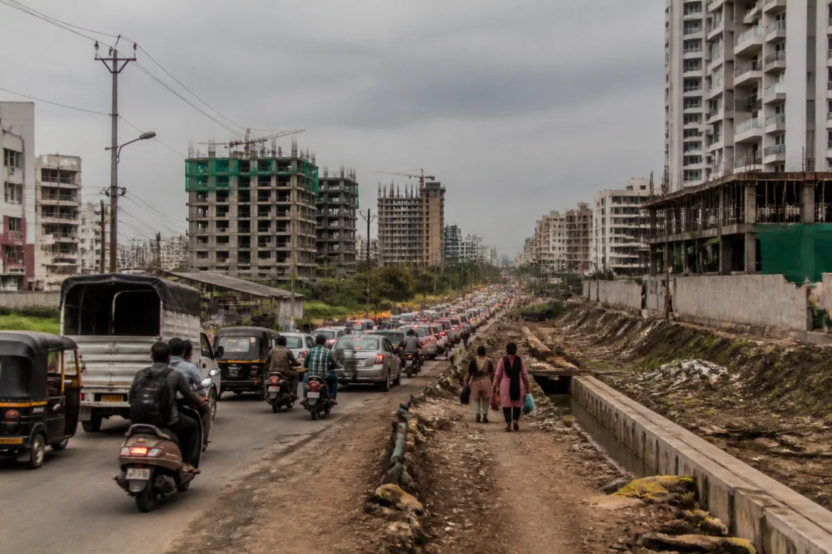
The report says many internal roads in the merged villages already face unauthorised construction. That condition narrows the city’s future choices. If smaller roads are retained at reduced widths and wider alternative routes are not provided elsewhere, traffic may be concentrated on a limited number of corridors. The supplied material does not establish the future traffic volumes or prove that congestion will worsen as a direct result of every individual reduction. It does, however, document why the question has become urgent: the affected areas are experiencing daily congestion while new development continues.
The Undri highway reduction illustrates the scale of the issue. A corridor shown at 60 metres in the earlier provision is now proposed at 45 metres. The report does not specify whether the revised width applies uniformly along the highway, how the cross-section will be divided among traffic lanes and other functions, or whether an alternative alignment is planned. Those details matter because nominal road width alone does not determine mobility. Junction design, access control, public transport space, drainage, pedestrian facilities and development intensity along the route also shape how a corridor performs.
The same caution applies to the 36-metre roads reduced to 24 metres. A 12-metre difference can have major implications, but its effect depends on the surrounding street network and the functions assigned to the road. A corridor connected to multiple alternatives may operate differently from one serving as the only route between a village settlement and a major arterial. The available report identifies the reductions and their locations, but not the traffic modelling, network analysis or corridor-by-corridor rationale used to select them.
That missing evidence is significant because the development plan is simultaneously a land-use document and an infrastructure commitment. Decisions about road reservations influence where housing, commercial activity and future public facilities can grow. They also determine whether the municipal corporation will have room to install utilities or create safer movement routes later. If the plan converts released road land into adjoining development zones, the decision may have a lasting effect on the density and access pattern of these peripheral neighbourhoods.
The approval process provides a formal route for resolving some of these questions. The state-appointed committee invited objections and suggestions, conducted hearings and submitted its report to the state government. The plan has not yet received its final approval, according to the supplied report. That means the current stage is neither a completed infrastructure programme nor a final operating design. It is a decision point at which the legal planning reservation, the city’s acquisition constraints and the public’s concerns about congestion are being brought together.
The governance structure also explains why the issue has taken years to reach this stage. The villages were incorporated into Pune Municipal Corporation in 2017, but the development plan has been prepared through a state-supervised process involving public notices, hearings and committee recommendations. The delay reflects the complexity of extending a city’s planning framework over settlements with existing development, varied land records, approved layouts, natural features and established roads. It also means that the assumptions used in an early planning exercise may have to be tested against conditions that have changed during the intervening period.
For residents, the immediate concern is not the language of the notification but the reliability of everyday movement. A road reservation affects how people reach schools, workplaces, markets, hospitals and public transport. In the merged villages, where construction has expanded without a fully implemented urban network, the distinction between an internal road and a strategic corridor can become blurred. A road that appears adequate on a map may carry local access, through traffic, service vehicles and stormwater functions at the same time.
The evidence currently confirms three things. First, 50 road reservations in the nine merged-village areas have been reduced in the draft development plan. Second, the reductions are linked to existing construction, planning provisions, acquisition conditions and physical boundaries such as canals and natural drainage. Third, the plan is approaching final approval after objections and hearings, while the affected areas are already experiencing congestion and continued development.
What remains unclear from the supplied material is equally important: the traffic studies behind each reduction, the proposed cross-sections of the revised roads, the status of alternative routes, the land-acquisition cost avoided and the infrastructure capacity that the city expects to provide instead. Those details will determine whether the plan represents a practical adjustment to difficult ground conditions or a transfer of today’s land constraints into tomorrow’s mobility problem. The next decisive milestone is the state government’s final decision on the development plan.

