


A recent Climate Central study places Mumbai and Navi Mumbai at the centre of a changing monsoon pattern, finding that human activity influenced local weather on 86 of 92 days between June 1 and August 31. The finding is significant not only because it links climate change to extreme heat and rainfall, but because it shows how the effects are distributed across the Mumbai Metropolitan Region (MMR), where urban growth, emissions and infrastructure pressures operate across municipal boundaries.
The study found that Mumbai and Navi Mumbai experienced weather patterns influenced by human activity on 86 days during the period. In the same analysis, Dombivali and Thane recorded 81 such days, while Kalyan recorded 79. Pimpri, Pune and Shivaji Nagar recorded 76 days each. The concentration of the highest figures in Maharashtra indicates that the climate signal is not confined to Mumbai’s municipal limits. It extends across a connected urban region whose residents, transport systems and infrastructure are exposed to the same broad atmospheric conditions.
The report, published by the US-based climate research organisation Climate Central, used a Climate Shift Index (CSI) to identify the influence of climate change on daily temperatures. Cities were assigned CSI levels from zero to five, with zero representing the lowest impact and levels four and five indicating severe impact. Mumbai’s average markings remained between four and five during the specified period.
That measurement matters because it distinguishes between a day that is simply hot or wet and a day whose temperature is made more likely or more intense by long-term climate change. The study therefore does not treat every episode of unusual weather as an isolated event. Instead, it places daily conditions within a broader pattern of atmospheric change.
The monsoon timing makes the finding especially important. Mumbai normally experiences lower temperatures during the rainy season, when persistent rainfall cools the city. Yet the source report notes that the city recorded deficit rainfall in June and August in 2026, while exceeding its average rainfall quota in July. This uneven distribution illustrates the operational difficulty created by a monsoon that does not necessarily deliver rainfall evenly across the season.
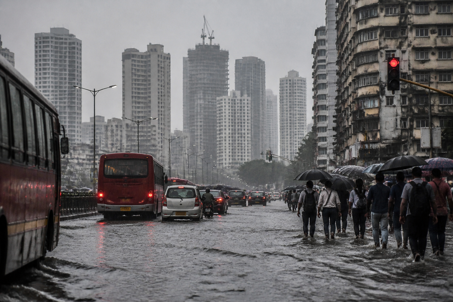
For cities, the difference between seasonal rainfall and rainfall distribution is crucial. A season can meet or exceed its overall quota while still producing long dry intervals, intense single-day downpours and localised flooding. The report notes that Mumbai has recorded episodes in the last four to five years in which 100-200 mm of rain fell in a single day. Such concentration places pressure on drainage systems, roads, public transport, housing and emergency response even when seasonal rainfall totals appear adequate.
Mahesh Palawat, a climate scientist and meteorologist quoted by The Indian Express, attributed the warmer temperatures during the monsoon months partly to a strong El Niño effect. El Niño is a climate pattern associated with warmer surface waters in the central and eastern Pacific Ocean. Palawat said the phenomenon contributed to uneven rainfall distribution across India, while human-driven factors such as vehicular emissions and industrial practices further aggravated the rise in local temperatures.
This distinction between large-scale climate variability and local human influence is central to understanding Mumbai’s weather risk. El Niño can affect the wider atmospheric system, but urban emissions and industrial activity influence conditions closer to the ground. The result, as described in the report, is not a single cause replacing another. It is the interaction of a global climate pattern with local activity in a dense and highly built-up region.
Palawat also pointed to changes in the lower atmosphere and their possible connection with rainfall patterns. He said that clouds previously associated with more consistent drizzle over cities had become less prevalent, and that industrial emissions and vehicular pollution were heating the lower atmosphere. The source article identifies these clouds as “Alto Strauss Cloud” and places them at an altitude of 800-1,000 feet. According to the explanation quoted in the report, their reduced presence could be contributing to less uniform rainfall over tropical regions such as the Indian subcontinent.
The evidence presented does not suggest that every heavy rainfall event in Mumbai has one identifiable cause. It does, however, show why the city’s rainfall challenge cannot be understood only through the annual monsoon total. The more relevant urban question is how rainfall arrives, where it falls, how quickly it accumulates and whether the city’s drainage and transport networks can absorb the resulting disruption.
The regional pattern makes governance more complicated. Mumbai and Navi Mumbai are separate urban jurisdictions, while Thane, Dombivali and Kalyan form part of a wider metropolitan system with linked travel, employment, housing and infrastructure networks. Weather-driven disruption in one area can affect commuters, supply chains and emergency operations elsewhere. A climate signal that spans the MMR therefore raises questions about coordination between municipal bodies and agencies responsible for roads, transport, drainage and disaster management.
The report’s findings also add to concerns about Mumbai’s exposure to rising sea levels. The Climate Central study came weeks after a United Nations study highlighted the city’s growing vulnerability to sea-level rise. Together, the findings describe two different but connected forms of risk: a changing atmosphere that can intensify heat and alter rainfall, and a changing coastline that can increase the consequences of flooding and stormwater discharge.
The available evidence points to a city facing compound exposure rather than a single climate threat. Heat can affect outdoor workers, commuters and residents of poorly ventilated homes. Uneven rainfall can create waterlogging and transport disruption. Rising sea levels can make it harder for stormwater systems to discharge during coastal flooding events. These pressures do not operate independently, particularly in a metropolitan region where land, infrastructure and population are concentrated.
The national comparison is equally significant. Climate Central’s analysis covered 59 cities, and the top nine cities on the list were from Maharashtra. The report said Indian cities recorded an average increase of 0.7 degrees in daytime temperatures during the period under review. Across Asia, 2.8 billion people, or 58 per cent of the continent’s population, were exposed to at least 30 risky heat days attributable to climate change. India accounted for 117 million people exposed to at least 30 such days, the largest country-level population in the analysis.
These figures shift the issue beyond Mumbai’s local weather experience. The city is part of a wider national and Asian pattern in which large populations are exposed to climate-linked heat while urban systems continue to depend on predictable seasonal conditions. The risk is especially consequential for cities because their infrastructure is designed around thresholds: road surfaces, drainage channels, electricity networks, buildings and transport systems all have limits beyond which disruption increases sharply.
The study does not provide, in the supplied material, a detailed assessment of which Mumbai infrastructure systems are most vulnerable or how much adaptation would cost. It also does not establish that the CSI alone can explain individual rainfall events. What it does provide is a consistent indicator that climate change influenced a large share of daily weather conditions during the 2026 monsoon period, with Mumbai’s readings remaining in the severe range.
That finding creates an institutional challenge. Climate resilience cannot be treated only as a disaster response function activated during heavy rain. The evidence presented by the study connects emissions, land-based activity, atmospheric heating, rainfall distribution and extreme heat. Urban planning, transport policy, industrial regulation, public health and drainage investment consequently become part of the same climate conversation.
For the MMR, the immediate lesson is that the monsoon is becoming harder to manage through seasonal averages alone. A city may experience a rainfall deficit in two months and an excess in another, while still facing dangerous single-day downpours and persistent heat. The urban system must therefore be evaluated against daily extremes and regional interdependence, not only against annual totals.
The Climate Central findings confirm that human-driven climate change influenced weather across Mumbai and surrounding urban districts during most of the 92-day period analysed. They also show that Maharashtra’s metropolitan regions are prominent within the national pattern of climate-linked heat and rainfall change. What remains to be established is how individual agencies will translate this evidence into coordinated planning for drainage, mobility, emissions and coastal risk. Those decisions will determine whether the changing monsoon becomes a recurring disruption or a central test of metropolitan governance.

