


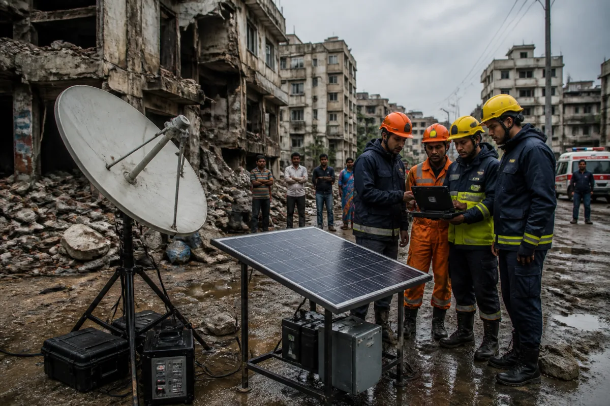
Satellite technology is increasingly being presented not as a distant space-sector capability but as a potential support layer for some of the most fragile systems on the ground: emergency communications, building-collapse response, disaster warnings, agriculture and connected infrastructure. Projects presented by six student innovators at the Viasat: Space for Good India Challenge in Delhi show how that shift is taking shape, while also exposing the difficult questions that determine whether such ideas can move beyond demonstrations.
The competition’s finalists proposed systems for moments when ordinary infrastructure stops working. Tanatswa Manjeya’s Aegis uses solar-powered communication hubs to allow stranded people to send SOS messages when mobile networks fail. Parth Bhagwat Kharat’s Bhu Kavach is designed to detect building collapses and transmit exact GPS coordinates. Nived Krishna’s MARK would use satellites to relay emergency alerts to low-cost receivers at schools and panchayat offices, which could then activate local sirens.
These are not simply technology solutions. They are responses to a recurring weakness in disaster management: the systems used to identify danger, communicate warnings and coordinate rescue are often dependent on the same physical and digital networks that a disaster can damage. When mobile towers, power supply, roads or local control rooms are disrupted, the problem is not only that people cannot call for help. Authorities may also lose the ability to locate affected communities, send instructions or establish a common operating picture.
That vulnerability was central to Manjeya’s motivation. The final-year electrical and electronics engineering student at Aditya University drew on his experience of Cyclone Idai in Zimbabwe in 2019, when communication networks collapsed and communities were cut off from rescue services. His Aegis proposal combines local communication infrastructure with satellite connectivity and uses artificial intelligence to analyse environmental data, anticipate infrastructure failures and identify safer evacuation routes.
The proposal illustrates an important principle in resilient infrastructure: redundancy matters. A city or settlement that relies on only one communications pathway has limited capacity to recover when that pathway fails. A system that can prioritise local networks and switch to satellite connectivity, as Bhu Kavach proposes, could provide an alternative route during an emergency. But the value of such a system would depend on more than the satellite link itself. Sensors would need power, the devices would need to survive physical damage, coordinates would need to reach an agency capable of responding, and rescue teams would need procedures for acting on the information.
## The last-mile problem in disaster warnings
MARK addresses a different part of the emergency chain: the last mile between a warning system and the people who need to act on it. Krishna, a computer science PhD student at IIT Kharagpur, proposed satellite-linked receivers at schools and panchayat offices that could trigger local sirens. The intended users include communities in remote Himalayan valleys, tribal forest belts and coastal areas where cell towers may be absent or could be knocked out during a calamity.
This model is significant because it does not assume that every resident will receive a warning through a smartphone. It places a receiving device in an existing local institution and uses a shared alert mechanism. Schools and panchayat offices could therefore become communication points during emergencies, at least in the design proposed by the student. The source material does not establish whether MARK has been deployed or tested in operational conditions, but the institutional choice is revealing: the project treats disaster communication as a public infrastructure function rather than only a personal-device service.
That distinction matters in India’s uneven urban and rural settlement patterns. A warning system designed around individual connectivity can fail when devices are uncharged, networks are congested, users are outside coverage areas or residents do not understand the message. A local siren or public receiver cannot solve every problem, but it can create a common signal in places where individual digital access is unreliable. Its effectiveness would still depend on maintenance, local authority ownership, language and message protocols, and regular testing—issues not resolved by the competition presentation.
## From building collapse to actionable coordinates
Bhu Kavach focuses on the first minutes after a building collapse, when locating the affected structure and people trapped inside can be difficult. Kharat’s sensor is designed to detect a collapse and immediately transmit GPS coordinates. The system prioritises local networks but switches to satellite connectivity when terrestrial infrastructure fails.
The urban importance of this concept is clear. In a collapse, the difference between detecting an incident and communicating its precise location can influence how quickly emergency teams are mobilised. A location-enabled alert could reduce dependence on a bystander making a call, particularly where access is blocked or the building is in a dense area. It could also create an early digital record of an incident for response coordination.
However, the proposed architecture also shows why technology cannot be separated from building governance. A sensor can report a sudden event, but it cannot by itself determine whether a structure was unsafe, whether illegal alterations contributed to the failure, or which agency has responsibility for inspection and rescue. For the system to become part of urban safety practice, municipal authorities, building owners, emergency services and network operators would need agreed protocols for installation, verification and response. The supplied report does not indicate that these institutional arrangements have been established.
## Satellites as an early-warning layer for agriculture and infrastructure
The competition extended beyond immediate disaster response. Shashank Kumar Singh, a PhD researcher at IIT Gandhinagar, proposed Chrono Sentinel, which combines satellite observations with the internal biological clocks of plants. The project is based on the idea that plants can show subtle changes in their internal rhythms before visible signs of disease, drought or environmental stress appear. Tracking those changes from space could help farmers and forest managers identify distress earlier.
This proposal links the built environment to the landscape around it. Crop stress, forest damage and water-related disruption may not be urban issues in isolation, but they affect food systems, livelihoods and the resilience of settlements. The project also demonstrates the breadth of satellite applications: the satellite is not necessarily delivering a direct service to a resident. It may instead provide data that supports earlier decisions by farmers, forest managers or public agencies.
The evidence presented in the source does not establish the accuracy, cost or operational readiness of Chrono Sentinel. It does, however, point to a broader movement towards using remote sensing to detect conditions that are difficult to monitor continuously from the ground. The practical test will be whether the information arrives early enough, in a form that users can interpret, and through institutions that have the authority and resources to intervene.
## Infrastructure is also becoming a space-security problem
Two other projects shifted attention from terrestrial emergencies to the infrastructure orbiting above Earth. Adeetya Uppal of IIT Kharagpur developed Drishti, an artificial intelligence-based system intended to prevent collisions involving space debris. She said traditional collision-warning protocols can take hours for human operators to react, potentially wasting fuel and endangering operational satellites.
Aryan Gupta of IIT Roorkee proposed Sentinel, a lightweight and battery-efficient security framework for satellite-connected devices used in agriculture, railways and other infrastructure. That focus is important because the expansion of connected systems creates another layer of dependency. Sensors deployed across farms, transport networks or civic assets may improve monitoring, but they can also become entry points for disruption if their communications and security are weak.
Together, the projects suggest that resilience has two dimensions. The first is continuity: whether a system can continue to communicate when ground networks fail. The second is integrity: whether the data and devices can be trusted when infrastructure is increasingly connected. Satellite connectivity may address one part of the continuity problem, but it does not automatically resolve affordability, cybersecurity, power supply, interoperability or institutional accountability.
## What the competition reveals about implementation
The challenge was organised by Viasat, a satellite communications company, in strategic partnership with the Indian National Space Promotion and Authorization Centre. Viasat India managing director Gautam Sharma said the programme provides students with technology, mentorship and industry engagement, while bringing stakeholders together because no single organisation can solve global challenges alone. The partnership gives the projects access to a technology and space-sector ecosystem, but the presentations also underline the distance between a promising prototype and public deployment.
The finalists were questioned about basic operational assumptions, including why a satellite was necessary and what would happen when the sky was cloudy. Those questions are not minor technical objections. They are tests of whether a proposed system adds capability that cannot be delivered more simply or cheaply through terrestrial means. They also force innovators to explain how a solution performs under the conditions in which it is most needed.
The competition carried a prize pool of Rs 11.5 lakh. Uppal won first place, Singh finished second and Gupta third. The finalists also received mentorship to refine their proposals. The source does not state that any of the systems has been adopted by a government agency, emergency service, municipality, railway operator or agricultural authority. That limitation is central to understanding the event. It records a pipeline of ideas and an industry-supported evaluation process, not evidence of completed public infrastructure.
The larger urban question is therefore not whether satellites can be used for disaster response or infrastructure monitoring. The projects demonstrate that they can be designed for those purposes. The harder question is how such tools would fit into India’s existing administrative systems, budgets and response chains. A satellite alert that does not reach a responsible agency, a collapse sensor that is not maintained, or a warning receiver without a tested local protocol would produce data without dependable public value.
The Delhi finale nevertheless provides a useful view of where innovation is heading. The proposed systems treat communications, sensing, early warning and security as connected parts of urban and regional resilience. They also challenge the assumption that infrastructure ends at roads, buildings, towers and cables. Increasingly, the reliability of those assets may depend on systems operating both on the ground and in orbit.
What the evidence confirms is that student innovators are applying satellite capabilities to concrete problems, including failed emergency communications, building collapses, remote disaster warnings, crop stress, space debris and connected-device security. What remains uncertain is their performance in real-world conditions, the agencies that would operate them and the funding and maintenance models needed for scale. Those questions—not the novelty of the satellite link alone—will determine whether these proposals become usable layers of India’s infrastructure resilience.

