


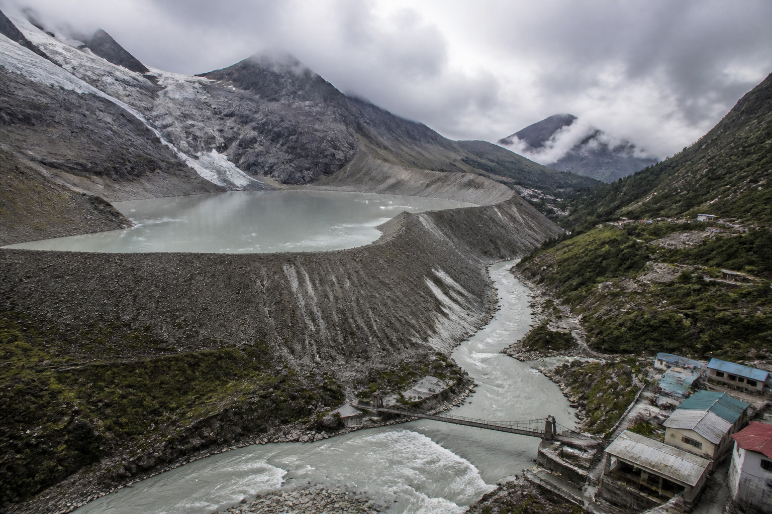
A new warning about Hindu Kush Himalayan glacial lakes points to a risk that extends far beyond high-altitude terrain: a sudden release of water, rock or ice can travel through river systems and damage bridges, buildings, hydropower facilities and downstream settlements across national borders. A report cited by Sangbad Pratidin says around 230 glacial lakes in the Hindu Kush, Karakoram and Himalayan region have been identified as dangerous, with 55 considered capable of causing severe consequences if they fail.
The finding matters because the hazard is not confined to remote mountain valleys. Infrastructure placed along river corridors is connected to the same hydrological and geological systems that begin in the high mountains. When a glacial lake expands or a slope collapses, the resulting flood can move rapidly through channels shared by several countries. The potential consequences therefore involve not only climate science, but also infrastructure planning, early-warning systems, cross-border data sharing and the location of settlements and public facilities.
The report attributes the assessment to the International Centre for Integrated Mountain Development, or ICIMOD. The Hindu Kush Himalayan region stretches across Afghanistan, Bangladesh, Bhutan, China, India, Myanmar, Nepal and Pakistan. Its glaciers, rivers and mountain slopes are interconnected, even though the administrative systems responsible for disaster management remain divided by national boundaries. This mismatch between connected natural systems and separate governance systems is at the centre of the emerging risk.
The immediate hazard is a glacial lake outburst flood, in which water held behind a natural dam of ice, sediment or rock is released suddenly. The source report says scientists have observed the expansion of glacial lakes as glaciers melt, the degradation of permafrost and increasing instability on mountain slopes. These changes can contribute to floods, landslides, rock and ice avalanches and cascading disasters in which one event triggers another.
The infrastructure exposure is particularly important. Potential flood paths contain bridges, buildings and hydropower projects, according to the report. Such assets are often concentrated along valleys and rivers because those locations provide transport routes, water access and opportunities for power generation. The same geography that makes a river corridor useful for development can also place essential infrastructure directly in the path of rapidly moving water and debris.
This creates a planning problem that conventional flood-risk assessments may not fully capture. A flood originating at a high-altitude lake may not resemble a slow, seasonal rise in a river. It can involve water combined with boulders, sediment, ice and material released by landslides. The source report cites an August flash-flood disaster in Nepal as an example of how quickly conditions in mountainous areas can change. It also refers to research by Manchester University scientists indicating that a landslide can transform into a flood within moments.
The significance of the 230-lake assessment lies not only in the number, but in the way the risk is distributed. The report identifies 55 lakes where a failure could have particularly serious consequences. It does not provide, in the supplied material, a lake-by-lake breakdown of locations, downstream population exposure, infrastructure values or probability estimates. That limitation is important. The figure signals a regional threat, but it does not by itself establish that all 55 lakes face an imminent failure or that each would produce the same scale of damage.
The evidence presented does, however, show why risk management cannot focus solely on the lake itself. A glacial lake is one element in a wider chain that includes the glacier, the surrounding slopes, the river channel and the communities and infrastructure below. Rising temperatures may enlarge the lake, while permafrost degradation and geological instability can weaken the terrain around it. A subsequent rock or ice fall may displace water or block a river, creating conditions for a sudden release and downstream flooding.
The report also cites a recent analysis by World Weather Attribution, which linked the increasing risk of such disasters to long-term warming, glacier melt, permafrost degradation and geological instability. These factors should not be treated as separate hazards operating independently. In mountain environments, they can interact. A warmer climate can change the stability of ice and soil; unstable slopes can release debris into water bodies; and a flood can then carry that material into settlements and infrastructure corridors.
For cities and towns downstream, the problem is one of visibility as much as physical exposure. The source of the hazard may be hundreds of kilometres away and beyond the jurisdiction of the affected settlement. A local authority may know how to respond to a river flood after water levels begin rising, but have less access to information about conditions in a distant glacier basin. Without early information from the upper catchment, the time available for evacuation and infrastructure protection can be limited.
This is why the report’s emphasis on monitoring and information exchange has institutional significance. ICIMOD had warned before the current monsoon season that the Hindu Kush Himalayan region faced risks from flash floods, landslides and glacial lake outburst floods. The warning places responsibility across several layers of governance: scientific agencies must monitor high-altitude changes; national authorities must share relevant data; disaster-management systems must translate warnings into local alerts; and municipal and infrastructure agencies must know which assets lie in vulnerable corridors.
The cross-border character of the region complicates each of these tasks. A dangerous lake or landslide in one country can affect populations and infrastructure downstream in another. Rivers do not follow political boundaries, and a flood wave does not pause at an international border while authorities coordinate a response. Effective preparedness therefore depends on arrangements that allow information about lake levels, slope movement, rainfall, river discharge and emerging blockages to move quickly between countries and agencies.
The infrastructure challenge is also tied to how development is organised in mountain regions. Bridges, roads, hydropower facilities and buildings are often built where the terrain permits access and connectivity. These corridors are economically valuable but physically constrained. A single bridge failure can isolate communities, interrupt relief operations and disrupt movement along an entire valley. Damage to hydropower infrastructure can affect electricity supply as well as transport and communications needed during an emergency.
The supplied report does not establish the design standards, inspection regimes or emergency plans currently applied to all infrastructure exposed to these hazards. Nor does it quantify the potential economic losses from a failure of any of the 55 high-risk lakes. Those details would be necessary for project-level decisions. The available evidence instead establishes the broader planning concern: infrastructure in the region is being exposed to rapidly changing mountain hazards that may not be adequately contained within existing administrative or sectoral boundaries.
The same distinction is important when interpreting recent disasters. The report links the August Nepal flash flood to concerns about growing glacier- and landslide-related risks, but it does not provide enough detail in the supplied material to attribute that specific event to one single cause. Mountain disasters can involve multiple interacting factors, including rainfall, slope failure, glacial conditions and river blockage. The lesson supported by the report is not that every flood has the same origin, but that response systems must be prepared for compound and fast-moving events.
For urban authorities, this changes the meaning of climate resilience. Resilience is not limited to drainage inside a city or flood barriers along an urban river. It also includes the condition of upstream catchments, the reliability of warning networks, the vulnerability of bridges and power facilities, and the ability of agencies to coordinate across jurisdictions. A town may have no glacier within its boundaries and still face a glacier-related infrastructure emergency.
The evidence currently supports three clear conclusions. First, the Hindu Kush Himalayan region contains a substantial number of glacial lakes identified as dangerous, including 55 where failure could have severe consequences. Second, warming, glacier melt, permafrost degradation and unstable slopes are interacting to increase the complexity of mountain hazards. Third, the consequences can extend across borders because rivers, valleys and infrastructure networks connect high-altitude areas to downstream settlements.
Several questions remain open in the supplied material: which lakes pose the greatest immediate threat, how frequently they are monitored, which downstream assets are exposed, and whether countries have interoperable warning and evacuation systems. These are not minor technical details. They determine whether a regional hazard assessment can be converted into timely protection for people and infrastructure.
The next stage of scrutiny should therefore focus on the underlying study, its lake-level risk classifications, the infrastructure mapped along possible flood paths and the mechanisms available for sharing warnings across the eight countries named in the report. The warning is regional, but its consequences will be experienced locally—at bridges, power projects, roads, buildings and settlements that depend on mountain river systems remaining stable.
