


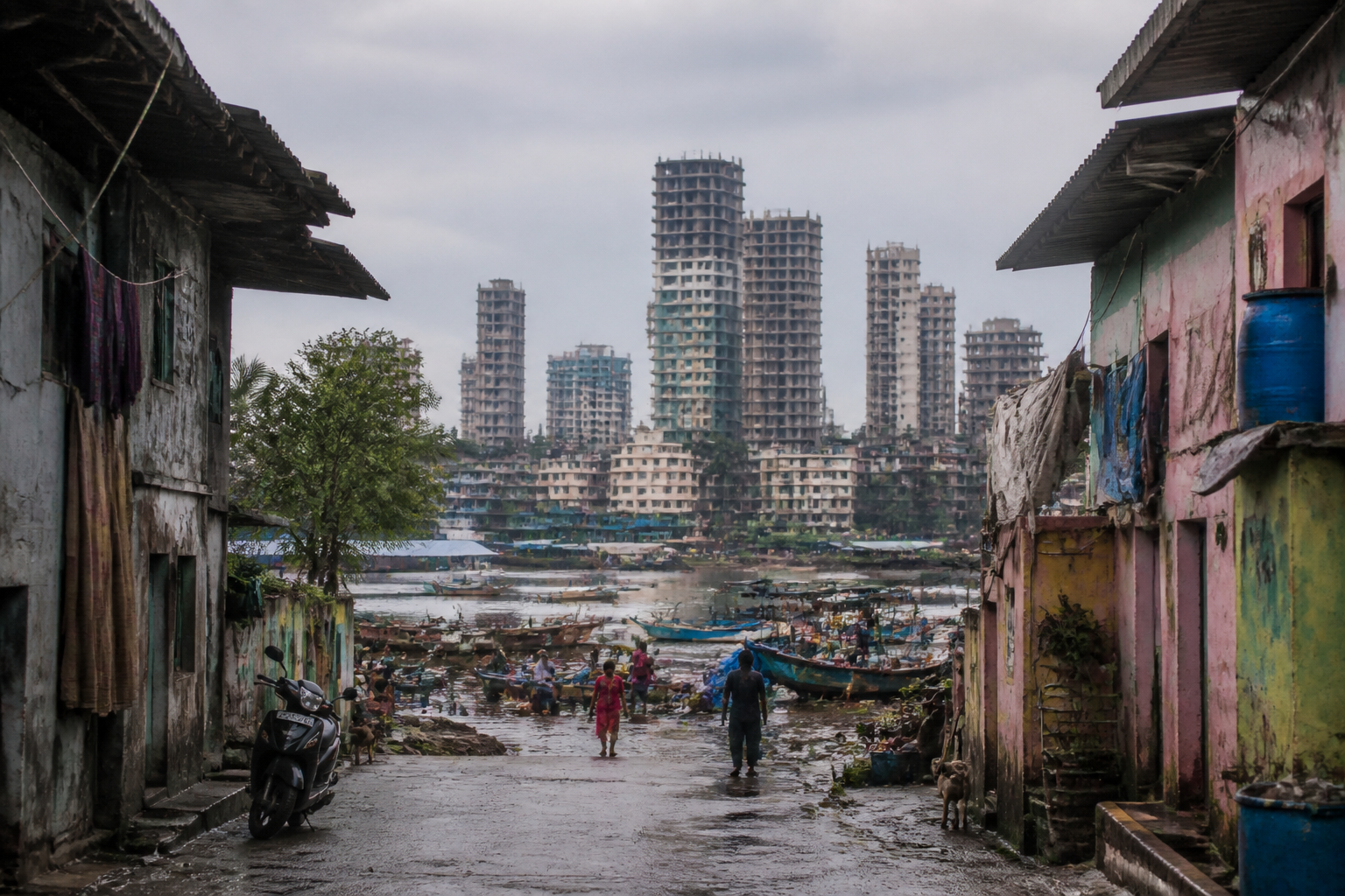
Dharavi Koliwada is not simply a neighbourhood located beside Mumbai’s redevelopment zone. It is a historic fishing settlement whose records, institutions, livelihoods and physical boundaries point to a much older urban identity than the redevelopment debate often acknowledges. The central question raised by the latest account is not only whether the Koliwada will be rebuilt, but whether a living community can retain its land, cultural institutions and relationship with the water while the city redraws its map.
A report published by Loksatta traces references to Dharavi Koliwada to historical surveys and records spanning more than two centuries. It cites a gazetteer reference stating that 93 Koli families lived in the settlement in 1784, while also pointing to references in Captain Thomas Dickinson’s 1812 survey, Colonel Lawton’s 1860 survey and a British survey conducted in 1912. The historical record presented in the report challenges claims that the Koliwada did not exist as an established settlement.
That historical continuity matters because the dispute is tied to the Dharavi redevelopment project. According to the report, members of the Koli community opposed attempts to include the Koliwada in the neighbouring redevelopment project. The report says the community believes the settlement is now being isolated from the surrounding project area. These are claims made in the source report and reflect the community’s position; the supplied material does not include a response from the redevelopment authority or an independently published government order defining the disputed boundary.
The conflict therefore involves more than the protection of old houses. It concerns how a redevelopment authority identifies a settlement, determines its legal and physical limits, and decides which forms of occupation and livelihood qualify for recognition. In a dense city, these decisions are often expressed through maps, property records, surveys and project boundaries. For residents, however, the boundary is also a social and economic system made up of homes, workspaces, public grounds, religious and community practices, access routes and ties to the waterfront.
### A fishing settlement inside a changing metropolis
The report describes Dharavi Koliwada as an urban village of the Koli fishing community. Its location is linked to the Mithi River, the creek and the sea. The account says that the area was once associated with salt trading and that 12 rivers met there before flowing into the sea. It also describes a period when fishing was a major source of livelihood and fish were available in large quantities.
The physical environment has since changed substantially. The report says the Mithi River is now polluted and that fishing has become more difficult after the construction of a sea link. Despite these pressures, members of the Koli community continue to take boats out to sea. The account describes the use of larger boats during high tide and smaller boats at other times, showing how livelihood practices continue to adapt to the altered coastal and riverine environment.
This is the first structural issue exposed by the Koliwada’s experience: redevelopment and environmental degradation cannot be treated as separate questions. A community whose historical livelihood depended on water is now dealing with pollution, changing access to fishing grounds and large infrastructure projects, while also facing uncertainty over land and redevelopment status. The source material does not quantify the economic loss caused by these changes, but it records that fishing remains part of the community’s life even as the conditions supporting it have weakened.
The settlement’s physical history also reflects Mumbai’s long effort to control water. According to the report, seawater once reached the Koliwada, leading to the construction of a wall in 1920 to prevent inundation. The location identified as the T-junction near the Dharavi-Sion junction was formerly a creek, the report says. A rough road connecting the area to Kalina in Bandra was built in 1970, followed by a paved road in 1980 that connected Sion-Dharavi with the western suburbs.
These details place the Koliwada within the broader making of Mumbai’s urban infrastructure. Roads, flood-control structures, rail and metro access and major transport links have progressively changed the settlement’s surroundings. The community has not existed outside the city’s development; it has been incorporated into the city through successive infrastructure decisions. The present redevelopment dispute is therefore another stage in a longer process in which water, mobility and land use have repeatedly reshaped the neighbourhood.
### The shrinking boundary
The most significant numerical claim in the report concerns the Koliwada’s land area. It says the settlement once covered 43,000 square metres but has now been reduced by about half to 23,000 square metres. The remaining area, according to the report, has been included in the Dharavi redevelopment project. The difference amounts to 20,000 square metres, although the supplied material does not provide the dates, survey documents or administrative orders used to establish the change.
That gap in documentation is important. A boundary dispute cannot be resolved only through competing descriptions of history or identity. It requires a transparent record of the maps, property documents, survey methods and notifications on which the boundary has been based. The source report says community representatives are contesting the matter with the government. It also raises the question of why original residents of Dharavi and Worli Koliwada were not excluded from the Dharavi project despite holding property records.
The report attributes this position to the Dharavi Koliwada Jamat Trust and quotes its secretary, Digambar Koli. He says the community should be delineated by treating the point where Koli families’ homes stand as the final boundary. He also refers to a statement attributed to Maharashtra Revenue Minister Chandrashekhar Bawankule that the boundary should be determined with the location of Koli homes as the last point. According to the report, applying that principle could release a substantial area currently included in the redevelopment project, although the supplied material does not establish whether a formal administrative decision has followed the statement.
The distinction between a political or ministerial statement and an operative boundary order is central to the issue. A statement can indicate an intended approach, but residents need to know which authority will conduct the demarcation, which records will be accepted, how objections will be heard and whether the final map will be legally binding. Without those details, the community remains dependent on an unresolved administrative process.
### Recognition is also institutional
Dharavi Koliwada’s identity is not represented only by its buildings. The report describes a community structure involving a panchayat, a village patil, caste and community meetings and a trust whose members act as panchas. It says decisions taken through the community process are binding for residents. The settlement includes both Hindu and Christian Koli residents, and the report notes that Christian residents also identify as Koli. Both communities participate in festivals, while the Koliwada’s patil is Christian.
These details show that the settlement has its own institutions and social arrangements. They also raise a question that standard redevelopment categories may not adequately address: whether eligibility is being assessed at the level of individual property ownership alone, or whether the community is being recognised as a historic settlement with collective institutions and a distinct livelihood culture.
The report cites payment records from 1927 to 1964 for fees connected with fishing. It says receipts used the description “Hindu Christian Fishermen Water Tax”. Such records, if accepted by the relevant authorities, could form part of the documentary history of occupation and livelihood. The supplied report does not state how these records have been treated in the current redevelopment process, but their existence reinforces the community’s argument that its presence is historically documented rather than recent or informal.
For redevelopment policy, this distinction has practical consequences. If recognition is based only on current structures, communities whose physical environment has been altered by roads, transport infrastructure, pollution or land reclamation may be disadvantaged. If recognition includes historical surveys, property records, livelihood documents and community institutions, the process becomes more complex but may better reflect how older urban settlements function.
### The redevelopment question
The Dharavi project is presented in the source report as the immediate pressure shaping the Koliwada’s future. Yet the larger issue is how a large redevelopment framework interacts with a settlement that has a different historical and economic logic from the surrounding built fabric. Dharavi Koliwada is described as a fishing village within the city, not simply as a cluster of structures awaiting replacement.
This creates a governance problem involving multiple kinds of authority. Revenue records influence land and property recognition. Redevelopment authorities determine project boundaries and implementation. Municipal and infrastructure agencies shape roads, transport access and environmental conditions. Community bodies preserve local decision-making structures. The source material does not set out the precise institutional responsibilities of each agency, but the dispute demonstrates that a single redevelopment plan can affect all of them at once.
The environmental dimension further complicates the project. The report connects the decline of fishing to pollution in the Mithi River and to the difficulty of obtaining fish after the construction of a sea link. If redevelopment changes land use without addressing the ecological and livelihood conditions of the waterfront, physical housing replacement may not restore the community’s economic base. At the same time, the supplied material does not provide an environmental assessment, rehabilitation plan or livelihood restoration proposal for the Koli community.
The evidence available in the report confirms three broad facts: Dharavi Koliwada has a documented historical presence; its reported land area has reduced significantly; and the community remains in conflict with the government over its inclusion in the Dharavi redevelopment project. It also records continuing fishing activity, environmental pressure and functioning community institutions. What remains unclear is the official basis of the current boundary, the legal status of the disputed land, the treatment of existing property records and the precise rehabilitation framework applicable to Koli residents.
Those unanswered questions should define the next stage of scrutiny. The critical documents are the historical and current survey maps, the project notification and boundary plan, the records relied upon for inclusion, the government’s response to the community’s objections and any formal order translating the minister’s reported position into an administrative process. Until those are placed alongside the community’s records, Dharavi Koliwada’s redevelopment dispute will remain not only a question of land, but also a test of whether Mumbai’s planning system can recognise historic urban communities before their physical and cultural boundaries disappear.
