


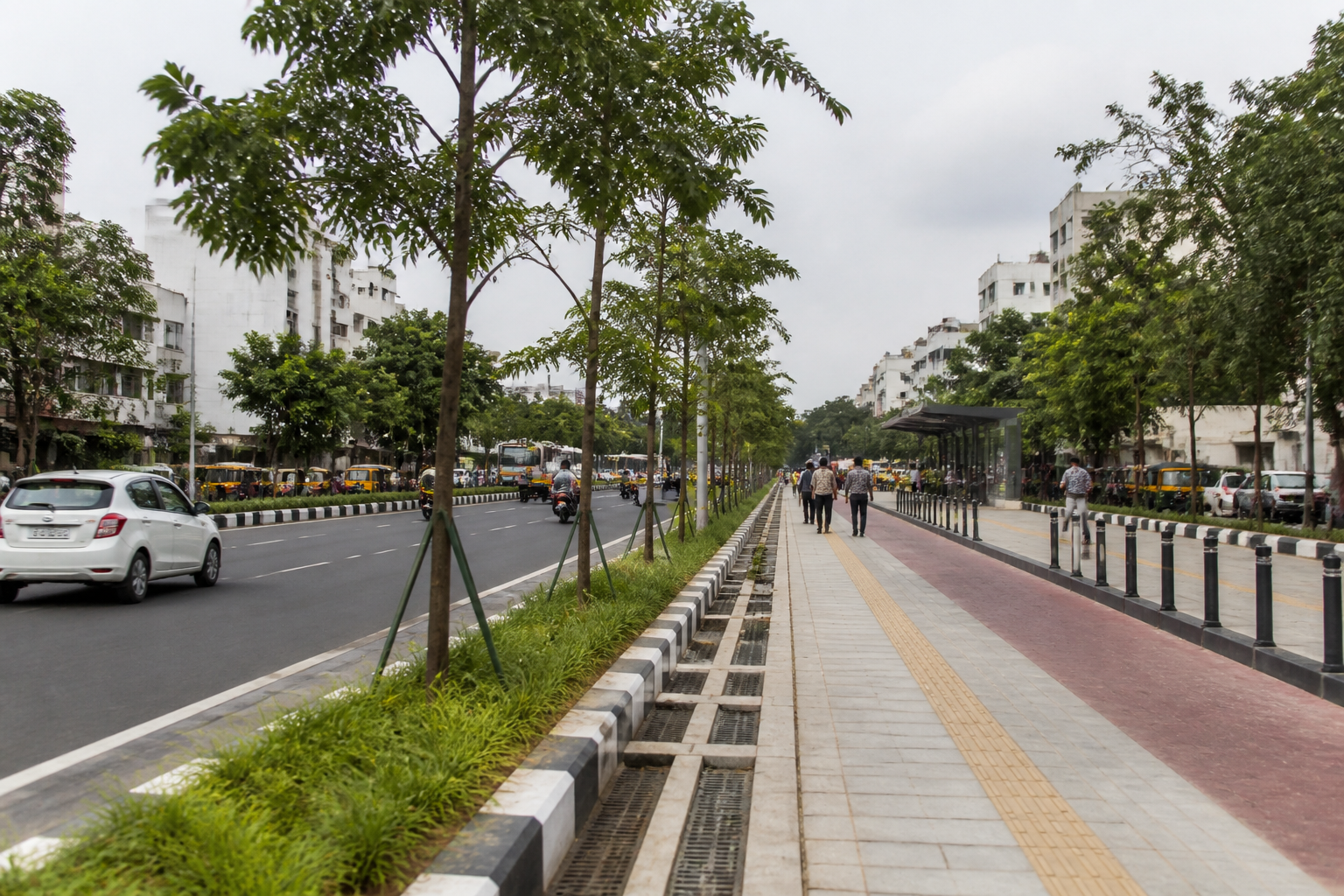
Chennai’s proposed Street Design Guidelines could change how the city plans and builds roads by replacing fragmented agency practices with a common, road-width-based template for vehicles, pedestrians, trees, public transport, utilities and drainage. The framework is being prepared by the Chennai Unified Metropolitan Transport Authority (CUMTA), with a draft expected to be released in the next four to six weeks.
The proposal responds to a problem that is easy to see on a city street but difficult to solve through isolated projects: different government agencies often build different components of the same road without a shared design governing how those components should fit together. A footpath may be planned separately from a stormwater drain, a utility corridor separately from a tree line, and a transport project separately from the road’s eventual width. CUMTA’s proposed rulebook attempts to bring these elements into one framework.
That institutional change is more significant than the document’s technical format. The city already has provisions in Indian Roads Congress guidelines and earlier guidelines issued by different agencies, according to CUMTA officials cited by DT Next. The stated gap is that these requirements are spread across multiple documents and practices. By consolidating them into a single checklist, CUMTA is seeking to make street design a coordinated planning exercise rather than a sequence of disconnected works.
The draft divides roads into widths ranging from 9 metres to 60 metres. It assigns different requirements to local streets, collector streets, sub-arterial roads and arterial roads. The checklist covers footpaths, cycle tracks, tree corridors, medians, service lanes, public transport infrastructure, Metro-related space, parking and multi-utility zones.
This road-width approach matters because the available space on a street determines what can realistically be accommodated. A narrow local street cannot be designed in the same way as a wide arterial road. Without a clear template, decisions about carriageways, footpaths, parking, trees and utilities can be made project by project, often after the surrounding development has already fixed the road’s practical limits. CUMTA’s proposal seeks to establish those relationships earlier in the planning process.
The official explanation cited in the report focuses on a recurring development problem. A road may be identified as 36 metres wide on paper, but houses may later come up on the land reserved for it. If the road is widened after that development, the city faces relocation and substantial expenditure. The proposed framework is therefore intended not only to guide construction but also to protect the road network identified during planning from being compromised by subsequent development.
This is where the guidelines connect street design with land-use governance. A road is not simply the paved surface used by moving vehicles. Its planned width also determines whether there is room for safe walking, public transport infrastructure, stormwater management, trees, utilities and future changes in mobility. If the planned corridor is narrowed or occupied before construction, the city loses options that may be expensive or impossible to restore later.
The framework also places drainage within the street cross-section rather than treating it as an unrelated underground or roadside intervention. Under the proposed approach, the carriageway, footpath, utility space and stormwater drain would be positioned in relation to one another so that water naturally moves towards the drain. This is a design principle with direct implications for how roads function during rainfall, although the supplied report does not establish how the provision will be implemented or monitored across Chennai.
CUMTA has also earmarked one metre specifically as a tree corridor in the road cross-section. That provision indicates an attempt to reserve space for trees at the planning stage instead of leaving greenery dependent on leftover roadside land. The width-based checklist is intended to make such space part of the road’s basic design, alongside the carriageway and pedestrian infrastructure.
The example given in the report is a 12-metre local street, such as Conron Smith Road and Prakasam Salai. Under the proposed template, it would have a six-metre, two-lane carriageway, two-metre footpaths on both sides and one-metre tree corridors on both sides, with no on-street parking. The example makes the framework’s priorities visible: movement space is defined alongside pedestrian space and greenery, while parking is excluded from the cross-section.
That allocation also reveals the choices that a common template is designed to make explicit. Road space is limited, and each function assigned to it reduces the space available for another. A street that includes footpaths and tree corridors cannot automatically accommodate unrestricted parking. A road designed to preserve utility space may leave less room for vehicle lanes. A drain placed correctly in relation to the carriageway and footpath may require the agencies responsible for those elements to coordinate before construction begins.
The proposed framework is expected to acquire legal backing through a government notification. A senior CUMTA official told DT Next that once the government order is issued, it would become the rule. This proposed notification is central to whether the guidelines remain advisory or become binding on government departments. The supplied report does not specify the notification’s final form, the departments it will cover, or the enforcement mechanism that will apply after adoption.
That distinction between drafting and implementation is important. CUMTA is currently discussing the draft among departments, and its release is expected in four to six weeks. The framework has therefore not yet become an operational rule. Its eventual impact will depend on the final provisions, the government notification, the way departments interpret the checklist, and whether project approvals and construction practices are aligned with it.
The guidelines are primarily intended to guide new assets and future works. Existing streets could be brought under the framework when major projects alter their geometry. This creates a two-track implementation model. New roads and new assets may be designed against the template from the outset, while older streets would be addressed mainly when another project provides an opportunity to change their layout.
That limitation is significant for a city where many street conditions are already established. A new rulebook can prevent some future conflicts, but it cannot automatically create footpaths, tree corridors or utility zones on roads where buildings, parking practices and existing infrastructure have already occupied the available space. The report does not establish how many existing roads could be retrofitted or what funding would be required for such changes.
The institutional question is therefore as important as the design question. CUMTA is attempting to coordinate requirements that currently sit across different documents and agency practices. The success of the proposed guidelines will depend on whether departments treat the road as a shared public corridor rather than as a series of separate assets. The rulebook’s value will be tested when a road project involves competing requirements for carriageway width, pedestrian movement, drainage, trees, utilities, parking and public transport.
The proposed checklist also places future Metro and public transport infrastructure within the same street-planning conversation. The report does not specify particular corridors or projects, but including these elements in the road-width framework suggests that transport infrastructure is being considered alongside the basic geometry of streets. That could reduce the risk of designing a road first and attempting to fit public transport facilities into it later, although the practical effect will depend on how the final guidelines are applied.
CUMTA’s initiative is ultimately an attempt to shift Chennai from component-based road construction towards coordinated corridor planning. Its immediate output will be a draft document, followed by departmental discussion and a possible government notification. Its larger significance lies in whether the city can protect planned road space before development closes it, reserve space for non-vehicular and environmental functions, and make agencies work from one common design logic.
What is established so far is that CUMTA is preparing the guidelines, that the draft is under interdepartmental discussion, and that the proposed system will classify roads from 9 metres to 60 metres while specifying space for multiple street functions. What remains to be seen is the final content, the scope of the government notification and the mechanisms through which departments will follow the rule. The next significant milestone is the expected release of the draft within four to six weeks.
