


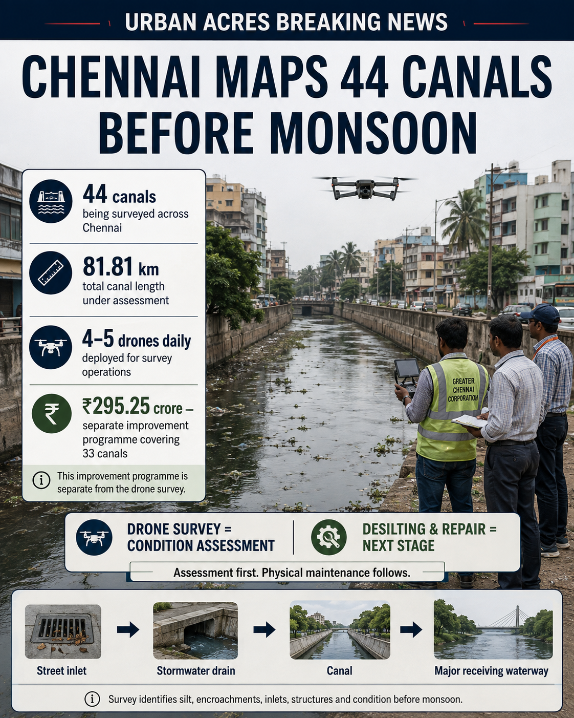
Greater Chennai Corporation has begun a drone-based condition survey covering 44 canals across 81.81 km, aiming to identify blockages and damaged stretches before the northeast monsoon. The exercise may improve maintenance targeting, but the more important test is what happens after the drones land: whether each identified obstruction is actually cleared and the drainage chain works during heavy rain.
CHENNAI — Greater Chennai Corporation has begun using drones to inspect all 44 canals under its maintenance network as part of preparations for the northeast monsoon, creating a geospatial record of where silt, solid waste, vegetation, blockages and physical damage require attention.
The exercise began on August 21 at Kodungaiyur North Canal in Muthamizh Nagar. Veerangal Odai and West Mambalam Canal were also among the early stretches surveyed. GCC plans to deploy around four to five drones each day until the network, which measures 81.81 km in total, is covered.
Images, video and location information from the survey are expected to be incorporated into GIS-based canal-condition maps. GCC says these records will then guide the prioritisation of desilting, blockage removal, vegetation clearance and repairs.
That distinction matters.
The city has begun assessing the canals; it has not completed the maintenance identified by that assessment.
The real project begins after the survey
A drone can establish where a canal is narrowed, obstructed or damaged more consistently than repeated visual inspection from accessible roads and bridges. Georeferenced imagery can also create a baseline against which maintenance can later be checked.
But the technology changes only the information layer of Chennai’s flood-management system.
Stormwater still has to move through a physical chain:
street inlet → local stormwater drain → larger drain → canal → macro waterway/outfall.
An obstruction or missing connection at any point can restrict the performance of upstream investment.
GCC itself highlighted this wider network problem in June, when Commissioner G.S. Sameeran instructed officials to complete ongoing stormwater-drain works and give special attention to missing SWD links while intensifying maintenance across the 44 canals.
This means the drone survey should not be evaluated merely by whether 81.81 km is photographed. The meaningful metric is how many actionable problems are detected, how quickly they are rectified and whether they remain rectified when intense rainfall arrives.
Drone mapping itself is not a new Chennai initiative
The latest exercise also needs historical context.
In October 2023, GCC had already outlined a drone-based flood-management programme intended to examine water flow, missing drainage links, gradients and river-basin conditions through photogrammetry, digital mapping and other geospatial techniques. That programme was expected to continue through 2026.
The relationship between that earlier initiative and the current 44-canal survey has not been established in the public material reviewed by Urban Acres.
That leaves an important procurement question: is the August 2026 exercise being carried out under the earlier programme, through a new contract, through an existing consultant or using another institutional arrangement?
The current reports do not provide an answer.
Separate the survey from ₹295.25 crore of canal works
The financial context also requires precision.
A wider programme covering major improvements to 33 of GCC’s 44 canals has been reported at ₹295.25 crore, covering interventions including desilting, wall works and fencing.
That ₹295.25 crore should not be presented as the cost of the drone exercise.
Nor should it be combined casually with the separately reported ₹22.55 crore programme for desilting 1,675 km of stormwater drains.
Urban Acres could not verify from publicly available material reviewed for this story the current drone survey’s contract value, procurement mechanism or operating cost.
A GIS database is useful only if it becomes an accountability tool
Perhaps the most important element of GCC’s announcement is not the drone itself but the proposed GIS-based condition database.
If retained and updated after maintenance, such a system could allow the corporation to move from periodic pre-monsoon drives towards asset-based drainage management: identifying repeat blockages, tracking damaged retaining structures, recording silt accumulation and comparing the same canal stretch across successive monsoons.
The public version, however, should go further.
For every canal, GCC could disclose the surveyed length, date of inspection, obstruction locations, work ordered, responsible division or contractor, completion date, quantity of silt or waste removed, repair status and post-work verification.
That would convert drone footage from a monitoring input into an accountability mechanism.
The need is becoming more significant as Chennai’s rainfall risk changes. A 2026 resilience assessment of the Chennai basin reports that short-duration, high-intensity rainfall events increased during 2011–22 compared with the preceding three decades.
Technology can improve where the city looks.
Flood resilience will ultimately depend on what the city fixes.
