


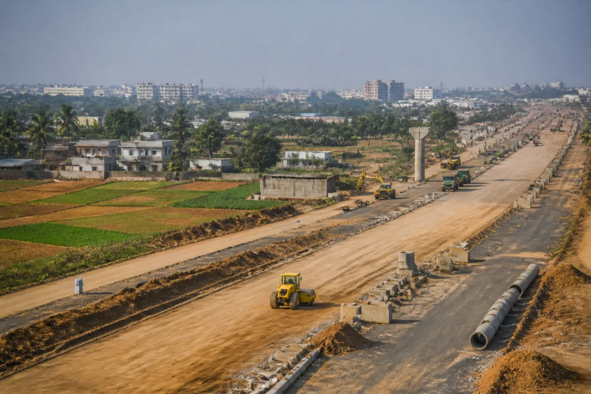
The Bengaluru Business Corridor was conceived as a large-scale answer to the city’s worsening connectivity pressures, but its progress shows that building a road is often less difficult than assembling the land needed to build it. The project, also known as PRR-1, has acquired only 250 acres of the approximately 600 acres required for its first package, leaving contractors able to work on only limited sections of the alignment.
The figures reported by Bangalore Mirror point to a project caught between infrastructure ambition and the realities of land ownership. Across the wider corridor, authorities have reportedly acquired around 1,000 acres, while substantial portions remain in private hands. Compensation disagreements, court cases and competing claims over the applicable acquisition formula have prevented construction from advancing as a continuous corridor.
That gap between planned alignment and available land is central to understanding the project’s present condition. The first package covers about 21 km between Madavara and Ballari Road. With only part of the required land secured, construction is reportedly limited to roughly 5–10 km. This means that the project’s physical progress cannot be assessed only through tenders, engineering work or construction activity. Its immediate constraint is administrative: whether the authorities can establish an acceptable and legally durable arrangement with affected landowners.
The compensation dispute reflects a broader question in urban infrastructure delivery: who bears the cost of creating metropolitan-scale connectivity? Farmers affected by the corridor are seeking compensation under the 2013 Land Acquisition Act, including twice the market value and rehabilitation and resettlement benefits, according to the report. Many have rejected the government’s formula, while others have approached the courts.
The government has offered a combination of cash, Floor Area Ratio benefits and residential or commercial sites. These options indicate that the authorities are attempting to move beyond a single cash-compensation model. Developed sites could allow landowners to participate in the future value created by the corridor, while FAR benefits could provide development rights rather than an immediate payment. But such arrangements also make the acquisition process more complex because they depend on the availability, location and usability of the promised benefits.
The difference between the first and second packages further illustrates how land readiness shapes infrastructure timelines. Package 2, extending approximately 18 km from Ballari Road to Old Madras Road, has reportedly achieved nearly 60% land acquisition. Authorities are preparing to invite tenders within a month, suggesting that this section has moved closer to a stage at which construction procurement can proceed. The contrast with Package 1 is significant: the same project can appear active in one section while remaining effectively constrained in another because the land position is uneven.
The proposed corridor will begin at Madavara Junction on Tumakuru Road, pass through 77 villages across northern and eastern Bengaluru, and end near Konappana Agrahara on Hosur Road. It is planned to connect with NICE Road at both ends, creating a larger ring around the city. The scale of this alignment means that the project is not simply a road-widening exercise. It is an attempt to create a new metropolitan movement structure across multiple settlements and administrative interfaces.
The project’s design also reveals the expectations being placed on the corridor. The ₹26,786-crore plan includes a 65-metre-wide expressway, service roads, footpaths, cycle tracks and dedicated utility corridors for water, electricity and optical fibre cables. Space has also been reserved for a possible metro or elevated rail link. In planning terms, this is a multi-utility and multimodal corridor rather than a single carriageway. In delivery terms, however, each additional layer increases the importance of acquiring a sufficiently wide and continuous right of way.
A fragmented land base creates problems beyond delayed construction. Expressways, service roads, pedestrian facilities, cycle tracks and utility corridors require continuity. A contractor may be able to build a completed segment where land is available, but the wider benefits of the corridor depend on connections between segments. Discontinuous access can reduce the usefulness of service roads, complicate utility installation and make it difficult to integrate future public transport infrastructure.
The corridor’s land strategy is also tied to its financing model. Officials are considering commercial development along 100-metre-wide strips on either side of the road and six residential layouts spread across more than 6,000 acres. The intention is to use the land around the infrastructure to help manage costs and create a source of value for the project. Landowners could receive developed sites as compensation, while a betterment levy could generate additional revenue.
This approach reflects a familiar infrastructure principle: public investment can increase the value of surrounding land, and part of that increase can potentially support the cost of the project. But value capture is not automatic. It depends on clear land records, credible development plans, timely layout formation, infrastructure provision and an administrative mechanism capable of translating future development value into present project finance. Until those steps are settled, the corridor’s proposed commercial and residential components remain part of the project architecture rather than a demonstrated source of funding.
The proposed development strips also raise a planning question about how the corridor will shape Bengaluru’s next growth pattern. A wide transport corridor can distribute traffic and improve regional access, but it can also become an axis for new development. The report does not establish how land-use controls, density, access management or public transport integration will be implemented along the proposed strips. What it does show is that the corridor is being planned not only as transport infrastructure but also as a framework for urban expansion.
That distinction matters because the corridor will pass through 77 villages. Its impact will therefore extend beyond motorists using the future expressway. Landowners, agricultural households, residents of surrounding settlements, future developers and users of proposed service infrastructure will all be affected by decisions made during acquisition and layout planning. The compensation model will influence who can remain economically secure after acquisition, while the alignment and development controls will influence how quickly land is urbanised around the road.
The reported doubling of Bengaluru’s vehicle numbers over the past decade provides the immediate mobility context for the project. The corridor is being advanced in a city where road demand has risen sharply, but the project itself is designed with elements that go beyond vehicle movement. Footpaths, cycle tracks, utility corridors and reserved space for a possible metro or elevated rail link indicate an attempt to keep future transport and infrastructure options open.
That provision, however, will have value only if it survives implementation. A reserved strip for future rail is not the same as a funded rail project, just as a planned cycle track is not the same as a continuous, usable network. The supplied report confirms that these elements are included in the project design, but it does not establish when they will be built or how they will be operated. Their eventual effectiveness will depend on later decisions about funding, construction sequencing and institutional coordination.
The Bengaluru Development Authority has sought approval for a revised Detailed Project Report. Once the government approves the report, the BDA Commissioner is expected to lead a committee to determine compensation. This sequence places the revised project document at an important administrative juncture. It must connect the physical plan with the land-acquisition approach, compensation framework and financial structure required to move construction forward.
The committee’s role will be particularly important because compensation is not a peripheral issue in this project. It is the condition that determines whether the alignment can be made available for construction. If the process produces agreements that are accepted by landowners and can withstand legal scrutiny, the project can expand beyond isolated work fronts. If disputes continue, procurement and construction may advance in selected packages without creating a functioning corridor.
The reported status also highlights the difference between announcing a large infrastructure project and delivering one. The corridor has a defined route, a large projected cost, a broad engineering scope and a proposed value-capture strategy. Yet the first package remains constrained because the required land has not been assembled. This is not simply a construction delay; it is a demonstration that project readiness depends on legal, financial and social preparation before heavy civil works can proceed.
For Bengaluru, the larger urban question is whether future connectivity projects will treat land acquisition as an early design and governance task rather than as an obstacle to be resolved after the route is announced. The Business Corridor’s progress will ultimately depend on the alignment between compensation, development rights, public finance, land-use planning and construction sequencing. The project’s next measurable milestones are approval of the revised Detailed Project Report, formation of the compensation committee, further land acquisition in the first package and the proposed tender for Package 2.
The available evidence confirms that the corridor remains active but unevenly prepared. Package 2 is closer to tendering, while Package 1 continues to face a substantial land shortfall and legal resistance. Whether the project becomes a continuous metropolitan transport and development spine will depend less on the stated width of the road than on whether the institutions responsible can convert a disputed land plan into an implementable and accepted public project.

