


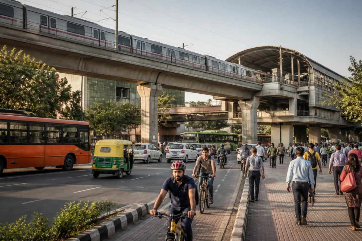
Delhi’s proposal to expand its metro network from 416 km to 695 km and develop about 200 km of new cycle tracks is not only an infrastructure target. It is an attempt to address the capital’s wider mobility problem through a combination of mass transit, last-mile connectivity, parking management, pedestrian access and road redesign under the Master Plan for Delhi-2047.
The proposals were discussed at the 11th stakeholder meeting convened by the Delhi Development Authority for MPD-2047. Representatives of the Municipal Corporation of Delhi, the Public Works Department, Delhi Traffic Police, the Transport Department, the National Highways Authority of India, the Delhi Metro Rail Corporation and other institutions participated in the meeting. The gathering was part of a three-month consultation programme intended to secure stakeholder participation in implementing the master plan.
The scale of the proposed metro expansion is significant. The plan would add 279 km to the network from the level cited in the report. But the proposal also reveals that Delhi’s transport strategy is being framed as a network problem rather than a metro-construction problem alone. The meeting discussed links between different transport modes, access to newly developing urban areas, parking regulation, road bottlenecks, walking infrastructure and accessibility for persons with disabilities.
That broader framing matters because a metro line is useful to passengers only when they can reach the station, transfer between services and complete the final part of their journey safely and efficiently. The proposals for transport hubs at Sarai Kale Khan, Anand Vihar and Kashmere Gate are intended to improve connections between the metro and other modes. The plan also proposes stronger last-mile links for passengers travelling to and from expanding parts of the city.
The Master Plan-2047 proposal includes a separate expansion target for the Namo Bharat network. It envisages increasing the network in the National Capital Region from the existing 82 km cited in the report to 383 km. While the report does not provide a project-wise implementation schedule or funding structure for this expansion, placing the metro and Namo Bharat systems within the same planning framework indicates an effort to treat regional and urban transport as connected layers.
The three proposed transport centres are important in that context. Sarai Kale Khan, Anand Vihar and Kashmere Gate are being considered as locations where passengers can shift between different services. The stated objective is to improve intermodal connectivity, but the effectiveness of such hubs will depend on how transfers are designed at street level. The source material does not establish the detailed layouts, delivery timelines or operating arrangements for these centres. It does, however, make clear that the planning discussion is moving beyond individual corridors towards interchange and network integration.
The same shift is visible in the treatment of cycling and walking. The proposed 200 km of cycle tracks is accompanied by an emphasis on pedestrian movement, safe street design and accessibility for persons with disabilities. This is a departure from a mobility framework based only on increasing road capacity or building grade-separated corridors. In the meeting, stakeholders also discussed new road networks, underpasses, elevated corridors, missing road links and junction improvements as ways to address traffic obstructions.
These elements are not interchangeable. A new road connection may remove a local bottleneck, while an underpass or elevated corridor may separate traffic flows. A cycle track or accessible footpath serves a different purpose: it enables short trips and access to public transport without requiring a car or two-wheeler. The source report does not quantify how the proposed projects will be prioritised or how competing uses of road space will be resolved. That absence is important because the success of a multi-modal plan depends on how these interventions are sequenced and connected.
Parking is another central part of the proposal. The DDA meeting discussed area-wise parking plans and the improved use of existing parking sites. High-pressure areas would be identified as parking management zones, with an integrated framework proposed for parking planning, operations and regulation. This places parking within the transport system rather than treating it as an isolated land-use issue.
The report does not provide details of the proposed parking charges, enforcement mechanisms, agency responsible for regulation or locations of the management zones. It does indicate, however, that Delhi’s planning authorities recognise parking demand as a source of traffic pressure and are considering a citywide framework for its management. That is an institutional question as much as an engineering one because parking involves the DDA, municipal bodies, traffic authorities, land-owning agencies and private operators.
The proposal to use artificial intelligence in traffic and parking management adds a technology layer to the plan. Yet the available material does not specify the systems to be deployed, the data they would use, the agencies that would operate them or the safeguards governing their use. The proposal for an Integrated Metropolitan Transport Authority, or UMTA, similarly points to a coordination challenge. Multiple agencies participated in the meeting, and the proposal suggests that a unified institutional mechanism may be needed to manage transport across administrative boundaries and modes.
This coordination issue is visible throughout the plan. Metro expansion involves DMRC and other transport institutions. Roads, junctions and underpasses involve agencies such as the PWD, MCD and NHAI. Parking regulation requires coordination with municipal and traffic authorities. Walking, cycling and accessibility depend on street design and implementation at the local level. A master plan can set a common direction, but delivery will require clearly assigned responsibilities and continuing coordination between agencies.
The evidence available from the meeting is therefore strongest on intent and weakest on implementation detail. The reported targets are clear: metro capacity is proposed to rise from 416 km to 695 km, Namo Bharat coverage from 82 km to 383 km, and around 200 km of cycle tracks are proposed. The meeting also identifies transport hubs, parking management zones, road improvements, safer streets, accessibility, artificial intelligence and a possible UMTA. But the supplied report does not establish budgets, completion dates, project lists, land requirements or performance indicators for these measures.
That distinction is essential for reading the announcement. The figures describe the scale of the planning ambition, not completed infrastructure. The consultation is still under way, and the DDA’s programme is intended to gather suggestions from stakeholders before the master plan is implemented. The final form of the proposals, their legal status and their delivery sequence are not established in the material available.
The larger urban question is whether Delhi can make its transport system function as a connected network instead of a collection of separate projects. Metro expansion can increase reach, but without safe walking routes, cycling links, reliable interchanges and managed parking, passengers may continue to face difficult journeys before and after the rail trip. Likewise, road construction can address selected bottlenecks without resolving the institutional and street-level conditions that shape everyday mobility.
MPD-2047’s transport discussion brings these issues into one planning conversation. It links regional rail, urban metro, road capacity, parking, active mobility, accessibility and digital management. The next test will be whether this framework produces specific responsibilities, timelines and implementation mechanisms through the ongoing consultation and subsequent planning process. For now, the evidence confirms a large expansion agenda, while leaving the details of delivery open.

