


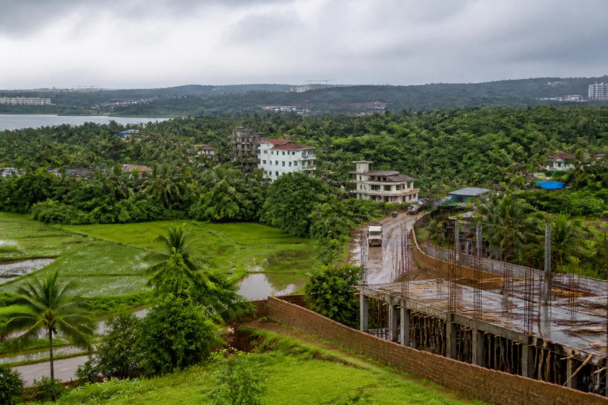
The opposition to Bambolim’s inclusion in the North Goa Planning and Development Authority (NGPDA) planning area is not simply a dispute over a government notification. It is a test of how Goa expands planning jurisdiction over villages where land, infrastructure, biodiversity and traditional livelihoods are already under pressure. At a gram sabha of the Curca-Bambolim-Talaulim panchayat, residents unanimously opposed the inclusion, arguing that the decision was taken without an assessment of infrastructure availability or environmental impact.
The immediate trigger was a government notification announcing the appointment of Rohit Monserrate as chairman of the reconstituted NGPDA and identifying Bambolim among its planning areas. The notification prompted opposition from residents of Bambolim, Nauxi and surrounding areas. Their objections, as reported by the Times of India, centre on the absence of a publicly discussed study before the village was brought within the planning area.
That question is important because a planning-area designation is not only an administrative boundary. It determines which planning authority has a role in regulating land use and development. In Bambolim, residents say the consequences of development are already visible. They told the gram sabha that illegal construction had contributed to the loss of hilly and agricultural areas and placed additional pressure on existing infrastructure. Their concern is that extending planning jurisdiction without first establishing the village’s carrying capacity could deepen those pressures rather than resolve them.
The dispute also reveals a long-running gap between local objections and government decision-making. Residents had submitted memoranda to the government in 2017 and 2018 and passed resolutions opposing the proposed inclusion on several occasions. One memorandum described the proposal as arbitrary and undemocratic, saying the local body had not been properly informed and that no adequate study had been carried out. The current gram sabha opposition therefore represents a continuation of an unresolved institutional disagreement, rather than a reaction that began with the latest notification.
The planning question is closely connected to the physical character of the area. The village includes agricultural land, traditional fishing areas and hilly landscapes described in the report as rich in biodiversity. Residents argue that development affects these spaces together: construction can alter agricultural land, place pressure on natural areas and affect access to places and ecosystems linked to traditional livelihoods. The objection is therefore not limited to the visual character of the village. It concerns whether the planning system can account for land, water, ecology and employment as connected parts of the same settlement.
The reference to the Zuari river adds a wider ecological dimension. One of the memoranda cited research by fisheries scientists documenting 300 fish species in the river. The figure was presented by residents as evidence of the ecological value at stake. It also underlines why an environmental assessment, in their view, cannot be replaced by a narrow examination of individual construction permissions. The reported concern is about cumulative change across the village and its surrounding ecological systems.
The infrastructure argument follows the same logic. Residents said the area’s carrying capacity had already been exceeded, while construction activity had burdened infrastructure. The source report does not provide an independent infrastructure inventory or quantify shortages in roads, drainage, water supply, sewage capacity or public services. That absence is itself central to the dispute: villagers say a decision affecting development potential should have been preceded by a clear assessment of what the existing systems can support.
This is where the role of the NGPDA becomes significant. The authority’s reconstitution and the identification of Bambolim as a planning area place the village within a broader planning framework. Yet the reported objections show that the legitimacy of that framework depends not only on the authority’s formal notification. It also depends on whether local bodies and residents were informed, whether environmental and infrastructure evidence was made available, and whether the planning process recognises existing community decisions.
The history of political and local resistance reinforces that institutional question. In 2018, then MLA Francis Silveira and sarpanch Maria da Cunha resigned as members of the Greater Panaji Planning and Development Authority while opposing the inclusion. Their resignations, along with the memoranda and gram sabha resolutions, indicate that the disagreement has involved elected representatives and local institutions over several years. The present dispute therefore involves competing ideas of planning: one based on expanding the authority’s geographical remit, and another that insists planning must begin with local capacity and consent-related processes.
The distinction between planning and construction regulation is also relevant. The residents’ account links illegal construction with the loss of agricultural and hilly land. If those allegations are accurate, bringing an area under a planning authority does not by itself explain how enforcement will improve. The effectiveness of any planning arrangement would depend on the rules applied, the quality of permissions, monitoring of construction and the capacity of institutions to act against violations. The supplied report does not establish whether the NGPDA has undertaken such an enforcement assessment for Bambolim, leaving that as an important unanswered administrative question.
The gram sabha’s objection also raises the issue of sequencing. Residents are asking for studies on infrastructure availability and environmental impact before the planning-area inclusion proceeds. That is different from opposing all planning. Their position, as reported, is that planning must account for the village’s existing conditions and ecological limits before development pressures are formally accommodated. The government notification and the local opposition have therefore brought two steps into conflict: the expansion of planning jurisdiction and the prior assessment of what the jurisdiction should protect.
For Goa, the Bambolim dispute is a compact example of a larger built-environment challenge: how to manage development in places where rural landscapes, urban expansion and regional infrastructure meet. The source material does not establish the government’s detailed rationale for including Bambolim, nor does it record a response from the NGPDA or the state government to the gram sabha’s latest objections. Those gaps matter because the credibility of the decision will depend on the evidence made public and on how authorities address the specific concerns about capacity, biodiversity, livelihoods and local participation.
What is established is that Bambolim’s inclusion has faced sustained local resistance, that residents have repeatedly raised the issue since at least 2017, and that the latest gram sabha has again rejected the proposal. The next significant development will be whether the government or the NGPDA publishes or commissions the infrastructure and environmental assessments sought by residents, and how the authority responds to the gram sabha’s resolution and earlier memoranda.

