


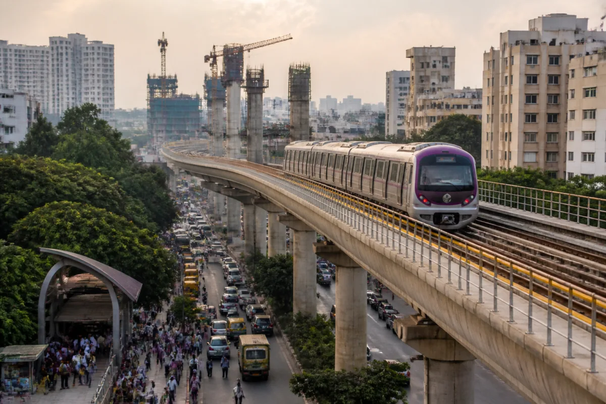
Bengaluru’s metro network has crossed the 100-km mark with the partial opening of the Pink Line, a milestone that expands rail access across the city but also exposes how unevenly the network is being built. The operational system has reached 103.6 km, according to a report by Vijay Karnataka, while several major corridors remain under construction or await approval.
The latest expansion changes the geography of rapid transit in Bengaluru. The Pink Line connects the southern corridor from Kalena Agrahara towards Tavarekere in its currently operating section, while construction continues on the underground stretch towards Nagawara. At the same time, the Blue Line is being built across the Outer Ring Road and towards Kempegowda International Airport. Together, these projects are intended to connect residential districts, employment centres, industrial areas and the airport more directly to the metro system.
The milestone is significant because Bengaluru’s network is no longer concentrated around a small number of central corridors. The Purple Line now runs 43.49 km between Whitefield and Challaghatta, covering technology and employment districts in the east as well as western neighbourhoods. The Green Line covers 33.46 km between Madavara and Silk Board, linking northern industrial areas with southern residential and commercial districts. The Yellow Line, extending 19.15 km from RV Road to Bommasandra, has added a direct metro connection towards Electronics City and the Bommasandra industrial area.
With the Pink Line’s partial operation, four principal corridors are now in service. The source report lists 37 stations on the Purple Line, 32 on the Green Line, 16 on the Yellow Line and 18 associated with the Pink Line’s full alignment. The Pink Line’s current service is only partial, however, and the complete 21.26-km corridor between Kalena Agrahara and Nagawara is still unfinished.
That distinction matters for how the network will function. A metro line does not create equal access simply by being sanctioned or partially opened. Its value depends on the continuity of the corridor, the location of stations, interchange possibilities and whether passengers can reach employment and residential destinations without lengthy road journeys. The current Pink Line service gives parts of Bannerghatta Road, Hulimavu, JP Nagar Phase 4 and Tavarekere access to the system, but the unfinished underground section is intended to extend that benefit towards Shivajinagar, Langford Town, Cantonment, Venkateshpura, KG Halli and Nagawara.
The available ridership figures also show that Bengaluru’s operational lines are serving different urban markets. The Purple Line is estimated to carry between 400,000 and 450,000 passengers a day, reflecting its connection between Whitefield, ITPL, KR Puram, central Bengaluru, Vijayanagar, Rajarajeshwari Nagar, Kengeri and Challaghatta. The Green Line is estimated at 300,000 to 350,000 daily passengers and serves Peenya’s industrial area, Yeshwanthpur, Malleshwaram, Jayanagar, Banashankari, JP Nagar and the Silk Board area.
The Yellow Line is expected to carry between 100,000 and 120,000 passengers a day. Its route links RV Road and Jayadeva Hospital with BTM Layout, Central Silk Board, HSR Layout, Hosur Road, Electronics City and Bommasandra. The source report places the expected daily ridership of the partially operating Pink Line at 50,000 to 80,000 passengers, rather than presenting it as a mature corridor with established demand.
This variation suggests that the operational network is serving a combination of established central travel patterns and newer connections to peripheral employment zones. The Purple and Green lines already cover long corridors with multiple established neighbourhoods and commercial districts. The Yellow Line is oriented towards the technology and industrial belt along Hosur Road. The Pink Line, once complete, is expected to add a cross-city connection between southern Bengaluru and the northern side of the central urban area.
The most immediate construction challenge is the remaining Pink Line work. The report states that 13.76 km between Dairy Circle and Nagawara is under construction, including 12 underground works, with a deadline of May 2027. This section includes some of the most complex and heavily built-up parts of the city. Its completion would extend the line beyond the current southern operating section and create a continuous corridor through areas that presently depend heavily on roads and buses.
The Blue Line is expected to become the next major test of Bengaluru’s expansion strategy. Phase 2A covers 19.75 km between Central Silk Board and KR Puram along the Outer Ring Road. The corridor is planned to serve Agara, Iblur, Bellandur, Kadubeesanahalli, Marathahalli, ISRO, Doddanekkundi and KR Puram, with completion targeted for the middle of 2027. These locations contain major employment clusters and high-density residential development, making the corridor important to the city’s daily commuting system.
Phase 2B extends the Blue Line by 38.44 km from KR Puram towards Kempegowda International Airport. The report gives a March 2028 deadline and lists Kasturi Nagar, Horamavu, Kalyan Nagar, Kempapura, Hebbal, Kodigehalli, Jakkur, Bettahalasuru and Doddajala among the areas expected to benefit. The corridor is therefore not merely an airport link. It is also planned as a north-eastern urban connection through neighbourhoods that have expanded faster than high-capacity public transport.
The construction programme shows that the metro authority is attempting to address two different mobility problems at once. The Pink Line is focused on strengthening cross-city movement through central and southern Bengaluru, including an underground section. The Blue Line is aimed at the Outer Ring Road employment corridor and the airport region. These are different construction environments and passenger markets, and their deadlines will determine how quickly the network becomes a connected system rather than a collection of separate corridors.
Beyond the projects already under construction, the next phase indicates a further shift towards extending the network into peripheral growth areas. The proposed Orange Line under Phase 3 is listed at 44.65 km, running from JP Nagar Phase 4 to Kempapura and from Hosahalli to Kadabagere. The project has received central approval and soil testing has begun, according to the source report. Its proposed catchment includes Banashankari 3rd Stage, Padmanabhanagar, Mysuru Road, Dwaraka Nagar, Nagarabhavi, Hosahalli, Sumanahalli, Byadarahalli and Kadabagere.
Phase 3A of the Orange Line is listed at 37.85 km between Hebbal and Sarjapur. The report says the project is at the stage of awaiting Union Cabinet approval and would serve Sarjapur, Sompura, Dommasandra, Hebbal, Ganganagar, Palace Guttahalli and Dairy Circle. Unlike the Pink and Blue lines, these projects are not yet equivalent to operational infrastructure. Their status demonstrates that Bengaluru’s future network depends not only on construction speed but also on approvals, testing, funding and the movement from planning to execution.
The timelines also show why the 103.6-km milestone should be read as an intermediate point rather than the completion of Bengaluru’s metro transformation. The Pink Line is only partly operational. The Blue Line phases are scheduled for 2027 and 2028. The Orange Line projects remain at different stages of preparation and approval. Each stage carries a different degree of certainty, and treating sanctioned, under-construction and operational sections as equivalent can create an inflated picture of actual passenger access.
For residents, the practical question is not the total length of the network but whether a station is close enough, whether the line reaches the destination that matters and whether the journey can be completed without an unreliable road connection at either end. The routes listed in the report cover major employment areas such as Whitefield, ITPL, Electronics City, Bommasandra and the Outer Ring Road, as well as established residential districts across the east, west, north and south of the city.
Bengaluru’s metro expansion is therefore producing two outcomes simultaneously. It is building a broader rapid-transit backbone and revealing the gaps that remain between project announcement and usable citywide connectivity. The operational network has crossed 100 km, but the next measure of progress will be whether the incomplete Pink Line, the Blue Line corridors and later Orange Line projects meet their stated milestones and convert planned coverage into continuous, reliable access.

