


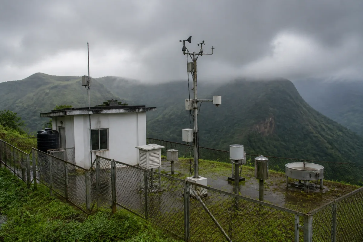
The planned Mawsynram IMD observatory is more than a new weather facility in the world’s wettest place. It marks a long-delayed institutional upgrade in Meghalaya, where a location recognised for extreme rainfall has until now depended on a temporary setup inside a Public Works Department office, an automatic weather station and weather inputs from trained PWD officials.
The India Meteorological Department’s decision to establish permanent observation facilities in Mawsynram and Tura creates an opportunity to improve how Meghalaya measures and responds to weather. According to Thangjalal Lhouvum, Scientist D at IMD Shillong, the Mawsynram facility is currently at the land acquisition stage, while the Tura office is expected to become functional from the next monsoon. Once both facilities begin operating, Meghalaya will have five IMD observatories, compared with three at present.
The institutional gap is particularly striking in Mawsynram. The place holds the world record for the highest average annual rainfall, a record recognised in the World Meteorological Organization’s 2025 evaluation of weather records. Yet the IMD has so far relied on a temporary arrangement at the PWD office, supported by an automatic weather monitoring station. PWD officials trained by the IMD have been supplying weather inputs to the department.
This arrangement can generate useful observations, but it is not the same as a permanent meteorological facility staffed and designed for continuous observation. The distinction matters in a state where terrain, intense rainfall and dispersed settlements make local weather information important for more than climate records. Weather data supports public departments, tourism, transport and border administration, while also helping establish a more precise picture of how weather varies across Meghalaya’s hills and valleys.
Meghalaya’s formal meteorological history goes back to 1902, when the IMD opened an observatory in Cherrapunji, now known as Sohra. The observatory was established inside the Post and Telegraph Office compound and used standardised instruments, including a five-inch Symon’s rain gauge, which trained officials regularly inspected. Sohra continues to hold two World Meteorological Organization records: the greatest rainfall over a 12-month period and the greatest rainfall over 48 hours.
Rainfall records in Cherrapunji predate the formal observatory. Tracking began in the 1830s under the British administration, with early records maintained by local post offices and missionaries. Those records included the 26,471 millimetres of rainfall recorded between August 1860 and July 1861. The history shows that Meghalaya has long been treated as a significant site for weather observation. The proposed Mawsynram facility therefore extends an established regional function rather than creating a new one.
The difference between historical importance and present-day observation capacity is visible in the number of facilities and reporting intervals. Meghalaya currently has IMD observatories in Shillong, Sohra and Barapani. The Meghalaya Basin Development Authority operates 102 automatic weather stations across the state, while the IMD operates 30. Automatic stations expand the geographical reach of monitoring, but the planned observatories are intended to strengthen the department’s formal observation network and reporting capability.
Lhouvum said the new facilities would allow the IMD to release eight observations in 24 hours instead of the one observation currently issued in 24 hours. That change is central to the proposal’s value. A single daily observation provides a limited snapshot of changing conditions. More frequent observations can create a denser record of rainfall and atmospheric conditions, particularly in places where weather can shift rapidly because of terrain and heavy precipitation.
The improvement should not be understood simply as an increase in the number of reports. Observation frequency affects how quickly public agencies and other users receive information. The IMD scientist said more frequent reporting would provide more accurate and real-time information and benefit tourists as well as other places. The supplied account does not specify the precise instruments, staffing pattern or communication systems that will be installed at Mawsynram, so the eventual performance of the facility will depend on how the approved proposal is implemented.
The planned Tura facility adds a different administrative and geographic dimension. Tura is the administrative headquarters and largest town of West Garo Hills. The Indo-Bangladesh border at Dalu is about 50 kilometres south of the town. The IMD said the facility would assist the Border Security Force at the Indo-Bangladesh border, as well as residents and government departments.
This makes the two projects complementary rather than interchangeable. Mawsynram addresses a major gap at a globally significant rainfall location in the Khasi Hills. Tura would extend dedicated IMD capacity into the Garo Hills and provide a formal observation point closer to the western part of the state and the international border. Together, they would reduce the concentration of dedicated facilities around Shillong, Sohra and Barapani.
The proposed expansion also sits within a wider effort to strengthen weather infrastructure in Meghalaya. The IMD is expected to have Doppler Weather Radars in Shillong and Tura soon. A Doppler Weather Radar tracks the position and speed of atmospheric particles such as rain, snow or hail by using the Doppler effect. The source account does not provide commissioning dates, coverage areas or technical specifications for the proposed radars, but their mention indicates that the state’s observation network is being developed through multiple layers: automatic weather stations, permanent observatories and radar systems.
Each layer performs a different function. Automatic weather stations can provide observations from a large number of locations. Observatories offer dedicated, standardised facilities and regular reporting. Radar systems track the movement and intensity of precipitation across a wider area. The value of the network therefore depends not only on the number of installations, but also on how their data is collected, validated, communicated and used by departments and communities.
The state already has a sizeable automatic station network through the Meghalaya Basin Development Authority. The fact that the IMD operates 30 stations while the state authority operates 102 suggests that Meghalaya’s weather information system involves more than one institution. The new facilities may help connect these different sources to the national meteorological system, although the supplied material does not establish how data-sharing arrangements will work.
That institutional question is important because weather observation is ultimately a governance function. The temporary Mawsynram setup has depended on cooperation between the IMD, the PWD and trained PWD officials. Such arrangements can keep information flowing, but permanent facilities clarify responsibility for observation, maintenance and reporting. Land acquisition is now the immediate procedural stage for Mawsynram, while Tura has a stated operational target for the next monsoon.
The proposed Mawsynram observatory also highlights how infrastructure gaps can remain hidden when a location is famous for the phenomenon being measured. Mawsynram’s global rainfall record creates visibility, but recognition does not automatically produce permanent public infrastructure. The town’s importance to meteorology has existed for decades alongside reliance on temporary arrangements.
The evidence available at present confirms the direction of change but not the final delivery timeline for Mawsynram. The land acquisition stage means the facility is not yet operational. Tura has a clearer target, with the IMD expecting its observation office to function from the next monsoon. The new observatories and proposed radars will therefore need to be assessed by whether they deliver the promised increase from one to eight daily observations, integrate with existing automatic stations and provide usable information to the departments and communities identified by the IMD.
For Meghalaya, the central issue is not whether the state receives more weather equipment in isolation. It is whether a historically important but uneven observation network becomes a dependable public system. The Mawsynram and Tura projects establish that institutional expansion is planned. Their significance will ultimately be measured when the facilities become operational and the additional observations begin reaching the people and agencies expected to use them.

