


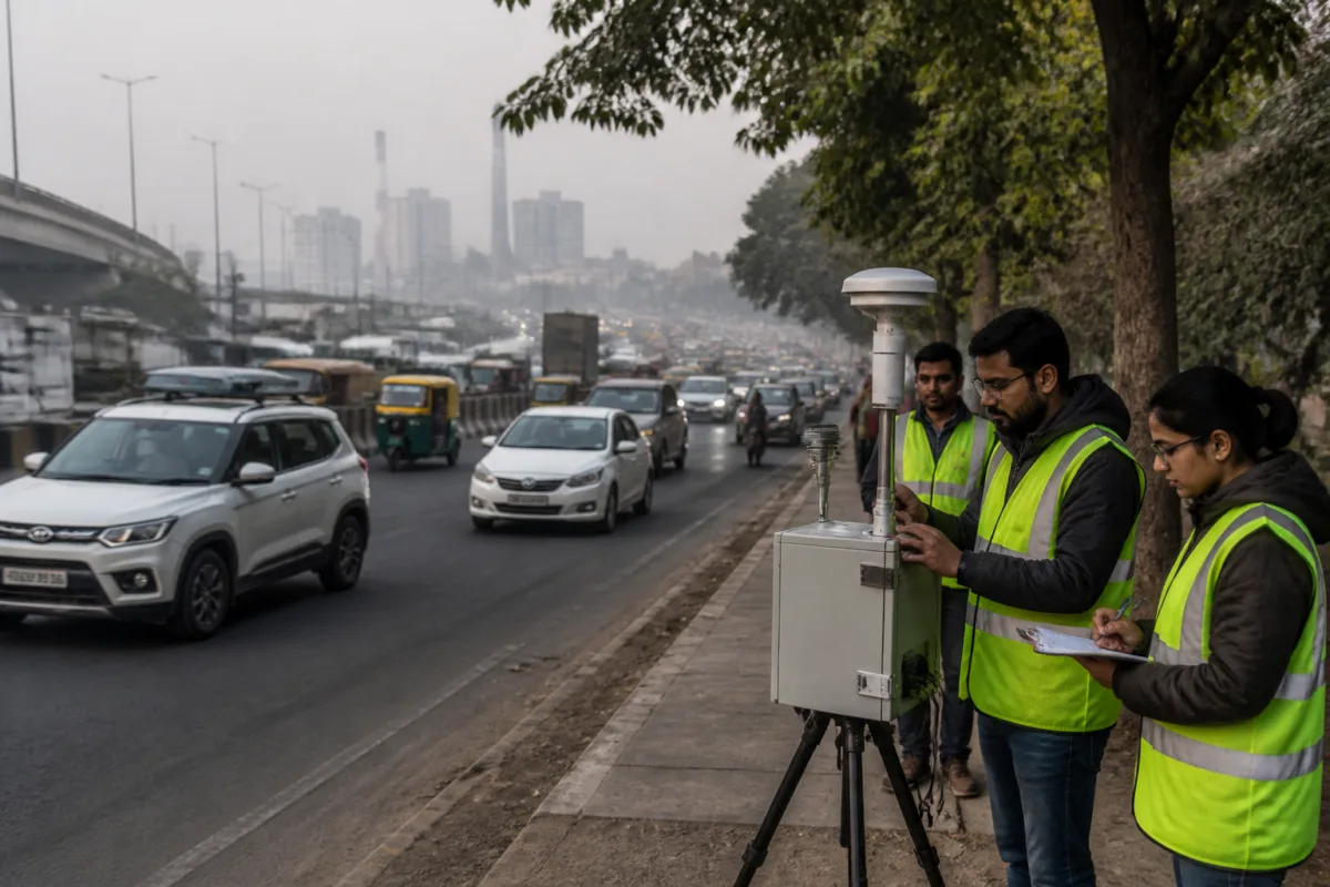
Delhi-NCR is beginning a year-long effort to determine how its pollution mix has changed since the last major source-apportionment assessments, but the significance of the exercise lies beyond updating a technical report. The new study is intended to create a common, high-resolution evidence base for deciding where emissions originate, how they move across the region and which pollution-control measures can be evaluated over the next two decades.
The assessment will cover Delhi and 27 National Capital Region districts using a 500-metre by 500-metre grid. Each cell will cover 0.25 square kilometres, allowing the study to examine emissions at a much finer geographical scale than a broad citywide estimate. The work will use 2026 as its base year, run from January 1 to December 31 and be analysed by the middle of 2027.
That timeline matters because Delhi’s pollution is not produced by a single source or confined within the city’s administrative boundary. The study will extend beyond NCR into the wider north Indian domain so that regional transport of pollutants can also be examined. The framework is therefore designed to connect local emissions, such as traffic and industrial activity, with pollution that travels across state and regional boundaries.
The immediate urban challenge is not merely the absence of pollution-control measures. It is the difficulty of matching those measures to a changing emissions profile. Vehicle technology, fuel standards, industrial practices, urban development, waste management and agricultural activity may all have altered the relative contribution of different sources over the past decade. A policy based on older estimates can therefore misidentify where intervention is most needed or fail to account for changes in the way emissions are generated.
Delhi’s first source-apportionment study was conducted by IIT-Kanpur in 2016. It was followed by an assessment by the Automotive Research Association of India and The Energy and Resources Institute in 2018. The Central Pollution Control Board had earlier attempted to develop an emissions inventory for six cities, including Delhi, between 2007 and 2010. However, the report notes that previous studies differed in methodology, geographical coverage, source-sector classification and base years, making direct comparison difficult.
The new exercise is intended to address that inconsistency through a common framework. It is being led by ARAI, Pune, in association with IIT-Delhi, TERI and the Indian Institute of Tropical Meteorology, Pune. The CPCB is funding the project and implementing a framework developed by the Commission for Air Quality Management in April 2025 through a consortium of four institutes.
The pollutants covered will include PM10, PM2.5, nitrogen oxides, sulphur dioxide, carbon monoxide, non-methane volatile organic compounds and ammonia. The inventory will also include elemental carbon, organic carbon, methane and hydrogen chloride. This broader pollutant set is important because the sources and atmospheric behaviour of particulate matter are not identical to those of gaseous pollutants.
The study’s proposed resolution could make a difference to how authorities identify pollution hotspots. According to SD Attri, CAQM’s member technical, small geographical cells will help distinguish areas with different source profiles. The work will combine high-resolution mapping, activity data, emission factors, geographical information, seasonal changes and field verification by deployed teams.
The methodology is designed to translate activity into emissions estimates. Vehicular emissions will be assessed using road networks, traffic volumes, vehicle categories and activity patterns. Industrial emissions will draw on information about industrial locations, production, fuel consumption and pollution-control equipment. Road-dust estimates will require data on road characteristics, silt loading and related activity patterns.
The use of satellite imagery and artificial-intelligence-based mapping is intended to improve the identification of smaller sites, but the project will also rely on teams conducting ground verification. That combination reflects a central problem in urban emissions inventories: maps can identify land-use patterns and visible assets, while field checks are needed to establish whether a site is active, what it produces and which fuels or control systems it uses.
The inventory is also expected to improve the use of air-quality decision-support systems. IITM’s existing Decision Support System estimates the contribution of local and regional sources to Delhi’s winter PM2.5 levels, but the report says the estimate is limited because it relies on a 2021 emissions inventory. Once the new inventory is prepared, it is expected to provide the system with updated inputs.
This limitation illustrates why source apportionment cannot be treated as a one-time academic exercise. Pollution levels are measured continuously, but the explanation for those levels depends on the quality and age of the underlying inventory. A monitoring station can show what is present in the air at a particular location. An emissions inventory is needed to estimate what activities produced those pollutants, while source apportionment helps assess their relative contribution.
The project will prepare scenario assessments for 2030, 2035 and 2040 under different mitigation pathways. CAQM has said these scenarios will provide a scientific basis for long-term pollution-control planning. The scenarios will not, by themselves, constitute new regulations or guarantee improved air quality. Their value will depend on how clearly they connect changes in emissions to specific interventions and how consistently authorities use the evidence across jurisdictions.
The institutional arrangement reflects the regional nature of the problem. CPCB is funding and implementing the project, CAQM is overseeing the framework and a consortium of research and technical institutions is carrying out the work. The study will cover Delhi and 27 NCR districts, while its wider north Indian domain will allow regional transport to be considered. This creates a larger coordination challenge because different sources may fall under different state, municipal and sectoral authorities.
The report also points to an expansion of real-time source-apportionment capacity. A network of super-sites has been proposed across NCR. IITM’s super-site at New Rajendra Nagar was inaugurated on the Saturday before the report, while the Delhi Pollution Control Committee’s super-site at Rouse Avenue is to be revived. Four additional sites have been proposed at Sonipat, Rohtak and Rewari in Haryana and Greater Noida in Uttar Pradesh.
These sites could complement the inventory by providing more continuous evidence on changing pollution sources. Their proposed locations also show why Delhi’s air cannot be understood through measurements from the capital alone. NCR’s transport links, industrial locations, roads and seasonal conditions create an interconnected airshed in which pollution sources and exposure patterns extend across administrative borders.
The study’s central contribution, therefore, is not simply a new percentage breakdown of Delhi’s pollution. It is an attempt to create a consistent spatial and institutional platform for comparing sources, testing mitigation pathways and updating decision-support tools. The shift from older, differently designed assessments to a common 2026 baseline could make long-term planning more coherent, provided the data is completed, reviewed and applied in policy decisions.
Several milestones remain ahead. The study will collect information throughout 2026, its findings are expected to be analysed by mid-2027 and the resulting scenarios will cover 2030, 2035 and 2040. Until that work is completed, the precise current contribution of individual pollution sources remains unsettled in the supplied material. What is established is that Delhi-NCR’s next phase of air-quality planning is being built around more granular, regionally connected and regularly updated evidence.

