


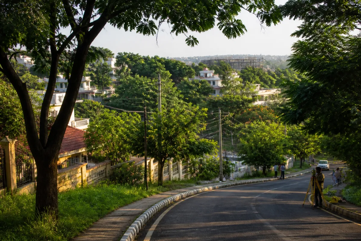
The proposed redevelopment of five established Bhopal neighbourhoods has brought a larger question into focus: can the city add housing and reshape older urban districts without dismantling the mature landscape that makes them distinctive? The MP Housing Board project could affect about 4,500 existing homes across Shivaji Nagar, Tulsi Nagar, Char Imli, 74 Bungalows and adjoining areas, while the same neighbourhoods are estimated to contain nearly one lakh trees.
That combination makes the proposal more than a routine redevelopment exercise. It places housing, land use, road design, building intensity and ecological protection within the same planning decision. The debate is also unfolding alongside the draft Bhopal Development Plan 2047, which proposes wider roads and could allow a higher Floor Area Ratio, or FAR. If those provisions apply to the redevelopment area, critics fear that the three Link Roads could gradually become corridors for taller buildings and more intensive construction.
The supplied report does not establish that such a transformation has been approved. A Housing Board official said the proposal has not been finalised. The official also said only 30% of the proposed area would be developed and that satellite mapping of trees would be undertaken. Those details are important because they indicate that the project remains at a proposal stage, while also showing that the eventual form of development will depend on decisions about the development footprint, tree mapping, building permissions and the relationship between the project and the new master plan.
The central planning issue is therefore not simply whether redevelopment is required. It is how the city defines the land that can be redeveloped, the intensity that can be accommodated and the environmental assets that must remain intact. In a neighbourhood with natural slopes, established residential streets and decades-old tree cover, the physical consequences of construction would extend beyond individual plots. Road widening, taller structures and a higher permissible FAR can change the relationship between buildings, open space, drainage patterns, shade and movement through the area.
The numbers indicate the scale of the decision. About 4,500 homes could be affected across the larger redevelopment area, with 547 homes in Char Imli alone. Nearly one lakh trees are estimated to stand across the neighbourhoods. These figures do not by themselves establish how many trees would be removed, how many homes would be rebuilt or how many residents would be relocated. They do, however, show why the proposal cannot be assessed only through the number of new buildings or units it may eventually create.
A redevelopment plan changes an existing urban system before it produces a new one. Residents currently live within neighbourhoods shaped by mature vegetation, natural slopes and established housing. Any replacement project would need to address not only the construction of new homes but also the transition between the existing settlement and the proposed built form. The report provides no final project design, phasing plan, relocation framework, rehabilitation terms or traffic assessment. Those absences are not proof of failure, but they are central pieces of information that will determine the project’s public consequences.
The ecological argument made by architect Avnish Saxena is that a mature urban forest cannot be recreated through conventional landscaping. He warned that green spaces lose climatic advantage and aesthetic value when they are surrounded by high-rise concrete structures, and advocated a height restriction of three to four storeys. His intervention frames the dispute as a question of urban form rather than tree counts alone. A replacement landscape may include planted areas, but it would not necessarily replicate the shade, canopy, spatial character or ecological continuity of a landscape built over several decades.
This distinction matters in planning because a tree-mapping exercise and a green-area calculation answer different questions. Satellite mapping can help establish the location and extent of tree cover. It does not, by itself, decide which trees are mature, which clusters are ecologically significant, how slopes function during rainfall or how construction would affect the continuity of the existing landscape. The Housing Board’s statement about mapping is therefore a proposed technical step, not evidence that the ecological question has been resolved.
The draft Bhopal Development Plan 2047 adds another layer to the dispute. Wider roads and higher FAR are planning instruments intended to influence the amount and distribution of development. But their effect depends on where they are applied and how they interact with existing neighbourhood conditions. In this case, critics are concerned that broader road reservations and increased development rights could encourage taller and denser construction along the three Link Roads. The report does not state that high-rise construction has been sanctioned there. It records a concern about the direction in which the planning framework could take the area.
That distinction between a plan provision and a completed project is essential. A master plan establishes a framework; it does not automatically deliver a building. Development still requires project-level decisions, approvals and implementation. At the same time, the planning framework can materially influence land values, redevelopment expectations and the scale of proposals that become financially feasible. The concern raised by residents is consequently about cumulative change: a series of individually approved interventions could eventually alter the character of the whole neighbourhood.
Bhopal has encountered a similar conflict before. The report recalls protests during 2015-16 over the proposed Shivaji Nagar Smart City project, after which the project was relocated to TT Nagar. A blue-green master plan was subsequently introduced, but residents say much of the green space has since been lost. The supplied material does not quantify that loss or identify the specific projects responsible. It does show that the present controversy is connected to an earlier cycle of promises about protecting the city’s green structure and concerns about how those commitments translated into land-use decisions.
That history has shaped the credibility problem surrounding the current proposal. Residents are not evaluating the Housing Board project in isolation. They are comparing it with earlier planning commitments and with the visible evolution of established neighbourhoods. When a city introduces a new plan while a major redevelopment proposal is under discussion, the timing can create uncertainty even before final approvals are issued. People want to know whether the plan will protect existing ecological assets, permit their replacement or leave the outcome to later project-level decisions.
The housing argument remains part of the policy landscape. Critics acknowledge that Bhopal has housing needs but argue that new housing should not be provided by sacrificing established green areas. They have suggested that alternative locations could be considered for high-density housing, reducing pressure on the older neighbourhoods. The report does not identify those locations or compare their infrastructure capacity, land ownership, cost or access to services. As a result, the question of alternatives remains open rather than settled.
This is where the institutional structure becomes significant. The Housing Board is advancing the redevelopment proposal, while the Development Plan 2047 establishes a wider land-use and development context. The report also places residents, architects and city planners in the debate, but does not specify the complete approval chain or the formal public consultation process. The eventual outcome will depend on how these institutions define the project boundary, assess tree cover, determine permissible height and FAR, address existing households and interpret the proposed road network.
The project’s stated 30% development footprint could become a key measure in that assessment. On its own, the percentage does not explain whether the remaining area would remain protected, landscaped, publicly accessible or subject to future development. Nor does it reveal how the developed portion would be distributed across the neighbourhoods. A credible evaluation would require the boundary of the proposed area, the location of the development footprint, the treatment of existing trees and the relationship between built-up land and open space.
The same applies to the figure of nearly one lakh trees. It is presented in the report as an estimate of the area’s tree cover, not as an official inventory. The proposed satellite mapping could provide a more precise baseline, but the report does not yet contain its findings. Until that information is available, the public debate is taking place around an important but not fully documented ecological count. That makes transparent mapping and disclosure consequential to the planning process.
The larger urban question is whether redevelopment should be measured only by the additional housing it can deliver. In a mature neighbourhood, value is also carried by the landscape, street network, slope, canopy and continuity of homes and public spaces. Rebuilding can change those assets even when a project retains some green area. Conversely, protecting every existing condition may constrain the amount and form of new housing. The planning challenge is to make those trade-offs visible before a project is treated as a final design.
For Bhopal, the proposed redevelopment and the Development Plan 2047 have therefore become a test of whether growth can be directed without making the city’s green structure incidental. The facts currently established are limited but significant: the proposal is not finalised; it could affect about 4,500 homes; Char Imli accounts for 547 of them; the area is estimated to contain nearly one lakh trees; the draft plan proposes wider roads and potentially higher FAR; and the Housing Board says 30% of the area would be developed with satellite tree mapping planned. The next decisive evidence will be the project’s final boundary, development plan, height and FAR provisions, tree inventory, household rehabilitation framework and formal approval process.

