


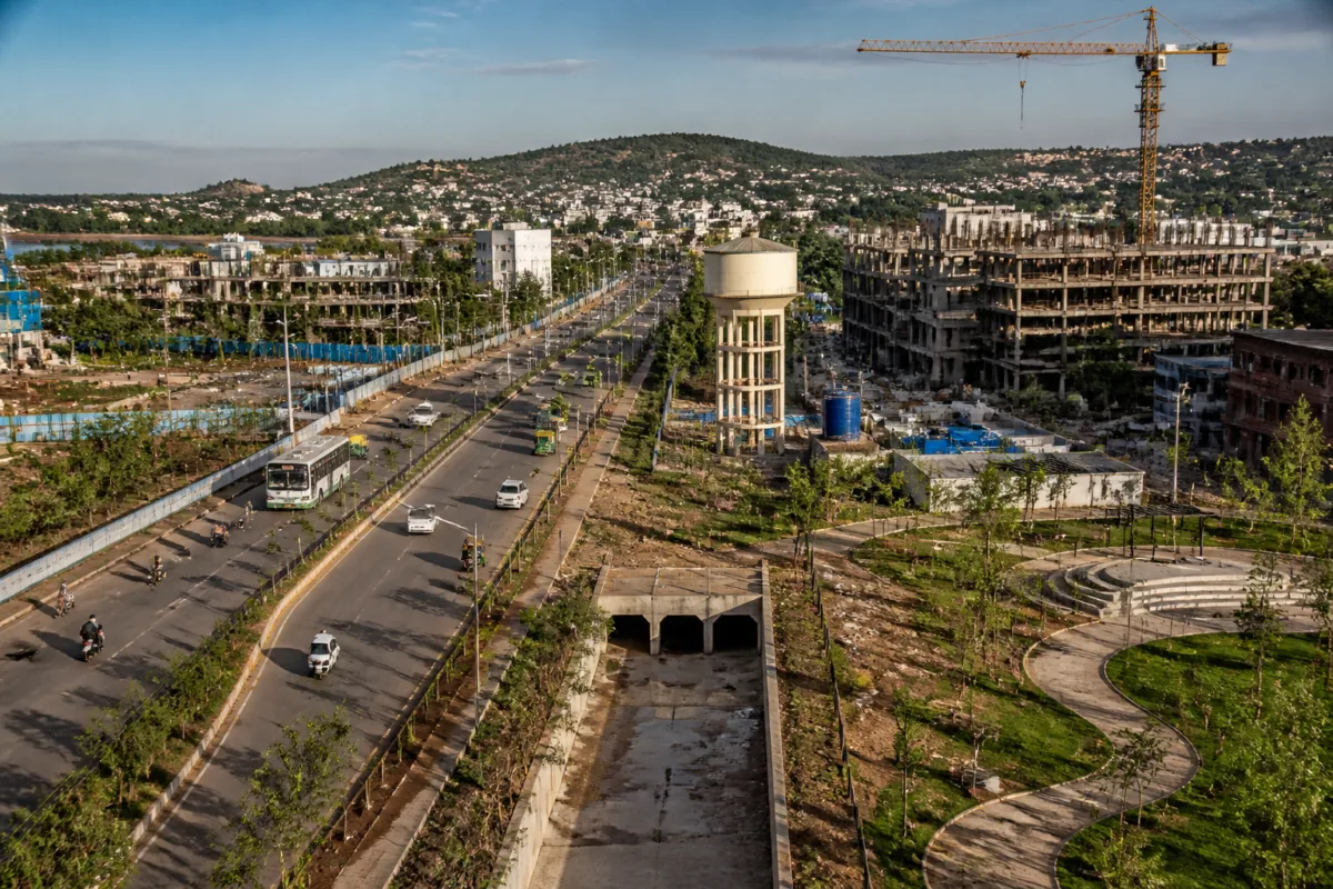
Bhopal’s Draft Development Plan 2047 promises to make the city the “best liveable city”, but an objection to the plan raises a more basic question: can the city expand its residential and transport footprint faster than it can provide water, sewerage, parks, drainage and other everyday services? The concern is not about the ambition of the plan alone. It is about whether liveability has been defined through measurable outcomes or left as a broad aspiration attached mainly to land-use and construction proposals.
The objection, cited in a report by the Times of India, argues that the draft focuses on land use, roads and construction without setting clear targets for essential facilities. It calls for ward-wise quality-of-life indicators, milestones for 2033, 2040 and 2047, and an annual public report card in simple Hindi. These demands shift the discussion from how much land the plan allocates to whether residents will receive the infrastructure that makes development functional.
That distinction is central to long-term urban planning. A development plan can reserve land for housing, roads, parks and public utilities, but reservation is not the same as delivery. The figures cited in the objection suggest that Bhopal’s previous plan experienced a substantial gap between planned allocation and completed development, particularly in parks and public utilities. The proposed 2047 plan is considerably larger, which makes the question of implementation more important rather than less.
The comparison presented in the submission is stark. The 1995 plan allocated 3,827 hectares for parks and recreation, of which 1,131.51 hectares, or about 30%, had been developed. For public utilities, the earlier allocation was 755 hectares, while 254.63 hectares, or about 34%, had been developed. Roads and transport recorded a higher implementation level, with 1,831.83 hectares developed out of 3,662 hectares, or about 50%.
The objection says the 2047 draft proposes 670.93 hectares for gardens and parks and 259.28 hectares for public utilities. These figures cannot be read as completed projects. They are proposed land-use allocations, and the supplied material cautions that categories across the two plans may not be directly comparable. Even with that limitation, the earlier record raises an institutional question: what mechanisms will ensure that land earmarked for public purposes is acquired, funded, built and maintained?
The concern is particularly visible in the proposed residential expansion. The 1995 plan allocated 11,850 hectares for residential development, with 9,546.64 hectares recorded as developed. The new draft proposes 26,240.12 hectares for residential use. Overall, the 1995 plan covered approximately 25,352 hectares, while Part A of the 2047 draft proposes 61,017.03 hectares—about 2.4 times the earlier allocation.
Expansion at this scale can create opportunities for new housing and planned growth, but it also increases the service burden on public agencies. New residential areas require water supply networks, sewerage connections, storm-water drainage, roads, public transport, parks and waste-management systems. If these systems are added after construction or remain incomplete, the city can acquire a larger built footprint without gaining a proportionate improvement in liveability.
The water figures cited in the objection illustrate the scale of the challenge. The draft estimates drinking-water demand at 675 million litres per day by 2047, against available sources of 466 million litres per day. The stated gap is therefore 209 million litres per day. The figures are presented in the submitted objection, not as independently verified calculations in the supplied material, but they identify a basic test for the plan: whether projected population and development are tied to a funded and time-bound source augmentation strategy.
The same submission states that only around 28–30% of Bhopal’s population is served by the sewer network. If that estimate is accurate, the issue is not merely the capacity required for future growth. It is also the unfinished task of extending essential networks to existing residents. A city cannot measure liveability only through new roads or new construction when large sections of its population remain outside basic urban service systems.
Parks provide another measure of the difference between planning intent and daily experience. According to the objection, proposed parks and gardens cover just 0.66% of the planning area. At a projected population of 45 lakh, this would amount to around 1.5 square metres per person. The number is cited as a planning concern because open space is not simply a decorative land-use category. It affects access to recreation, neighbourhood quality, heat exposure and the distribution of public amenities, although the supplied material does not provide a wider assessment of Bhopal’s open-space network.
The objection also states that only about 30% of the recreational land reserved under the previous development plan was developed. This is the clearest link between the old plan and the new proposal. When implementation remains incomplete, a new plan needs more than revised allocations. It needs a public explanation of which departments are responsible, what budgets are committed, when projects will be completed and how residents can track progress.
This is where the proposed ward-wise quality-of-life index becomes significant. A citywide claim of being the “best liveable city” can conceal sharp differences between wards. A ward-level system could, in principle, show whether residents have access to drinking water, sewerage, drainage, parks and roads, rather than treating the planning area as a single unit. The objection specifically calls for targets for 2033, 2040 and 2047, along with an annual public report card in simple Hindi. The supplied report does not establish whether the planning authorities have accepted these demands.
The administrative challenge is that a development plan usually distributes land uses, while service delivery involves multiple agencies, budgets and implementation schedules. Water sources and distribution may involve one set of institutions; sewerage, roads, parks and drainage may involve others. Unless the plan connects its spatial proposals to departmental responsibilities and financial commitments, the document can remain stronger as a map of intended growth than as a delivery framework.
The data in the objection also highlights a potential imbalance between mobility and social infrastructure. The 2047 draft proposes 5,793.82 hectares for roads and transport, compared with 670.93 hectares for gardens and parks and 259.28 hectares for public utilities. These categories serve different purposes and cannot be compared as equivalent investments. However, their presence in the same planning document makes it necessary to ask whether road expansion is being matched by the basic facilities needed to support the communities that new roads will open for development.
The plan’s success will therefore depend on more than the total area proposed for development. It will depend on whether implementation is sequenced. The objection calls for essential facilities to be built first, with higher-density development allowed only when water, sewerage, roads and open spaces can support it. That proposal addresses a familiar urban planning problem: development can proceed quickly because construction and land conversion are visible, while underground networks and public amenities lag behind.
The supplied material does not establish the final position of the authorities, the funding arrangements for the 2047 proposals or whether revised service targets will be incorporated into the draft. It does establish that objections and suggestions are being invited, with October 25 given as the last date for submissions, described as 30 days from the draft notice.
Bhopal’s planning debate is consequently about accountability as much as expansion. The draft proposes a city more than twice the size of the earlier plan’s overall allocation, while the objection points to incomplete delivery of parks and utilities under that earlier framework. Until targets, budgets, responsible departments and annual public reporting are attached to the promise of liveability, the most important question will remain unresolved: how will Bhopal know, and how will its residents verify, whether the city is actually becoming more liveable?

