


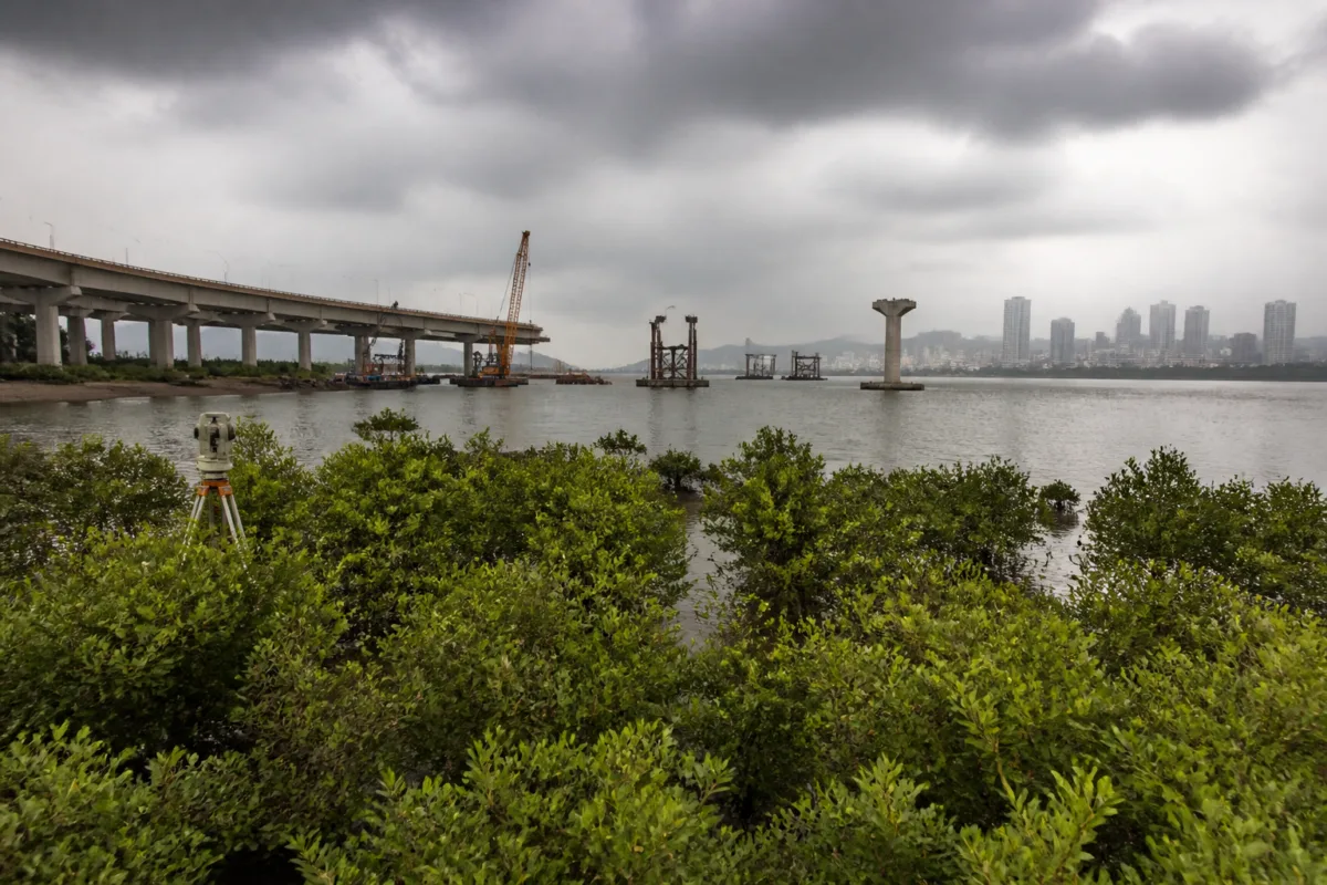
The Maharashtra Coastal Zone Management Authority’s recommendation for the Thane Coastal Road 2 project has moved a long-running infrastructure-environment conflict closer to construction, while leaving the Union Environment Ministry and other statutory authorities to decide whether the proposed safeguards are sufficient. The project is planned along the Thane Creek Flamingo Sanctuary, and the alignment would permanently eliminate 680 mangroves while affecting 3,754 mangroves across the project area.
The recommendation, recorded in the minutes of the authority’s 202nd meeting held on September 24, accepted the Mumbai Metropolitan Region Development Authority’s submission that no alternative alignment could substantially avoid the mangroves. The decision is therefore not simply a technical approval for a road. It is also a formal administrative choice between a proposed regional mobility link and an ecologically sensitive landscape recognised as a Ramsar site.
That distinction matters because the project’s environmental impact is not confined to the footprint of the elevated road. The minutes divide the affected mangroves into three groups: those expected to be permanently lost because they fall within proposed pier locations, those likely to be damaged during construction and subsequently restored, and those expected to remain largely untouched. This classification provides the clearest picture in the supplied record of how the project’s impact has been assessed.
The numbers show both the scale of the infrastructure proposal and the limits of mitigation. Of the 3,754 mangroves identified across the project area, 680 spread over approximately 17 hectares would be permanently lost. Another 1,053 are expected to be damaged during construction and restored afterwards. The remaining 2,021 would largely be left untouched, according to the meeting minutes cited by PTI.
In August, the MCZMA had deferred its decision and asked MMRDA to examine alternative alignments that could minimise damage to mangroves and the eco-sensitive zone. The subsequent recommendation indicates that the authority considered MMRDA’s response adequate for the proposal to be sent to the Union Environment Ministry. It does not, however, mean that all statutory approvals have been completed. The project still requires applicable clearances from the Union Environment Ministry and other concerned authorities.
The alignment problem described by MMRDA is a spatial one. The proposed route lies between existing development on the western side and Thane Creek on the eastern side. According to the development authority, there is no alternative alignment that can substantially save the mangroves while maintaining the intended connection. This places the project within a familiar pattern of metropolitan infrastructure planning: existing urbanisation narrows the available corridor, while the remaining open land performs important ecological functions.
The project is designed as an elevated road, a choice intended to reduce the amount of land occupied at ground level. MMRDA has also proposed increasing the distance between piers from 30 metres to 50 metres. Fewer foundations would mean a smaller direct construction footprint, although the project’s own estimates still identify permanent loss and temporary damage to mangroves. The elevated design therefore reduces, rather than removes, the environmental conflict.
The proposed 7.129-kilometre greenfield road would run along Thane Creek from Anand Nagar in Mulund East to Balkum in Thane. It is intended to extend Thane Coastal Road 1, which runs from Gaimukh in Thane to Kasheli Bridge, and connect with the proposed Kopri-Patni bridge and the Eastern Express Highway extension. In network terms, the road is planned as a link between existing and proposed parts of the metropolitan transport system rather than as an isolated coastal street.
MMRDA has said the road would divert regional and outside traffic away from Thane city and improve connectivity with Mumbai and other parts of the metropolitan region. The authority also expects it to reduce congestion, accidents, air pollution, noise pollution and delays affecting passengers and freight. These are the principal public-interest claims supporting the project in the supplied material. The record does not provide traffic forecasts, travel-time estimates, construction costs or a comparison of projected benefits with the ecological losses.
That missing information is important for understanding the project’s institutional decision-making. The environmental authority’s recommendation addresses the acceptability of the proposal subject to safeguards, while MMRDA’s transport case concerns regional connectivity and traffic diversion. These are related but distinct tests. A road may improve network capacity, but that does not by itself establish whether its selected alignment is the least damaging option or whether the promised mobility benefits will materialise at the scale claimed.
The safeguards attached to the recommendation are therefore central to the next stage. They include compensatory mangrove plantation in consultation with the Mangrove Cell, implementation of an Environmental Management Plan and monitoring of the project’s environmental impact. The recommendation also remains subject to other statutory clearances. In practical terms, the project’s environmental obligations will have to be translated into construction controls, restoration work, monitoring arrangements and institutional responsibility.
The distinction between permanent loss and restoration is particularly significant. The minutes state that 1,053 mangroves are expected to be damaged during construction and restored afterwards, while 680 would be permanently lost because they fall within areas where elevated-road piers are proposed. Restoration can address some construction-related damage, but it cannot reverse the permanent removal of mangroves from pier locations. The two categories therefore represent different kinds of environmental impact and should not be treated as interchangeable.
The decision also illustrates how the Mumbai Metropolitan Region’s infrastructure is increasingly being planned through narrow, contested corridors. On one side are existing settlements, roads and built-up areas; on the other are waterways, wetlands and mangrove systems that restrict conventional expansion but provide ecological functions. When a transport authority says that no alternative alignment is feasible, the question is not only whether another line can be drawn on a map. It is also whether the metropolitan region has preserved enough right-of-way and environmental buffers to avoid making every future connection a choice between congestion and ecological damage.
The Thane Creek Flamingo Sanctuary adds another layer to that question. The project alignment passes through its eco-sensitive zone, and the source identifies the sanctuary as an internationally recognised Ramsar site. That status makes the road’s approval process more than a local engineering matter. It places the project within a framework where the proposed transport connection must be considered alongside the protection of a wetland landscape.
At present, the supplied record establishes the authority’s recommendation, the proposed alignment, the estimated mangrove impact, MMRDA’s position on alternatives and the safeguards attached to the decision. It does not establish that the Union Environment Ministry has granted its approval, that construction has begun, or that the restoration and monitoring systems are operational. Those are the next factual milestones to watch.
The immediate institutional sequence is clear: MMRDA’s proposal has been recommended by the MCZMA, but applicable approvals from the Union Environment Ministry and other concerned authorities remain necessary. The project’s eventual progress will show whether the stated environmental safeguards can be enforced alongside construction and whether the promised regional traffic benefits justify proceeding through the selected corridor. Until those steps are completed, Thane Coastal Road 2 remains an approved-in-principle alignment with a defined ecological cost, not a fully cleared or operational road.

