


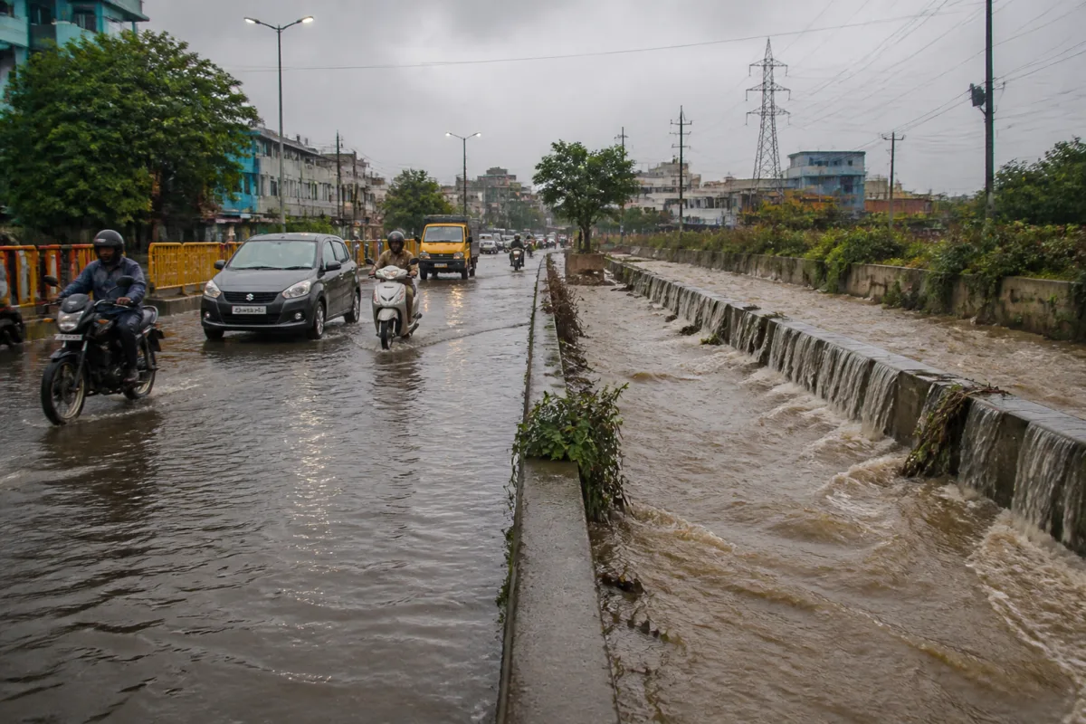
Chennai flood risk is being shaped by two forces moving at different speeds: the city is expanding across low-lying and peri-urban areas, while natural water-retention spaces and drainage coverage are under pressure. A University of Madras study, cited in a report by the Times of India, found that the city’s built-up area grew 7.6% between 2000 and 2024, even as vegetation cover declined 26.14% and water bodies shrank 22.54%. The findings place the city’s flood challenge within a wider urban planning problem rather than treating each inundation as an isolated drainage failure.
The study identified flood-risk hotspots in Velachery, Pallavaram, Chromepet and surrounding southern localities, along with parts of western Chennai, Koyambedu, Villivakkam and areas around Tondiarpet. It found that flood-prone areas are concentrated in low-lying coastal zones, western and southern peri-urban areas and the Adyar River floodplain, where urban expansion, high flow accumulation and historical flood occurrences overlap.
That spatial pattern is important because it shows how flood exposure is produced by the interaction of terrain and development. Roads and buildings replace permeable surfaces that would otherwise absorb rainfall. The result is greater surface runoff, placing more pressure on stormwater drains, canals, water bodies and river systems. In the western and southern peripheral areas, the study found that drainage gaps overlap with recent urban expansion, suggesting that civic infrastructure has not kept pace with the geography of development.
The researchers classified areas more than 1 kilometre from mapped stormwater drains as having drainage gaps. This does not by itself establish that every such location will flood, but it identifies a basic infrastructure vulnerability: parts of the expanding urban edge are farther from the systems intended to move excess rainwater away from streets and settlements.
Chennai’s rainfall pattern makes that vulnerability more consequential. The city receives annual rainfall of 1,382.9 mm, of which 867.4 mm falls during the northeast monsoon between October and December. The report said the 2015 rainfall event exceeded its estimated 100-year return-period intensity, while the 2023 event was associated with a nearly 25-year return period. These figures point to the challenge of designing urban systems that can cope with both frequent seasonal rainfall and much rarer, more intense events.
The study’s central recommendation is to bring land-use planning, terrain characteristics and historical flood records into the same flood-risk management framework. That approach would shift attention from drains as standalone engineering assets to the larger catchment in which water moves. Construction decisions, road layouts, the retention of water bodies and the capacity of downstream channels all influence whether rainfall is absorbed, stored or rapidly converted into runoff.
The administrative response is already organised around mapped vulnerability. Revenue administration and disaster management commissioner B Chandra Mohan said Tamil Nadu had identified 1,030 locations with high or very high vulnerability and another 1,003 locations with moderate vulnerability. According to him, each location has a mitigation plan and a response plan, including water-level triggers for action and evacuation instructions specifying where residents should be moved as water rises.
The Greater Chennai Corporation has also expanded its stormwater network. Between 2022 and 2025, 1,144.5 km of stormwater drains were laid, according to the corporation. The city corporation said it would focus on 219 flood-prone locations during the northeast monsoon, down from 230 the previous year after the construction of additional drains. The reduction is an operational indicator of expanded coverage, but it does not eliminate the underlying exposure created by new development, shrinking water bodies or low-lying terrain.
The distribution of hotspots shows where that pressure is most concentrated. The Old Mahabalipuram Road corridor has the highest concentration in the reported assessment, with 43 hotspots in Perungudi zone and 37 in Sholinganallur. These areas represent the intersection of rapid urbanisation, transport infrastructure, large built-up surfaces and drainage requirements. The flood question there is therefore linked not only to emergency response, but also to how urban expansion is approved, serviced and connected to the wider water system.
The corporation’s preparedness measures include 1,326 motor pumps, 311 boats, 220 relief camps and 110 central kitchens, according to the figures in the report. It has also reported pruning 78,161 trees, desilting 1,670 km of drains and desilting 81 km of canals. Such measures are designed to improve immediate response and maintain the carrying capacity of existing infrastructure. They do not, however, substitute for preserving or restoring the spaces that slow and store water before it reaches the drainage network.
Previous flooding also provides the operational basis for monitoring. During the 2023 northeast monsoon, water levels exceeded three feet for several hours at 15 locations, including the Perambur subway, Ganeshpuram subway, MMDA Colony, 100 Feet Road near Arumbakkam metro station, Valluvar Kottam High Road and AGS Colony. The locations span transport links, dense residential areas and major roads, showing how flooding can interrupt movement and access even when the affected point is not directly adjacent to a river or canal.
The water management system has consequently become more dependent on real-time information. To avoid a repeat of the 2015 floods, the water resources department uses the Chennai Real-Time Flood Forecasting System and the Real-Time Data Acquisition System to guide reservoir releases. The monitoring network is being expanded to include 117 rain gauges, 30 weather stations and 185 water-level recorders across reservoirs, rivers, canals and other waterways.
GCC commissioner G S Sameeran said water releases are now regulated, timed ahead of heavy rain and coordinated with tides at river mouths, so that sudden flush releases such as those seen in 2015 are avoided. This represents a shift from responding only after streets are inundated to using forecasts and water-level data to coordinate decisions across reservoirs, waterways and the coast. Its effectiveness depends on the quality of the data, the timing of alerts and the ability of agencies to act on the information.
Preparedness is also being organised at the level of neighbouring urban bodies. Tambaram Corporation has identified 32 vulnerable locations, desilted 897 km of drains, including 344 km of stormwater drains, and cleared 45 km of channels connecting lakes and water bodies. It has kept 15 shelters and nine kitchens ready. Commissioner R Saranya said East Tambaram underpass was the only location to experience flooding during the Friday event referred to in the report, and that it was cleared within a few hours using heavy-duty pumps kept ready in low-lying areas.
The administrative picture therefore contains both expansion and limitation. Drain construction, desilting, pumps, shelters and forecasting systems show that agencies have increased preparedness capacity. At the same time, the University of Madras study indicates that the physical conditions generating runoff continue to change. Built-up land has expanded, vegetation has declined and water bodies have contracted over the same broad period in which the city has had to strengthen its flood response.
That gap is the larger urban question. Flood resilience cannot be measured only by the number of pumps deployed or the kilometres of drains laid after development has taken place. It also depends on whether land-use decisions account for terrain, whether natural storage areas remain connected, whether new neighbourhoods receive adequate drainage before they fill with buildings and whether historical flood evidence is used to guide future construction.
The evidence supplied in the report confirms that Chennai’s flood risk is unevenly distributed and closely linked to urban growth. It also shows that the state and civic agencies have built a more extensive preparedness and monitoring system. What remains unresolved is whether infrastructure expansion and emergency planning can keep pace with the continued conversion of permeable and water-retaining landscapes. The next monsoon will test not only individual drains and pumps, but the coordination between land-use planning, drainage provision, water management and evacuation systems.

