


Subheadline: A long-delayed 52-km road project is moving back into the acquisition phase, but its progress now depends on compensation, litigation and the logic of Bengaluru’s outward expansion.
Standfirst: The Bangalore Development Authority has revived land acquisition for the second leg of Bengaluru’s Peripheral Ring Road, a project first sanctioned in 2004 and tied to a preliminary notification issued in 2005. The latest final notifications cover 30 villages and 1,427 acres, placing 1,126 landowners in the path of a proposed 42-km stretch that will run parallel to NICE Road. The project is presented as a way to connect major radial roads and support development around Bidadi, including a proposed township. But the immediate question is not only whether the road can improve regional connectivity. It is whether a project delayed for nearly two decades can proceed without repeating the legal and compensation disputes that have slowed it from the beginning. The evidence in the latest announcement points to a familiar Bengaluru pattern: infrastructure is planned at metropolitan scale, while its costs are negotiated parcel by parcel.
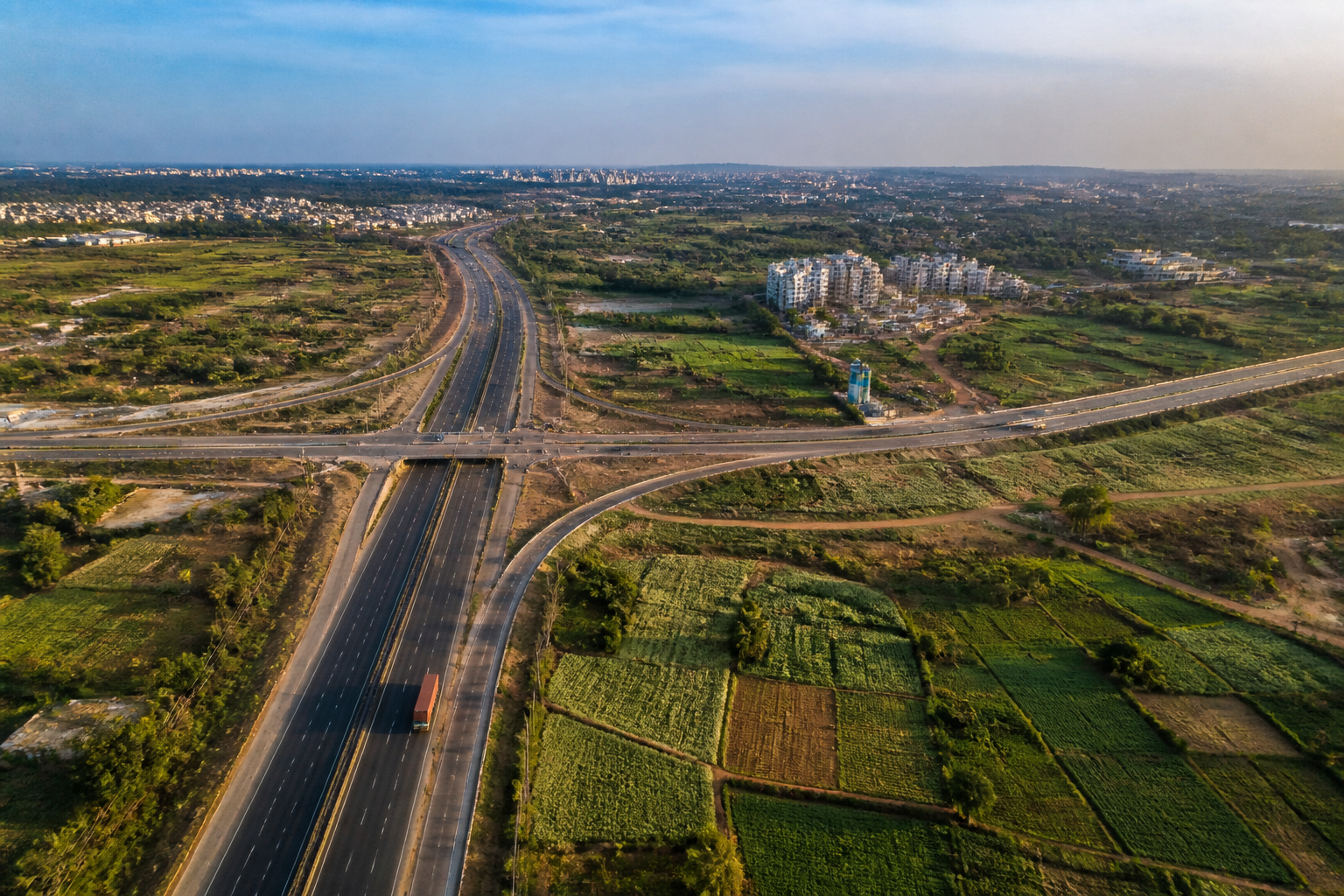
The latest move by the Bangalore Development Authority marks the return of PRR-2 to the active land-acquisition process. The Karnataka government issued final notifications last week for land in 30 villages across parts of Attibele, Jigani, Begur, Uttarahalli, Kengeri and Dasanapura, among other areas. The notified land is intended for the remaining portion of a 52-km, 10-lane road running parallel to NICE Road and connecting the Hosur, Mysuru and Tumakuru corridors.
According to the report, the notification covers approximately 1,427 acres and affects 1,126 landowners. The BDA has already built about 10 km of the proposed road between Magadi Road and Mysuru Road. The latest acquisition is for roughly 42 km still to be developed. The project is estimated to cost Rs 3,500 crore, although the supplied material does not establish whether that estimate has been revised since the project was originally sanctioned.
That distinction matters because PRR-2 is not a new proposal awaiting a first decision. It was sanctioned in 2004, and the preliminary land-acquisition notification followed in December 2005. The long gap between the preliminary and final notifications has changed the context in which the project must now be implemented. Landowners are being asked to respond to a scheme conceived almost two decades ago, while the city and the surrounding development corridors have continued to change.
The report places the revival within a broader push to develop Bengaluru South, formerly Ramanagara. The proposed road would also provide connectivity to a planned township in Bidadi. This gives PRR-2 two functions in the official project narrative. It is a transport link intended to distribute traffic between radial highways, but it is also part of a land-development strategy around the southern edge of the metropolitan region.
The proposed alignment would run parallel to NICE Road, an arrangement that reflects the complicated history of Bengaluru’s peripheral infrastructure. The report says PRR and the Bidadi township were originally viewed in the context of the state government’s dissatisfaction with the promoters of the NICE project. Agreements related to NICE had also included the formation of townships. The supplied material does not provide the terms of those agreements or explain how the earlier dispute was resolved, but it shows that PRR-2 emerged from an institutional and contractual history rather than from a standalone traffic plan.
The road’s proposed junctions also reveal the scale of the network being assembled. The BDA has proposed cloverleaf interchanges where PRR-2 would meet Mysuru Road, Tumakuru Road, Kanakapura Road and Hosur Road. A senior BDA official said additional land may be required for these junctions. That possibility is significant because the 1,427-acre figure may not represent the entire land requirement if interchange designs expand or change during implementation.
For affected owners, the central unresolved issue is compensation. T Yashvantha, state general secretary of the Karnataka Prantha Raitha Sangha, said landowners were likely to oppose the acquisition unless they received the current market value of their land. He also said there was no clarity on the compensation structure. These comments are not a formal assessment of the final notification, but they identify the immediate point at which the project could face resistance: the gap between a government valuation and the value landowners attach to property that may have appreciated during the delay.
A senior BDA official told Deccan Herald that the authority would soon begin passing consent awards to landowners. The official said the BDA had arrived at a compensation structure similar to options offered for the Bengaluru Business Corridor project, with a slight modification, and had sought government approval. The report does not specify the proposed options, the value of compensation, the terms of the modification or the date on which the government is expected to decide.
That lack of detail leaves the project’s most consequential implementation question open. The final notification establishes the government’s acquisition step, but it does not by itself show how quickly possession can be secured, how many owners will accept the awards or whether further legal challenges will follow. The report notes that the High Court has been quashing preliminary notifications after landowners sought legal relief while the government delayed the project. The precise cases, grounds for the orders and status of any related litigation are not provided in the supplied material.
The legal history demonstrates how delay can alter the viability of large urban projects. A preliminary notification issued in 2005 began a process that remained incomplete for years. During that period, the road did not become irrelevant: the BDA constructed a 10-km section, while the remaining alignment stayed unresolved. The result is a partially realised corridor whose next phase depends on land acquisition decisions made against a substantially changed urban and property context.
PRR-2 also needs to be read alongside the other acquisition measures listed in the report. These include the 71-km Bengaluru Business Corridor, SWIFT City in Sarjapur, KWIN City in Doddaballapur and Karnataka Industrial Areas Development Board notifications around the Satellite Town Ring Road. Together, the projects indicate a broad expansion of infrastructure and development planning beyond the existing urban core. The report does not establish a common funding model or single coordinating authority for all of them, but their simultaneous land requirements create a wider administrative setting for PRR-2.
This is the policy landscape in which the BDA must operate. The authority is responsible for advancing the road and issuing consent awards, while the state government must approve the proposed compensation structure. The High Court remains a significant part of the project’s institutional environment because previous acquisition notifications have been challenged. The project therefore depends on coordination among a development authority, the state government, landowners and the courts. The supplied material does not indicate whether a dedicated dispute-resolution mechanism has been created.
The numbers show the tension between metropolitan ambition and local acquisition. A 52-km road, 10 lanes wide, is planned to connect four major radial corridors. About 10 km has already been built, leaving approximately 42 km in the final notification. That remaining distance represents more than four-fifths of the planned length. The project’s physical incompleteness is therefore not a minor gap in an otherwise operational corridor; it is the central implementation challenge.
The land requirement is equally substantial. The BDA is preparing to acquire 1,427 acres from 1,126 owners, an average of slightly more than one acre per affected owner if the reported figures are considered together. That average does not describe the distribution of holdings or the extent of individual displacement, but it indicates the number of separate negotiations embedded in the project. A corridor can be approved as one transport project while being experienced as more than a thousand separate property decisions.
The proposed cloverleaf junctions add another layer to the data story. A road intended to improve movement around the city cannot function only as a linear strip; it needs connections to the roads that carry traffic into and out of Bengaluru. Those connections require land, design approvals and construction beyond the main carriageway. The BDA official’s warning that additional land may be needed shows that the project’s eventual footprint could remain subject to technical and administrative change.
The development logic behind PRR-2 is also visible in its relationship with Bidadi. The road is expected to connect the proposed township and the wider southern region to Bengaluru’s radial roads. In this sense, it is not merely a bypass designed to divert existing traffic. It is also enabling infrastructure for future urbanisation. The supplied report does not provide projected population, traffic volumes or township occupancy figures, so it cannot establish how much demand the road is intended to serve or whether the proposed capacity matches a quantified forecast.
That missing evidence is important. A 10-lane peripheral road can be assessed as a response to current congestion, as a regional connector or as a tool for opening land to development. Each purpose would require different evidence. Current traffic data would show whether the road addresses an existing mobility problem. Land-use plans would clarify how it relates to planned growth. Financial and phasing documents would show whether the Rs 3,500-crore estimate accounts for junctions, escalation and the cost of delayed acquisition. None of those details is included in the source report.
The larger urban question is therefore not whether Bengaluru needs more roads in the abstract. It is how the city decides which peripheral infrastructure to pursue, when to acquire land and how to maintain legitimacy when projects remain unresolved for years. PRR-2 illustrates the consequences of separating the announcement of a corridor from the completion of its land, legal and compensation framework.
For the 1,126 affected owners, the next stage is the consent-award process and the government’s decision on the proposed compensation structure. For the BDA, the immediate task is to convert a final notification into negotiated or legally enforceable acquisition while clarifying the land needed for interchanges. The evidence confirms that PRR-2 has been revived, but not that construction of the remaining 42 km is imminent. The developments to monitor are government approval of compensation, the issuance of consent awards, further court proceedings and any revision to the project’s land requirement.
