


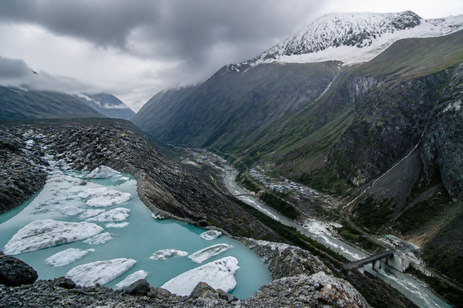
A warning about roughly 230 potentially dangerous glacial lakes across the Hindu Kush Himalaya is also a warning about the infrastructure built below them. Research cited in a report by Sangbad Pratidin says 55 of these lakes could create severe consequences if they fail, with possible flood paths containing bridges, buildings and hydropower facilities.
The risk extends well beyond Nepal. The Hindu Kush Himalaya spans Afghanistan, Bangladesh, Bhutan, China, India, Myanmar, Nepal and Pakistan, while its glaciers, rivers and mountain systems are physically connected. A failure in one location can therefore affect settlements and infrastructure downstream, including across national boundaries.
The finding matters because mountain hazards are not confined to a single type of disaster. A glacial lake outburst flood can be accompanied by landslides, rockfalls, ice avalanches and cascading floods. These events can damage roads, bridges, power facilities and buildings at the same time, disrupting both local access and wider regional networks.
The report attributes the assessment to the International Centre for Integrated Mountain Development, or ICIMOD, and refers to a 2024 study that identified approximately 230 dangerous glacial lakes in the Hindu Kush, Karakoram and Himalayan regions. It says 55 lakes were assessed as capable of producing particularly serious consequences in the event of a failure. The supplied report does not provide the individual locations, hazard ratings or modelling methodology for each lake.
That limitation is important for public planning. A regional count establishes the scale of exposure, but it does not by itself show which downstream settlements face the greatest danger, how much warning time is available, or whether existing bridges and hydropower plants can withstand a sudden surge. Those questions require lake-specific mapping, downstream exposure assessments and operational emergency plans.
The physical drivers described in the report are interconnected. Rising temperatures can accelerate glacier melt and increase the size of glacial lakes. The report also points to thawing permafrost, or permanently frozen ground, and increasingly unstable mountain slopes. Together, these processes can weaken the terrain surrounding a lake and increase the possibility of sudden water release, landslides or falling rock and ice.
This is where climate risk becomes an urban and infrastructure issue. Settlements are often concentrated along river valleys because those corridors provide access, water and relatively usable land. Roads, bridges and hydropower projects also follow valleys and river systems. The same geography that supports habitation and economic activity can place critical assets in the path of rapidly moving water and debris.
The report links the concern to a deadly flash-flood event in Nepal in August, saying the disaster renewed attention on the growing risks associated with glacial melt and landslides. It cites a recent analysis by World Weather Attribution that connected the increasing risk of such events with long-term warming, glacier melt, permafrost degradation and geological instability. The supplied material does not provide the analysis’s quantified estimate of how much climate change altered the probability or intensity of the specific event.
Researchers at the University of Manchester are also cited as finding that a landslide in the mountains can transform into a flood within moments. This short transition creates a major challenge for conventional disaster management. A system designed to respond separately to landslides, floods and infrastructure failure may not provide enough time when one hazard rapidly triggers another.
The governance problem is equally significant. Rivers and glaciers do not follow national borders, and a hazardous lake or slope failure in one country can damage downstream populations and infrastructure in another. Monitoring, warnings and evacuation decisions therefore cannot depend only on national systems operating independently. The report says researchers have called for stronger surveillance, information sharing and joint disaster preparedness among Himalayan countries.
Such cooperation would involve more than exchanging general warnings. Effective risk management would require compatible monitoring systems, agreed thresholds for alerts, clear communication channels and plans identifying who will notify downstream authorities and communities. The supplied report does not establish whether such a coordinated regional system currently exists or how consistently information is shared between the countries concerned.
For infrastructure agencies, the warning raises a question about how projects are planned and maintained in rapidly changing mountain environments. Bridges, buildings and hydropower plants may have been designed using earlier assumptions about slope stability, lake size or flood behaviour. As those conditions change, risk assessment cannot remain a one-time exercise conducted only before construction.
The issue also exposes a mismatch between the scale of hazard and the scale of administration. A bridge may be managed by a local or national agency, while the source of the flood risk may lie in a remote watershed and, potentially, another country. Hydropower operations, road closures, evacuation planning and downstream warnings must consequently be connected across agencies and jurisdictions.
The evidence in the supplied report confirms a broad regional risk, but it does not establish that all 230 lakes pose the same level of threat or that a failure is imminent. It identifies 55 lakes as especially concerning and describes the conditions that can increase danger. The next information needed for public decision-making is more granular: lake-by-lake hazard assessments, downstream exposure data, infrastructure inventories, warning lead times and documented response arrangements.
The larger urban question is whether mountain settlements and infrastructure systems are being managed for present conditions or for a climate and terrain system that is changing faster than planning assumptions. The warning from the Hindu Kush Himalaya shows that climate resilience is not only about protecting cities from gradual heat, rainfall or sea-level changes. It also requires preparing connected settlements and infrastructure networks for sudden, cascading hazards originating high in the watershed.
For now, the report points to surveillance, cross-border data exchange and joint preparedness as the central institutional priorities. The effectiveness of that approach will depend on whether the regional warning is converted into location-specific monitoring, publicly usable alerts and infrastructure decisions that account for hazards moving across both valleys and national boundaries.

