


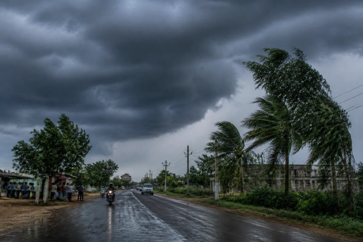
The Telangana heavy rain alert issued for November 20 is not a statewide warning. It is a geographically concentrated forecast that places Khammam, Bhadradri Kothagudem, Mahabubabad and Mulugu under a yellow alert for isolated heavy rainfall, while Hyderabad is expected to remain dry. That contrast is important because it shows how a single weather system can produce sharply different operational demands across a state whose cities, towns and rural districts do not share the same exposure or response capacity.
The India Meteorological Department’s forecast, reported by the Times of India, links the expected rain to a depression over the southeast and adjoining southwest Bay of Bengal. The system was forecast to intensify on November 16, become a severe cyclonic storm on November 17 and move northwest towards the Andhra Pradesh coast over the following two days. On November 20, the four districts may receive isolated heavy rainfall with thunderstorms, lightning and squally winds of 40-50 kmph, gusting to 60 kmph.
That sequence makes the warning more than a simple rain prediction. It is an early indication that the effects of a coastal weather system may extend inland, reaching districts with different landscapes, transport networks, settlements and administrative requirements. The forecast does not say that every location in the four districts will receive heavy rain. The phrase “isolated heavy rainfall” indicates that impacts may be uneven even within a district, which is one reason why district-level alerts need to be translated into local monitoring rather than treated as a uniform condition.
The warning also illustrates the layered nature of weather communication. Four districts face the yellow alert for November 20, while eight other districts, including Nalgonda, Suryapet, Warangal, Hanamkonda and Karimnagar, may see thunderstorms with lightning and gusty winds of 30-40 kmph at isolated places. Nalgonda and Suryapet are also among the districts forecast to receive isolated light to moderate rain or thundershowers on November 19, along with Khammam, Bhadradri Kothagudem and Mahabubabad.
In practical terms, the forecast describes a changing risk window rather than a single moment. Telangana is expected to remain dry until November 18. Rain may begin in isolated areas on November 19, with rainfall at a few places and isolated heavy spells possible on November 20 and 21. This progression matters for public agencies because preparation, response and recovery do not begin at the same time. A dry day before the rain may provide a limited window for checking drainage paths, low-lying roads, electricity infrastructure, public buildings and emergency communication systems, although the supplied report does not state whether any such preparations have been ordered.
The urban significance of the alert lies in how rainfall becomes an infrastructure problem. Heavy rain does not affect all places equally. Its consequences depend on the condition and capacity of local drainage, the presence of low-lying settlements, road design, the ability of culverts and stormwater channels to carry runoff, and the reliability of electricity and telecommunications during thunderstorms. None of these systems is assessed in the IMD forecast, so the warning alone cannot establish where flooding or service disruption will occur. It does, however, identify districts where local authorities and residents need to watch for the combination of heavy rain, lightning and strong winds.
The forecast is particularly relevant for districts with dispersed settlements and varied terrain. Khammam, Bhadradri Kothagudem, Mahabubabad and Mulugu are not presented as one continuous urban area. Their risk may therefore be distributed across towns, villages, roads and public facilities rather than concentrated in a single metropolitan core. The report provides no district-wise rainfall totals, flood-risk mapping or list of vulnerable locations. That absence limits what can responsibly be concluded, but it also highlights the importance of converting a broad weather alert into location-specific information before the expected event.
The state’s wider weather picture reinforces that point. Thunderstorms and lightning are forecast in eight additional districts, including the urban centres of Warangal and Hanamkonda. These districts may not face the same heavy-rain alert as the four named districts, but gusty winds and lightning can create a different set of risks for commuters, outdoor workers, construction sites, roadside infrastructure and electricity networks. A warning focused only on rainfall could therefore understate the operational significance of the weather system.
Hyderabad’s position in the forecast is a useful counterpoint. The city is expected to remain dry through November 19, with partly cloudy skies and morning mist or haze. The IMD’s zone-wise forecast indicates a very low likelihood of rainfall across all listed city zones, including Uppal, LB Nagar, Khairatabad, Golconda, Rajendranagar, Charminar, Serilingampally, Kukatpally, Secunderabad, Malkajgiri, Shamshabad and Quthbullapur. This is a citywide dry outlook, not evidence that the metropolitan region is unaffected by the weather system in every respect.
The Hyderabad forecast shows why state-level weather headlines can mislead urban readers when they are not read geographically. A resident in the capital may experience no rain while a district elsewhere faces heavy spells, lightning and squally winds. At the same time, the city’s dry conditions do not reduce the need for accurate public communication across the state. Transport operators, road users, district administrations and emergency agencies may have to respond to different conditions at the same time.
Temperature readings in Hyderabad also underline the limited scope of the forecast. The city’s maximum temperature rose from 31.6°C on November 14 to 32°C on November 15, while the minimum fell from 17.1°C to 16.9°C. The IMD forecast maximum temperatures of around 32°C and minimum temperatures of 17-18°C over the following 48 hours. These numbers describe Hyderabad’s immediate local weather, but they do not offer a proxy for conditions in the four districts under the yellow alert.
Institutionally, the IMD’s role in this report is to provide the forecast and alert classification. The article does not identify any separate state government order, district emergency plan, municipal advisory or transport restriction. That distinction is important. A weather alert communicates expected atmospheric conditions; it does not by itself confirm that roads will flood, schools will close, public transport will be disrupted or relief operations will be activated. Those outcomes depend on decisions by state, district and local authorities and on conditions observed on the ground.
The absence of a reported response should not be read as evidence that no response exists. It means only that the supplied report does not document one. The next layer of public-interest information would be whether the four districts issue local advisories, whether district control rooms are activated, whether vulnerable infrastructure is inspected and whether residents receive guidance on lightning and high-wind conditions. These are the implementation details that determine how a forecast is converted into public safety action.
The timing also matters for communication. The weather system was expected to intensify before moving towards the Andhra Pradesh coast, while the heavier rainfall in Telangana was forecast later. Forecasts can be refined as the system develops, and the article itself presents probabilities and expected locations rather than certainties. The yellow alert should therefore be understood as a preparedness signal. It identifies a period and a set of districts requiring attention, but it does not establish the exact location, duration or severity of rainfall in every affected area.
For urban and regional planning, the immediate lesson is that resilience cannot be measured only by the performance of a major city. Telangana’s weather exposure is distributed across multiple administrative and settlement systems. A state can have a dry capital while other districts manage heavy rain, lightning and strong winds. Planning for such events therefore requires coordination between state-level forecasting, district administration, local infrastructure agencies and public communication networks.
The evidence currently confirms three things: four Telangana districts are under a yellow alert for isolated heavy rainfall on November 20; several other districts face the possibility of thunderstorms, lightning and gusty winds; and Hyderabad is expected to remain largely dry through November 19. It does not yet establish the likely rainfall totals, specific flood points, service disruptions or official response measures. Those are the developments to monitor as the weather system intensifies and as district-level advisories are issued.

