


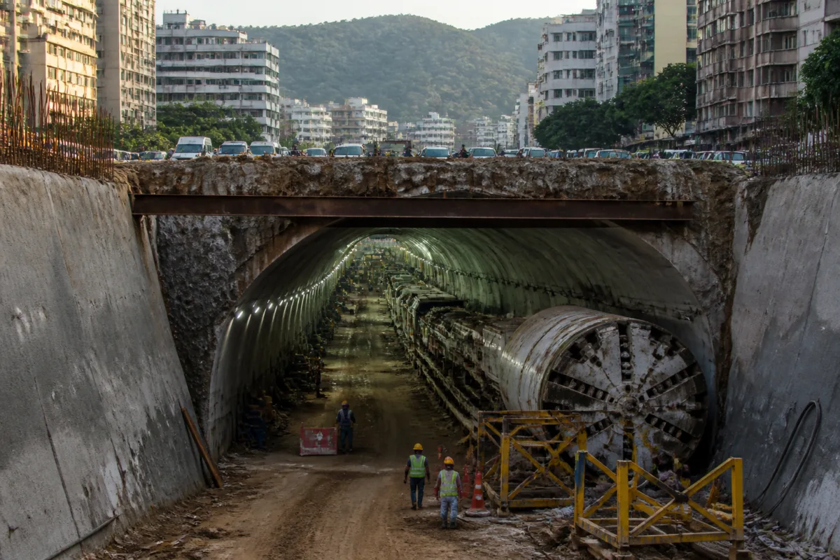
Pune’s proposed underground tunnel project has moved from a broad traffic solution into a more defined planning exercise, with the municipal corporation identifying two corridors totalling 31 kilometres and approving the appointment of expert consultants for detailed studies. The proposal is significant not because construction is imminent, but because it shows the city trying to address congestion through a network linked to metro lines, ring roads, bridges and bus services rather than through isolated road projects.
The two proposed tunnels are a 23-kilometre connection between Bhosari and Undri and an eight-kilometre route between the Ram River area at Bhugaon and D.P. Road in Erandwane. The first corridor is proposed to run through Bhosari, Sangamwadi, Dhobighat in the Pune Cantonment area, Kondhwa and Undri. The second would connect Ram River, Dukkar Khind and D.P. Road.
Both routes are still at the preliminary planning stage. Pune Municipal Corporation Commissioner Naval Kishore Ram has approved the next step of appointing expert consultants to prepare a detailed feasibility study and a detailed project report. A decision on implementation is expected only after technical, financial, environmental and traffic feasibility are examined. This distinction is important: the current announcement records administrative movement towards investigation, not approval to build the tunnels.
The proposal has emerged from a change in how Pune’s underground mobility options are being evaluated. An earlier possibility involving an underground route between Yerawada and Katraj was reportedly found to be less feasible and did not proceed. Other corridors were then examined before the two current routes were identified through traffic-related surveys and preliminary municipal planning.
That history places the current proposal within a wider challenge faced by Pune and Pimpri-Chinchwad. The two urban areas have expanded rapidly, while the number of vehicles and pressure on existing roads have increased. The municipal proposal treats congestion as a problem of missing connections between major movement corridors, not only as a shortage of road space at individual junctions.
The 23-kilometre Bhosari-Undri route is intended to provide a direct north-south connection across the urban region. Its proposed alignment passes through areas with different administrative and transport characteristics, including the Pune Cantonment and the southern parts of the city. The source report also identifies the corridor as potentially important in relation to the proposed international airport at Purandar, although the airport-related role would depend on the tunnel eventually being found feasible and receiving the necessary approvals.
The eight-kilometre Bhugaon-Erandwane route addresses a different urban constraint. It is intended to offer an alternative connection for western Pune while crossing the geographical barrier around Dukkar Khind. Its shorter length does not make it a standalone solution to city-wide congestion; its value would depend on how effectively it connects with the surrounding road network and distributes traffic beyond the tunnel itself.
The most consequential feature of the proposal is the use of traffic data to identify the corridors. According to the report, the preliminary study used TomTom origin-destination data, Google traffic and real-time traffic intelligence data, CMP data and travel-pattern analysis, with assistance from the traffic police. The study examined major traffic routes, gaps in connections between them and possible alternative routes.
This approach indicates a shift from selecting corridors primarily through geographic intuition to examining how people and vehicles actually move through the city. Origin-destination information can reveal where trips begin and end, while real-time traffic data can show where congestion accumulates. However, the source material does not establish the scale of the expected traffic diversion, the projected travel-time savings, the estimated cost or the number of vehicles that the tunnels could carry. Those are among the questions that the feasibility study and DPR will need to answer.
The municipal report has also identified a limitation in an earlier proposal prepared through the Pune Metropolitan Region Development Authority. According to the report, the earlier plan did not adequately consider connections with the High Capacity Mass Transit Route, the Inner Ring Road and the Outer Ring Road. The new planning exercise therefore places greater emphasis on integration with these wider transport systems.
That integration is central to whether the tunnels become useful mobility infrastructure or simply expensive underground road capacity. The proposed routes are being considered alongside the HCMTR, the Inner Ring Road, the Outer Ring Road, flyovers and bridges over the river. The municipal corporation also plans to study their relationship with proposed corridors of MahaMetro and the Maharashtra State Infrastructure Development Corporation.
The reference to bus planning is equally important. The proposal includes examining how bus services can be planned alongside metro corridors to strengthen public transport. This suggests that the municipal administration is not presenting the tunnels only as private-vehicle routes. At the same time, the source does not specify whether the tunnels would include dedicated bus lanes, public transport priority measures, walking facilities or cycling infrastructure. Those design choices will affect whether the project supports a broader mobility system or primarily expands road capacity for cars and other motor vehicles.
The governance structure will be a major test. The proposed alignments involve the Pune Municipal Corporation, the Pimpri-Chinchwad Municipal Corporation, a cantonment board and the Ministry of Defence. The Bhosari-Undri route in particular crosses a broad urban geography in which responsibilities for roads, land, clearances and operations may not rest with one authority. Coordination will therefore be required before construction can be considered.
The cantonment and defence-related jurisdictions are not administrative details that can be resolved after design work. They can influence alignment, land access, construction methods, security permissions and the timing of approvals. The involvement of multiple agencies also means that the DPR will need to clarify who owns the project, who finances it, who executes it and who will operate and maintain the completed infrastructure. The supplied material does not yet provide those details.
The project’s institutional complexity is matched by its technical complexity. Underground construction across a large metropolitan area requires assessments of geology, utilities, groundwater, ventilation, emergency access, tunnelling methods and the effect on surface roads and neighbourhoods. The source confirms that technical, financial, environmental and traffic feasibility will be examined, but it does not disclose the proposed tunnelling technology, construction cost, funding model or implementation schedule.
The available numbers show the scale of the ambition. The two corridors together would cover 31 kilometres, with the Bhosari-Undri tunnel accounting for roughly three-fourths of the proposed length and the Bhugaon-Erandwane tunnel making up the remaining eight kilometres. Yet distance alone cannot establish the project’s effectiveness. The key measure will be how the tunnels connect origins and destinations, what traffic they attract, what surface routes they relieve and whether they connect efficiently with mass transit.
The proposal also illustrates the limits of treating major urban infrastructure as a single announcement. At present, the project has a defined preliminary network, a stated data basis and approval to move towards consultant-led feasibility and DPR preparation. It does not yet have a public construction decision, a disclosed budget, an implementation timetable or confirmed financing. Those omissions are not minor gaps; they determine whether the proposal can move from planning to execution.
For residents, the immediate consequence is therefore not a new underground route but a new planning process that could affect future movement between northern, southern and western parts of the Pune urban region. The eventual citizen impact will depend on the alignment approved, the connections built at either end, the relationship with metro and bus services, and the disruption and cost associated with construction.
Pune’s underground tunnel proposal is consequently best understood as a test of integrated transport planning. The city is attempting to connect several major infrastructure systems and use travel data to refine its choices, while also navigating multiple jurisdictions. The next decisive stage will be the feasibility study and DPR, which are expected to establish the project’s technical, environmental, financial and traffic viability before any implementation decision is taken.

