


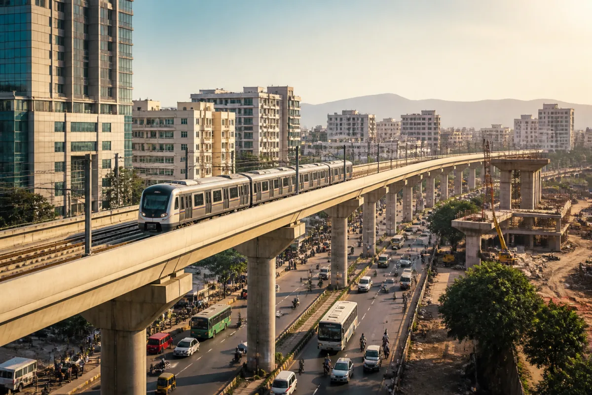
Pune Metro Phase 2 is being planned as a 44.39-kilometre network covering the city’s eastern, western and south-western growth corridors, with 41 proposed stations. The scale of the expansion shows how quickly Pune’s mobility challenge has moved beyond the two corridors delivered in the first phase: the next network will have to connect established neighbourhoods, employment districts, peripheral growth areas and future airport access while coordinating several projects at different stages of preparation.
The details were presented by MahaMetro director Shravan Hardikar at a press conference, according to a report by Lokmat – Pune. The second-phase network includes the Vanaz–Chandani Chowk, Ramwadi–Wagholi/Vitthalwadi, Kharadi–Khadakwasla and Nal Stop–Warje–Manikbag routes. Together, these corridors are intended to extend the operational network towards the city’s eastern and western edges and create stronger links between residential areas, commercial locations and information technology centres.
That geography is important. Pune’s urban expansion has produced a city in which employment and housing are distributed across multiple corridors rather than concentrated around a single central business district. Kharadi, Viman Nagar, Wagholi, Hadapsar, Magarpatta, Warje and Chandani Chowk represent different parts of this expanding urban system. A metro network can connect them, but only if the alignments, interchange points, construction schedules and feeder arrangements work as one system rather than as isolated projects.
The first part of the proposed expansion consists of two eastern and western extensions. Line 2A from Vanaz to Chandani Chowk is planned to run for 1.12 kilometres with two stations. Line 2B from Ramwadi to Vitthalwadi in Wagholi is planned to cover 11.63 kilometres with 11 stations. Their combined length is 12.75 kilometres. The report says these extensions would improve connections to Chandani Chowk, Viman Nagar, Kharadi and Wagholi, but it does not establish that construction has begun or provide a confirmed opening date for these two routes.
The larger component is the Kharadi–Hadapsar–Swargate–Khadakwasla corridor, identified as Line 4. It is planned to cover 25.52 kilometres and include 22 elevated stations. A 6.12-kilometre branch, Line 4A, would run from Nal Stop through Warje to Manikbag and include six elevated stations. The combined length of these two routes is 31.64 kilometres, with an estimated cost of Rs 9,857.85 crore, according to the report.
This corridor illustrates both the promise and complexity of Pune’s next metro phase. It would connect Kharadi and Magarpatta with Hadapsar and Swargate before extending towards Khadakwasla, while the branch would link Nal Stop, Warje and Manikbag. Interchange planning is proposed at Swargate, Nal Stop and Kharadi bypass. These points are not minor technical details: they will determine whether passengers can transfer conveniently between lines or whether the network remains a collection of long, disconnected journeys.
The proposed alignment also reflects the uneven structure of Pune’s growth. Kharadi is a major employment and technology corridor, Hadapsar combines offices, housing and industrial activity, and Swargate is an established transport node. Khadakwasla and Warje represent expanding residential areas on the city’s western and south-western side. The network therefore attempts to connect both existing demand and areas where development has spread faster than high-capacity public transport.
At the same time, the report presents several different categories of work under the broad umbrella of future metro expansion. The Pimpri–Nigdi corridor, covering 4.41 kilometres with four stations and an estimated cost of Rs 960.18 crore, is listed with an expected completion date of June 2027. The Swargate–Katraj corridor, covering 6.06 kilometres with five stations and an estimated cost of Rs 3,637.64 crore, is listed with an expected completion date of March 2029. The report does not specify the construction or contracting status of these corridors in the supplied material, so these dates should be read as reported project expectations rather than independently confirmed delivery commitments.
Several other connections remain at earlier planning stages. A three-kilometre airport link to Pune’s Lohegaon airport is at the route-finalisation stage. A 20-kilometre corridor from the District Court through Poolgate, Kondhwa and Yewalewadi, with a Kondhwa–Undri branch, is also under route finalisation. The Wakad–Katraj–Shewalewadi corridor is listed as a 45-kilometre proposal for which a detailed project report is being prepared. A 30-kilometre Pune–Purandar airport connection is likewise at the DPR preparation stage.
The distinction between these stages matters because a route appearing on an expansion map does not necessarily have the same administrative or financial status as a project under construction. Route finalisation, preparation of a detailed project report, approval, funding, tendering, land access and construction are separate steps. The available report provides route lengths, stations and some estimated costs, but it does not provide a complete funding plan, approval schedule, land-acquisition position or tender calendar for the 44.39-kilometre Phase 2 network.
The proposed Purandar airport connection is particularly significant in planning terms because it links metro expansion to a future regional infrastructure decision. The report identifies a 30-kilometre metro connection and says its DPR is being prepared, but it does not establish the airport’s implementation timetable or explain how the metro alignment would be integrated with airport construction, road access and other public transport services. That makes the airport link a planning proposal rather than an operational commitment at this stage.
The expansion also extends beyond Pune city into the wider metropolitan region. In Pimpri-Chinchwad, a detailed project report has been prepared for the Bhakti Shakti–Chakan route, while an 18-kilometre electric rapid transport system is also listed. The reported proposals for Hadapsar–Loni Kalbhor and Hadapsar–Saswad Road further indicate that the planning horizon is no longer limited to the existing municipal core. Pune’s transport network is being considered across a larger urban area in which daily commuting crosses municipal boundaries.
That regional scale creates an institutional challenge. A metro line can be planned by a transport agency, but its usefulness depends on decisions by municipal bodies, road authorities, land agencies and other public institutions responsible for junctions, bus connections, parking, footpaths and development controls. The supplied report identifies proposed interchanges but does not provide details of feeder services, pedestrian access or last-mile integration. Those elements will determine how many residents can actually use the network without relying on private vehicles for the first and final parts of their journeys.
The numbers reveal the ambition of the programme. The four principal Phase 2 corridors together total 44.39 kilometres and 41 proposed stations. Within them, the Kharadi–Khadakwasla line and its Nal Stop–Manikbag branch account for 31.64 kilometres and an estimated Rs 9,857.85 crore. Beyond that core, the report lists projects ranging from a 3-kilometre airport link to a 45-kilometre Wakad–Katraj–Shewalewadi corridor. These figures describe a large pipeline, but they should not be treated as a single construction package because the projects are at different stages.
For residents, the immediate issue is therefore not only how many kilometres are announced but when each corridor reaches the ground, which stations are funded and how the network connects with the existing lines. A 44.39-kilometre expansion could substantially widen the reach of public transport if the corridors are delivered as an integrated system. If different routes move at different speeds, however, the city may continue to experience fragmented connectivity even as the overall project map grows.
The announcement confirms that Pune’s transport planning is moving towards a city-wide and metropolitan network, with the strongest emphasis on linking eastern employment districts, western residential areas and major interchange points. It does not yet establish a single delivery timetable for the entire Phase 2 network. The developments to monitor are the formal approvals, detailed project reports, funding decisions, route finalisation, tendering and construction milestones for each corridor. Those administrative steps will determine whether the proposed expansion becomes a functioning network or remains a long-term planning pipeline.

