


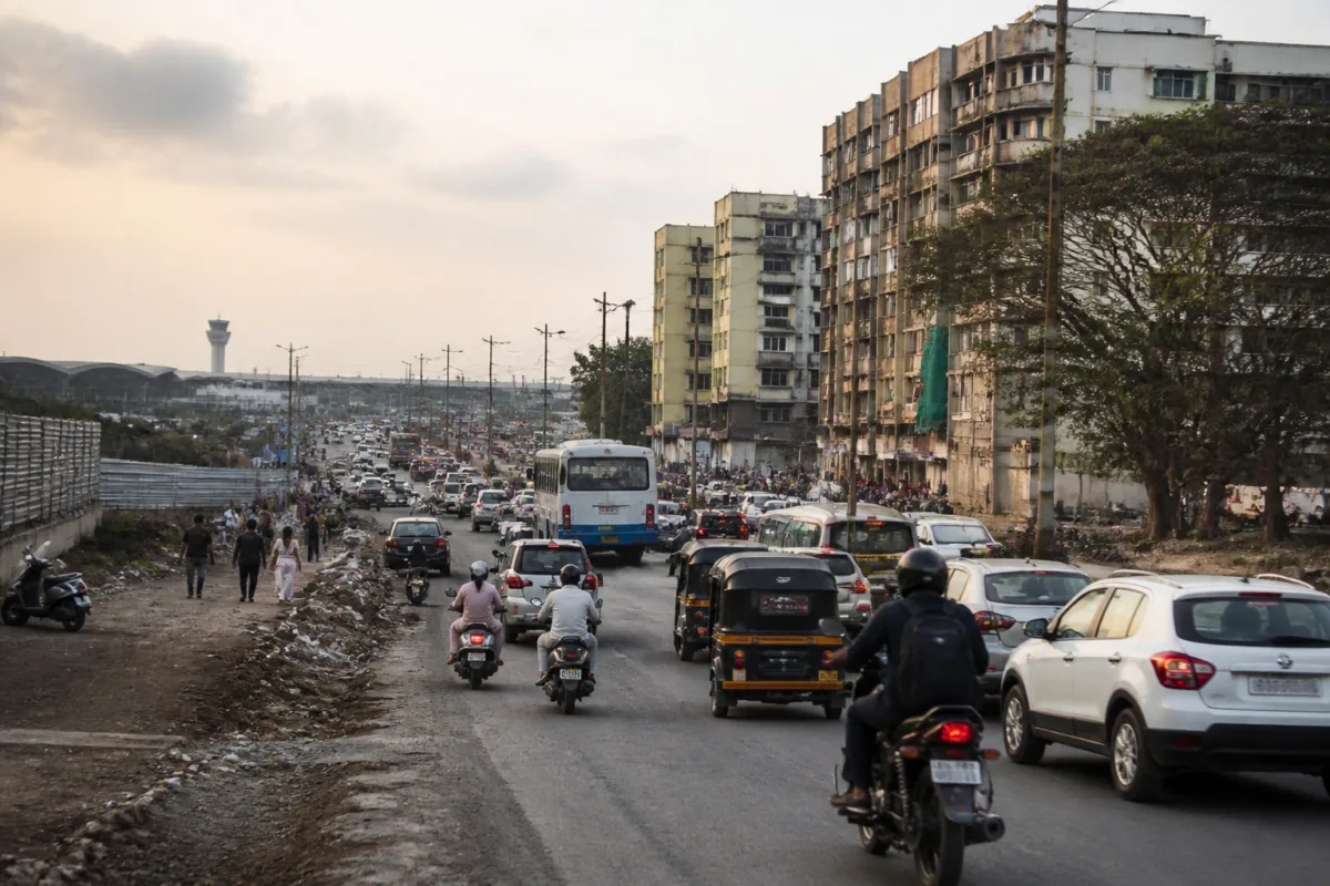
Pune’s Viman Nagar area is facing a cluster of unresolved transport, land-use and public-amenity questions as residents seek deadlines for road widening, clearer Metro and High Capacity Mass Transit Route (HCMTR) plans, and greater transparency over land reserved for civic facilities.
The Viman Nagar Citizens Forum has asked the Pune Municipal Corporation (PMC) to set a deadline for widening VIP Airport Road to 30 metres between the Ramwadi underpass and the airport gate. In a follow-up email sent on November 20, forum convenor Qaneez Sukhrani also sought a published schedule for completing missing road links in Viman Nagar.
The forum’s requests follow a PMC meeting held on October 29. According to the meeting minutes cited in the report, PMC City Engineer Aniruddha Pawaskar directed officials to act on several issues, but no deadlines had been fixed. The forum has now sought written action-taken reports from each department, the name of the officer responsible for coordinating the work and a date for the next review meeting.
The minutes list PMC engineers and a MahaMetro representative among those present. The forum has asked the civic body to clarify when it will take possession of land earmarked for road widening, including setback areas shown in sanctioned building plans. It has also pointed to conflicting Right to Information replies: the PMC Road Department provided a plot-wise list on October 1, while the property management department stated on October 23 that it had no record available. The minutes record that the property department was asked to check its records.
The road requests cover several local connections. The forum has identified the Balghire Road corner near Optimus Society, Symbiosis School Road between Rose Garden Society and Airport Road, the Oakwood–Parkland link towards Weikfield, Kashmiri Sauf Road towards Nagar Road and the Lane No. 19 junction near Rohan Mithila as priorities. The minutes state that work on Symbiosis School Road was already under way and that Pawaskar asked officials to complete it as soon as possible.
The forum has also sought an interim traffic management plan from Pune Traffic Police. It requested designated spaces for licensed street vendors, a timetable for clearing footpath obstructions and details on how land reserved for public amenities in Ward No. 3 is being used. It further sought updates on alleged encroachments involving 19 cafés, restaurants and garages along Airport Road, along with alleged unauthorised extensions at row houses used by businesses and schools. The meeting minutes record directions for joint inspections; they do not establish the allegations as findings.
The area’s wider transport planning is another point of concern. The forum has asked the PMC to publish an easy-to-read map of the proposed HCMTR between Neco NX, Airport Road and Dunkirk Lines, and to identify housing societies that could be affected by land acquisition. The minutes state that a digital map file was shared at the meeting, but the forum has asked for a PDF or image that residents can open without specialist software.
The forum has also questioned how the airport Metro would relate to the HCMTR. The minutes record that a MahaMetro official said the airport Metro would be planned in line with the HCMTR alignment. Residents have asked whether the two projects would share a corridor and how 3.2-metre-wide Metro pillars could be accommodated on a stretch they say is currently 18.3 metres wide without worsening congestion. They have also asked MahaMetro to examine an alternative route to the airport.
These questions are significant because the road network, proposed mass-transit corridors and land acquisition process could affect access to the airport, traffic movement on Nagar Road connections and the daily travel of residents in surrounding housing societies. The supplied report, however, does not provide a final Metro alignment, a confirmed construction timetable or a government response accepting the forum’s proposed alternative.
The forum has separately opposed the proposed Bharat Mandapam project in Lohgaon, described in the report as a 30,000-capacity venue. It has cited potential traffic and pollution concerns and the loss of land reserved for public amenities, and has urged the authorities to consider a site in one of Pune’s merged villages instead.
The Maharashtra government has since sanctioned a Development Plan change designating land in Lohgaon for the project. The notification, dated November 16 and published in the November 19 Maharashtra Government Gazette, requires the PMC to make nearby provision, as needed, for a hospital, vegetable market, parking, garden and playground reservations removed from the site. It also specifies a proposed 30-metre road connection and the retention of an existing 22-metre east–west road.
The notification creates a formal planning framework for the Lohgaon site, but the supplied report does not state where the replacement public amenities will be located or how their provision will be funded and delivered. It also does not establish whether the project will proceed alongside the requested road, traffic and Metro changes.
For Viman Nagar residents, the immediate issue is therefore not only whether individual road works will be completed, but whether the PMC, MahaMetro and traffic authorities will publish coordinated information on land, alignments, responsibilities and deadlines. The citizens forum’s request for department-wise action reports and accessible maps puts that demand for coordination at the centre of the area’s ongoing transport and development debate.

