


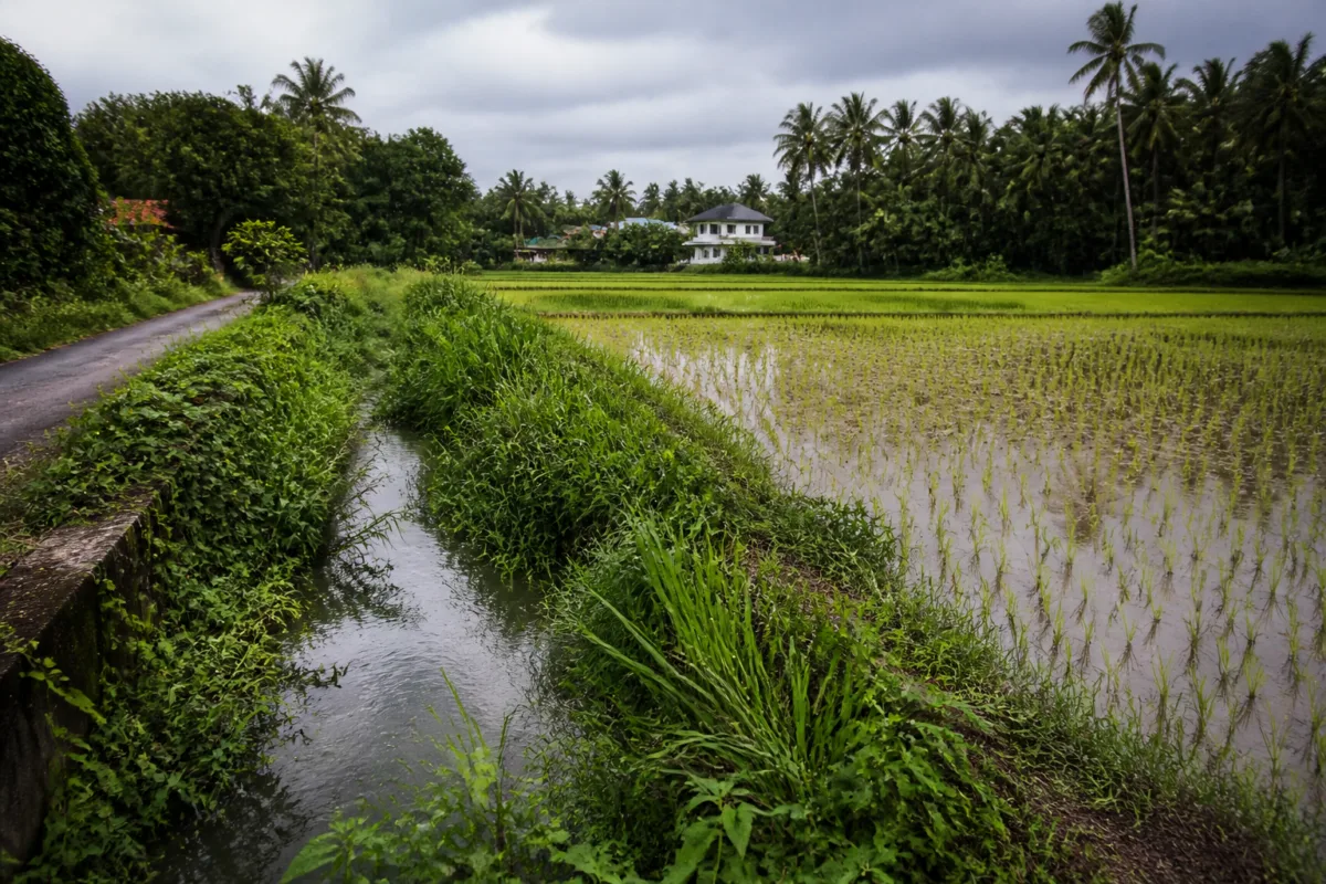
Rice planting has resumed in the Parakkadavu-Poovathussery paddy fields, but farmers are already facing waterlogging in parts of the fields after intermittent heavy rain. The immediate concern is that newly planted seedlings could rot if stagnant water remains. The larger problem, however, is not a single spell of rain. It is the fragile drainage system on which farming, nearby homes and the future of a 500-acre protected paddy landscape depend.
The fields lie in the Parakkadavu area near the Ernakulam-Thrissur district boundary. They are connected to the Chalakudy river through three drainage channels: the 2.5-kilometre Elathodu, the three-kilometre Vazhar Thodu and the 3.5-kilometre Aluvathodu. When these channels are clear, water from the paddy fields can move towards the river. When vegetation and silt obstruct them, the fields become a storage basin with limited capacity to drain after rain.
That distinction matters because the fields are not simply agricultural land waiting for development. The paddy area is protected for rice cultivation and has high productive capacity, according to the report. Around 250 acres are continuously cultivated, while roughly 200 farmers work through two rice producer committees. The wider paddy tract covers about 500 acres. Its drainage condition therefore affects both food production and the functioning of a landscape that also helps hold and move excess water.
The present planting follows a difficult history. The area once supported three rice crops a year, but waterlogging has reduced cultivation to one crop. For several years, farmers have followed a cycle in which planting begins in October and harvesting takes place in March. The current crop was started after the March harvest. Farmers used 5.5 tonnes of Ponmani seeds to raise the seedlings now being transplanted.
Two years ago, waterlogging destroyed the entire crop in the fields, the report says. The immediate cause identified by farmers was the failure to clean the Elathodu, Vazhar Thodu and Aluvathodu. Last year, following complaints from farmers and local representatives, the channels were cleaned under the Operation Vahini project. Farmers then resumed cultivation in October and obtained a good harvest in March.
The sequence shows why routine maintenance is more important than one-time intervention. Cleaning the channels restored enough flow for cultivation in the previous season, but the report says parts of Vazhar Thodu have again become overgrown after the post-harvest rains. If the three channels do not work as a connected system, cleaning one section or one channel cannot guarantee that water will reach the Chalakudy river.
This is the central infrastructure question in Parakkadavu: whether drainage should be treated as a seasonal response or as permanent public infrastructure requiring scheduled maintenance. The channels are long, interconnected and dependent on open flow. Elathodu leads into Vazhar Thodu, while Aluvathodu forms another route towards the river. An obstruction at any critical section can slow the movement of water from the wider paddy area.
The effect is felt beyond the farm boundary. Around 100 nearby homes reportedly face recurring waterlogging. This means the drainage network serves two connected functions: it supports agricultural production and reduces the exposure of surrounding residents to stagnant or rising water. When the channels fail, the loss is shared by farmers, households and the local landscape.
Farmers are now seeking timely cleaning of all three channels rather than waiting for waterlogging to become an emergency. Their demand is practical: if the channels remain clear, water can leave the fields more efficiently and newly planted rice will have a better chance of surviving heavy rain. The report does not establish that cleaning alone would eliminate every flood risk, but it clearly links previous crop loss and the improvement seen last year to the condition of the channels.
Farmers have also proposed a more permanent engineering solution: a 750-metre boundary drain along the district boundary between Ernakulam and Thrissur. The proposed route would follow a six-foot-wide path where boundary stones were historically placed. It would begin near the point where Elathodu and Vazhar Thodu meet and extend towards the Kochukadavu ferry point on the Chalakudy river.
The proposal would require the drain to pass along part of the Aluva-Eramathur road and cross the road at one point. Farmers say the new route could remove water from the paddy fields more quickly and benefit cultivators in Kuzhur panchayat as well. They have also suggested placing slabs over the drain so that it could serve as an access route to the fields.
A further proposal is to install a shutter at the Kochukadavu ferry point. The purpose would be to prevent water from the Chalakudy river flowing back into the fields when the river level rises during the monsoon. This identifies a second part of the drainage problem: water must not only be able to leave the fields, but also be prevented from returning through the same network when downstream levels are high.
The proposed boundary drain therefore represents more than an additional canal. It is an attempt to separate local field drainage from the risk of backflow and to create a more direct connection with the river. But its implementation would require coordination across panchayat boundaries, the two districts, the road authority responsible for the road crossing and the agencies responsible for the river-side structure. The supplied report does not indicate whether a technical survey, land assessment, cost estimate or administrative approval has been completed.
That institutional complexity is part of the reason why drainage failures can persist even when the physical solution appears straightforward. The three existing channels and the proposed boundary drain do not fall into a single functional category. They involve agricultural land, local roads, inter-panchayat boundaries and a river outlet. Maintenance, construction and flood control may therefore involve different authorities and budget lines. Without a clear maintenance calendar and responsibility for each section, a channel can again become overgrown after a successful cleaning operation.
The history of cultivation provides a useful measure of what is being lost. The fields supported three crops a year about 25 years ago. Today, waterlogging has reduced that to one crop. The change is not presented as the result of a single failed season. It reflects a gradual weakening of the drainage system and the repeated consequences for farm viability. A productive paddy landscape has been pushed from multiple harvests towards a narrower annual cycle.
The figures also show why the issue cannot be dismissed as a small local inconvenience. The landscape covers approximately 500 acres, with continuous cultivation on about 250 acres and around 200 farmers dependent on it. The three channels together extend for roughly nine kilometres. Nearby households are also exposed to waterlogging. Even without a published estimate of crop value or household losses, the scale of land, labour and infrastructure involved makes the drainage question a significant local governance issue.
The recent use of 5.5 tonnes of seed and the good harvest reported after last year’s cleaning demonstrate that farmers continue to invest in cultivation when the physical conditions allow it. Their decision to plant again reflects confidence in the productive potential of the land, but it also exposes them to a recurring operational risk. Seed, labour and planting effort can be lost if water remains in the fields at the wrong stage of the crop cycle.
The evidence in the report does not establish whether changing rainfall patterns are responsible for the current waterlogging, nor does it provide hydrological data on the channels or the river. It does establish a repeated relationship between channel obstruction, stagnant water and crop damage. It also records that cleaning carried out last year was followed by renewed cultivation and a good harvest. Those facts support the case for maintenance and a technical assessment, while leaving the broader design and capacity questions open.
Parakkadavu’s experience illustrates a wider principle of flood management: drainage is a network, not an isolated excavation. A channel can be newly cleaned and still fail if the next section is blocked, if the outlet is constricted or if river levels cause backflow. Agricultural protection, household safety and water management therefore converge in the same system.
The immediate test is whether the three channels will be cleaned before waterlogging damages the newly planted crop. The longer-term question is whether authorities will establish a coordinated solution for the existing channels, the proposed 750-metre boundary drain and the suggested shutter at the river outlet. Until that system is maintained as connected infrastructure, the return of rice cultivation to Parakkadavu-Poovathussery will remain vulnerable to the same drainage failure that has already reduced three annual crops to one.

