


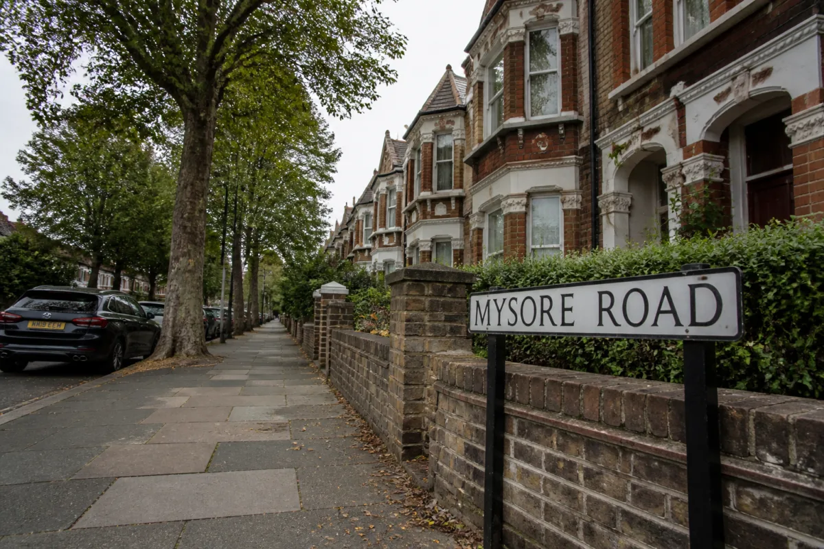
The sight of Mysore Road, Mysore Street or Bangalore Street in London can feel like a distant urban connection to Karnataka. But these names do not indicate Kannada neighbourhoods or direct municipal links with Mysuru and Bengaluru. They are part of a larger system through which London’s streets preserve the history of trade, imperial administration, war, migration and political relationships.
That distinction is important. A road name is often treated as a simple navigation device, but London’s examples show that it can also function as a historical record. The names survive in the everyday landscape, attached to residential streets and neighbourhoods whose present-day life may have little visible connection with the places they commemorate. For visitors from Karnataka, the names can create a moment of recognition. Historically, however, they point to the period when Britain’s imperial influence shaped how places across the world were represented in the capital.
The reported presence of these names does not mean that London’s Mysore or Bangalore roads were created as extensions of the Indian cities. The source makes clear that there is no direct contemporary relationship between the roads and the cities after which they are named. Nor are they described as areas settled by Kannada-speaking residents. Their significance lies instead in the circumstances under which British institutions and communities named streets during the expansion of London and the wider influence of the British Empire.
This is one reason street-name history matters to urban readers. Cities are built in layers. A new road, housing development or neighbourhood may be planned for an immediate practical purpose, but its name can carry older political or economic relationships into the present. In London, names linked to countries, cities and public figures sit alongside names that originated in local trades, land ownership, religious institutions and physical geography. The result is a map that records different periods of urban development at the same time.
The reported list includes India Street, Cuba Street, Moscow Road, Jamaica Road, Lisbon Avenue and Denmark Hill. These names do not share a single origin. Some reflect colonial administration, while others are associated with trade, migration, royal connections or wars. Lombard Street, for example, is linked in the report to traders from Italy’s Lombardy region. Denmark Hill is associated with the Danish prince George, who hunted in the area during the 17th century.
The point is not that every international name has the same political meaning. Rather, London’s street map demonstrates how different kinds of relationship become embedded in the built environment. Some names reflect commercial activity. Milk Street, Bread Street and Haymarket are cited as examples of streets named after older trades or markets. Others are connected to landowners, local estates or religious bodies. Still others refer to geographical characteristics. The naming system is therefore both historical and practical: it helps identify places while carrying traces of how the city developed.
War and imperial power form another layer. The report links Portobello Road to the British admiral Edward Vernon’s capture of the city of Portobelo in Panama in 1739. Belgrade, the Serbian capital, also appears in a London street name associated with Serbia’s support for Britain during the First World War. In the Indian context, Havelock Road, Canning Road, Lucknow Street and Khanpur Road are described as reminders of Britain’s military and administrative relationship with the subcontinent.
These examples reveal the uneven way public memory enters cities. A street name may commemorate a place without explaining the conflict or administrative structure behind it. For a resident, it may simply be an address. For a visitor or historian, it may open a route into questions about who had the authority to name urban space, which events were considered worthy of commemoration and how imperial relationships were normalised through ordinary infrastructure.
The Bangalore Street in the Putney area of the London Borough of Wandsworth offers a more specific example. According to the report, the name was officially adopted in 1898. A plan for constructing 27 houses on the street was prepared on 20 May 1901, while the remaining houses were built between 1900 and 1929. The street is described as a quiet residential road lined with homes rather than a busy urban corridor resembling Bengaluru’s major roads.
Some houses on Bangalore Street were damaged during the Second World War, after which new homes were built on the same site. That detail adds another layer to the street’s history. Its identity is not only connected to a name chosen in the late 19th century; it also reflects the physical changes brought by war, reconstruction and the gradual completion of a residential neighbourhood. The street’s present form is therefore the result of several urban processes rather than a single act of naming.
The report also refers to Mysore Road and Mysore Street in London. It does not establish a direct link between these roads and the current administration, planning or transport systems of Mysuru. Their value as evidence lies in what they show about the vocabulary of the city during the period when British power extended across India. In contemporary use, the names have acquired an additional meaning for Karnataka’s visitors: they can evoke a familiar place far from home, even though the original naming process belonged to a different political era.
London’s naming practices, as described in the report, also involve rules intended to reduce confusion and maintain administrative clarity. Streets in the same area are generally not given identical names. Living people are normally not commemorated through street names, and naming a street after a deceased person is subject to certain standards. Ease of pronunciation is also treated as a consideration. These rules show that street naming is not merely symbolic. It has an operational role in addressing, navigation and the organisation of urban services.
That administrative function can coexist with historical meaning. A name must be usable by residents, visitors and public agencies, but it may also preserve a contested or complicated past. The same sign can work as a practical address and as a reminder of empire. This dual role is particularly visible when names associated with colonial rule remain in ordinary residential settings, detached from the institutions or events that originally gave them meaning.
The report’s reference to Gandhi Close illustrates a different relationship between naming and political memory. Located in the London Borough of Waltham Forest, the residential area is named after Mahatma Gandhi, who opposed British rule in India. Unlike the names connected to imperial administration or military campaigns, Gandhi Close commemorates an anti-colonial leader. Its presence suggests that the city’s historical vocabulary is not fixed around one official narrative. Different periods and figures can enter the map through different forms of recognition.
This does not resolve the question of how cities should handle names inherited from difficult histories. The supplied material does not document any current renaming debate in London, nor does it establish whether residents or local authorities are seeking changes to the names discussed. What it does show is that naming decisions made in one period can continue to shape how later generations encounter the city. The names remain, while their meanings can change with distance, migration and public understanding.
For Bengaluru and Mysuru, the London examples offer a reminder that urban identity travels through more than buildings, businesses or migrant communities. It can also travel through administrative language and inherited maps. At the same time, the connection should not be overstated. The roads are not described as extensions of Karnataka’s cities, and the report does not identify present-day institutional ties between them. Their connection is historical and symbolic rather than municipal.
The broader urban question is who gets to name a city and what remains visible after the original power structure has changed. Street names are small pieces of infrastructure, but they influence addresses, postal systems, navigation, property records and public memory. They can preserve local occupations, geographical features and community histories, while also carrying the imprint of empire, war and political authority.
London’s Mysore, Bangalore and other international street names therefore matter not because they create a direct link between distant municipalities, but because they demonstrate how cities retain relationships in physical form. A quiet residential road can contain the record of a global political era. For today’s visitors, that record may produce recognition and pride. For urban historians and planners, it also raises a more difficult question: how should a modern city read, explain and manage the inherited names that continue to organise everyday life?

