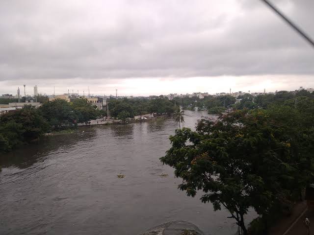
HYDERABAD: Hyderabad’s rapid urban expansion is emerging as a major factor behind its growing flood vulnerability, with a new study linking the sharp rise in built-up surfaces to reduced rainwater absorption. The research suggests that the city’s flood challenge is no longer only about intense rainfall. How land is developed, drained and managed is becoming equally important for the city’s resilience.
A study published in Environment, Development and Sustainability examined five major flood events between 2000 and 2024. It found that impervious surfaces, including buildings and roads, increased from 36.04% of the city’s area in 2000 to nearly 60% in 2024. Over the same period, vegetation and waterbodies declined. The findings carry implications for Hyderabad’s infrastructure and real estate growth. Concrete and other sealed surfaces prevent rainfall from soaking into the ground. Water therefore moves faster across streets and plots, placing greater pressure on drainage systems during heavy downpours. Importantly, the researchers did not find a statistically significant long-term rise in rainfall over the study period. This shifts attention towards land-use change and urban expansion as key contributors to rising flood exposure. The research found a positive relationship between built-up areas and flood extent, while vegetation and waterbodies were associated with lower flood exposure.
Drainage capacity remains another concern. The study, citing Hyderabad Metropolitan Water Supply and Sewerage Board data, reported that nearly 80% of the city lacks dedicated stormwater drainage networks. It also assessed the existing network at 73 km of natural drains, 44 km of side drains, 860 km of covered drains and 316 km of open drains, with an estimated effective carrying capacity of about 12 mm of rainfall an hour. The risk is not uniform across the city. Drainage limitations were identified as important factors in Saidabad and Safilguda. In Malakpet, low-lying terrain combined with dense development increases exposure. Urban expansion was a dominant factor in Uppal, while extensive impervious cover emerged as a major concern in Khairatabad. For Hyderabad’s expanding built environment, the findings raise questions about whether conventional infrastructure can keep pace with the consequences of land conversion. Drain expansion alone may not address the problem if new development continues to reduce natural spaces that absorb and temporarily store rainfall.
The study points towards a more distributed approach. Protecting waterbodies, improving drainage, and incorporating permeable pavements, rain gardens and bioretention areas could help retain rainfall closer to where it falls. Such measures can also reduce pressure on downstream infrastructure. The larger challenge is planning growth around the city’s natural drainage patterns. For Hyderabad, flood resilience will increasingly depend on treating open land, vegetation and water systems as infrastructure rather than leftover urban space.