


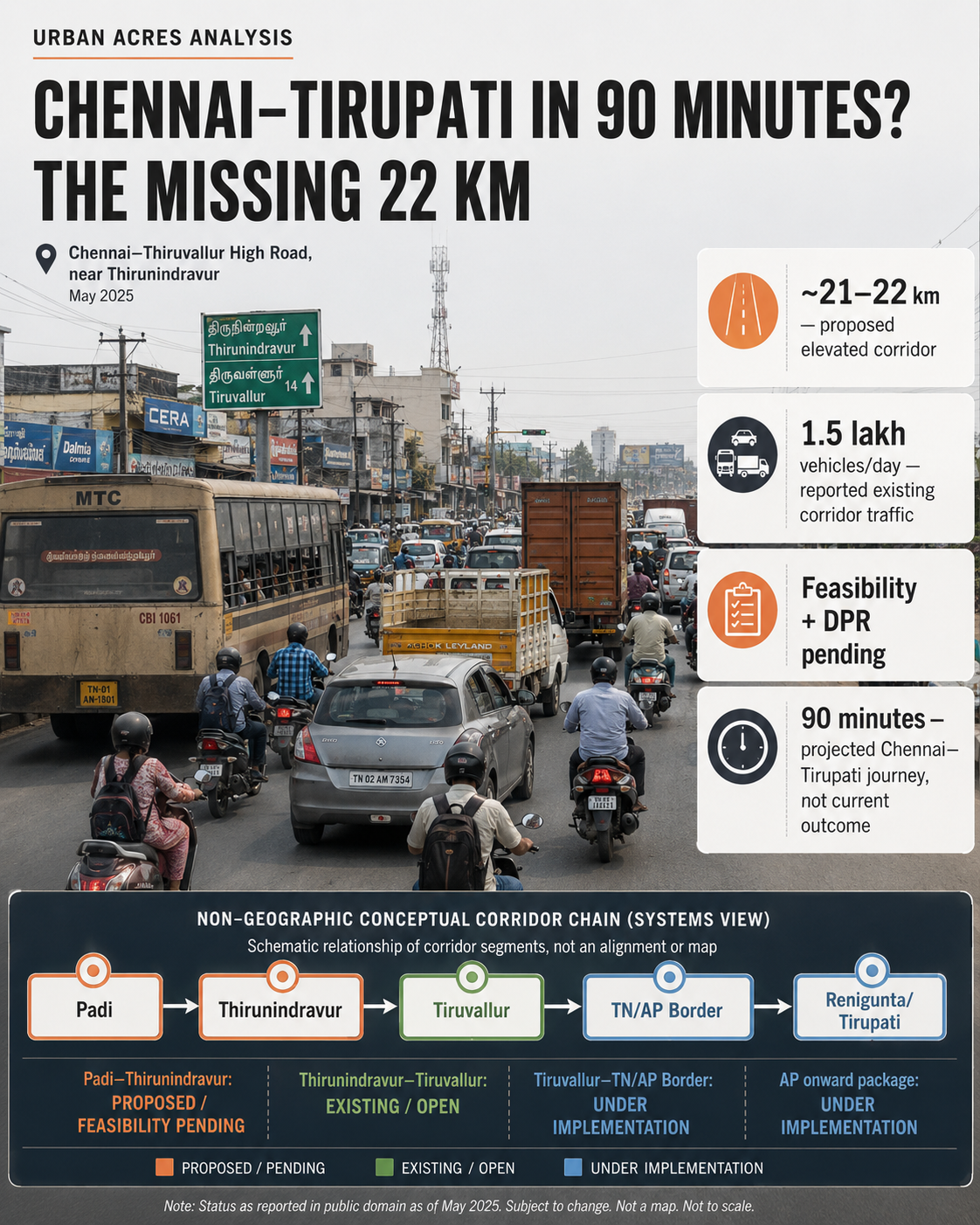
The proposed 21–22 km corridor could remove one of the slowest sections of the Chennai–Tirupati road journey, but feasibility, design, land, cost and financing remain unresolved—and the promised 90-minute trip depends on a much larger highway chain.
CHENNAI — Tamil Nadu has revived the question of how to move traffic through one of north-west Chennai’s most persistent road bottlenecks, this time with an elevated corridor proposed between Padi and Thirunindravur.
The proposal was announced in the Tamil Nadu Assembly on August 18 during debate over the Highways and Minor Ports Department. Subsequent reports have described a roughly 21–22 km elevated road that could substantially shorten travel through Padi, Ambattur, Avadi, Pattabiram and Thirunindravur.
But its project stage matters.
The elevated corridor has not been sanctioned for construction. Officials have said consultants are to be appointed for a feasibility study, after which a Detailed Project Report would be prepared. Cost, final lane configuration, ramps, construction method, implementation schedule and financing consequently remain unsettled.
That makes the immediate story less about a new flyover being built and more about whether Tamil Nadu can resolve a corridor problem that has survived successive widening and grade-separation proposals.
A new structure over an old constraint
The Chennai–Thiruvallur High Road through the western suburbs has faced capacity constraints for years.
Six-laning plans stretch back more than a decade, with acquisition and implementation slowed by the difficulty of widening an intensely developed road bordered by shops, homes and other structures.
Those widening efforts have not disappeared. Tamil Nadu Government Gazette notifications issued in 2025 show land being formally acquired for widening the Thirunindravur–Padi section of the Chennai–Thiruthani–Renigunda Road from four lanes to six.
That matters because the elevated proposal does not eliminate the surface-road problem.
Officials have said parts of the corridor are only about 45–50 ft wide and would need to reach approximately 80–90 ft to provide sufficient space for construction. Widening would therefore precede elevated construction wherever feasible.
Land is thus not a secondary issue. It is one of the project’s principal feasibility tests.
Why the Tirupati headline can be misleading
The project’s most eye-catching claim is that Chennai–Tirupati travel could eventually fall from roughly three hours to around 90 minutes.
That projection cannot be attributed solely to the elevated road.
The Padi–Thirunindravur section represents Chennai’s urban end of a longer transport chain. Beyond it, NHAI has been separately upgrading NH-716.
An approximately 18 km access-controlled section connecting the Thirunindravur side with Tiruvallur has already been reported open. Farther north-west, NHAI’s 43.95 km Tiruvallur–Tamil Nadu/Andhra Pradesh border Package I is a separate access-controlled highway project.
Across the border, another 37.43 km NHAI package covers the onward corridor towards Puttur and the Mallavaram–Renigunta section. Official government records have continued to describe that package as under implementation.
The correct service chain is therefore closer to:
Padi urban bottleneck → Thirunindravur → Tiruvallur bypass → TN/AP border → Puttur/Renigunta → Tirupati
Every link needs sufficient capacity and reliable operation for an end-to-end 90-minute journey.
The money is not yet known
Another discipline is necessary around cost.
The ₹153 crore cited in reporting relates to earlier land acquisition for road widening. It is not the cost of the proposed elevated corridor.
Likewise, the ₹21,524 crore associated with Tamil Nadu’s broader Highways budget covers a large programme of state road projects and cannot be treated as the elevated road’s financing.
No verified sanctioned cost for the Padi–Thirunindravur elevated facility was identified in the documents reviewed by Urban Acres.
That figure should come only after engineering scope and DPR work establish the structure, land requirement, ramps, junction treatments, utilities and associated road works.
The harder question is what happens below the viaduct
An elevated corridor can move through-traffic above junctions. It does not automatically solve the urban street beneath it.
Padi, Ambattur and Avadi are not simply points on an intercity highway. They are dense employment and residential districts with buses, pedestrians, two-wheelers, freight, industrial access and local commercial activity.
The DPR therefore needs to answer more than how quickly cars bound for Tirupati can travel.
It must establish how buses stop and interchange, where pedestrians cross, how properties retain access, how freight enters the Ambattur industrial area, how drainage and utilities are accommodated, and how traffic enters and exits the elevated facility without simply relocating congestion to its ramps.
That is the difference between an elevated highway project and an urban mobility solution.
The next meaningful milestone is not construction
For Urban Acres, the next reportable milestone should be consultant appointment and publication of the feasibility/DPR scope.
That document should reveal whether an elevated corridor genuinely performs better than widening plus selected grade separators; how much land is required; which junctions receive ramps; what traffic assumptions underpin the 25-minute Padi–Thirunindravur projection; and how the project interfaces with the completed and under-construction NHAI network.
Until then, the announcement establishes political and departmental intent.
It does not yet establish a buildable project.
