


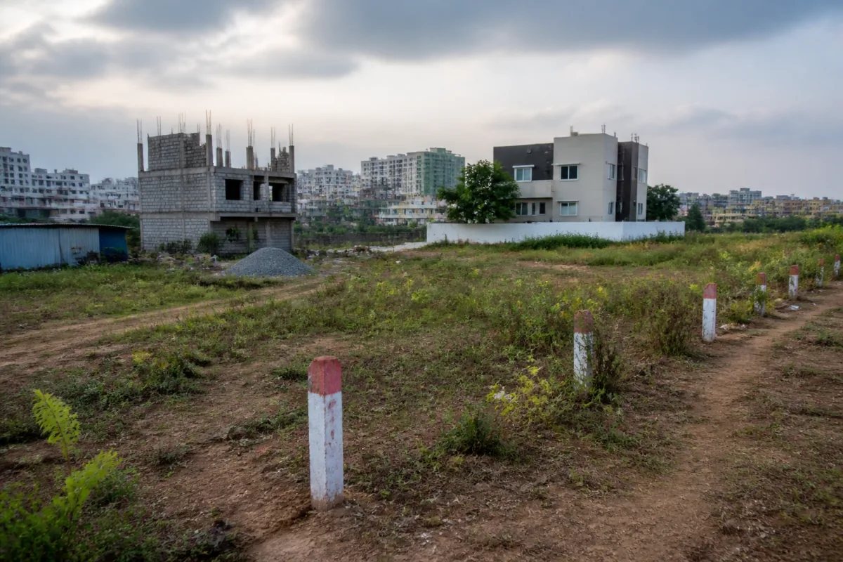
The reported encroachment of nearly 10 acres of Chengicherla endowment land is not simply a dispute over a valuable parcel. It exposes how gaps between revenue records, village maps, land surveys and municipal permissions can allow contested urban land to become physically occupied before ownership and boundaries are conclusively established.
The land, held by TLP Charities under the endowment department, covers about 30 acres across survey numbers 33/8, 33/9 and 33/10 in Chengicherla village in Medchal-Malkajgiri district. According to the report, nearly 10 acres is alleged to have been encroached upon, with the entire parcel valued at around Rs 100 crore. The endowment department has acknowledged allegations of encroachment, but a final survey intended to demarcate the property has not been completed because of a court stay on a comprehensive survey.
That unresolved survey is central to the dispute. Without a conclusive demarcation, the department has been unable to establish the precise ground boundaries of the endowment land and protect it through fencing, even as structures have emerged on the disputed portions over the last few years. The result is a familiar urban governance problem: the administrative record remains unsettled while the physical city continues to expand.
## Chengicherla endowment land and the records problem
The preliminary survey conducted in September 2024 found inconsistencies between older revenue records and scanned village maps. The survey was carried out by the assistant director of land survey and records, with officials from the endowment and municipal administration departments and the Medipally revenue office participating in the September 13 exercise.
The report cited a difference between the extent recorded in the 1974-75 pahanis and the area shown in the scanned village map. In survey number 33/8, the pahani recorded 15 acres, while the scanned village map showed 22 acres. In survey number 33/9, the corresponding figures were 16 acres and 18 acres. In survey number 33/10, the revenue record showed 13 acres, compared with 15.15 acres in the village map.
These discrepancies are not merely technical variations in old paperwork. They affect the basic question of where one parcel ends and another begins. In a fast-developing metropolitan region, that distinction determines which land can be sold, developed, fenced, granted permission or occupied. When different records represent different extents, subsequent transactions and approvals can inherit the original uncertainty.
The preliminary survey also found that the authentic village map did not contain sub-divisions within survey number 33. Another copy of the village map showed sub-divisions from 33/1 to 33/12, but the survey officials reportedly found that this version lacked authentication. This created a second layer of difficulty: the issue was not only the area shown against each survey number, but also the status and reliability of the map being used to interpret the land.
The distinction between an authentic record and an unauthenticated copy is especially important when permissions are issued on the ground. If neighbouring landowners claim that a different survey number applies to the disputed land, and those claims are accepted for development purposes, the administrative process can move ahead even while the underlying ownership and boundary questions remain unresolved.
## How disputed land becomes an urban development issue
Complaints were reportedly sent to the Medchal-Malkajgiri district collector and the endowment commissioner alleging that neighbouring landowners had encroached upon the endowment property by using other survey numbers. The complaints also alleged that permissions were obtained from the Hyderabad Metropolitan Development Authority for a layout and from the then Boduppal Municipal Corporation for a villa project.
The report does not establish that these permissions were wrongly granted or that the projects were built entirely on endowment land. It does, however, show how the case moved beyond a private boundary dispute. Once layout or building permissions are issued, a contested parcel can acquire roads, structures and other physical features that make administrative correction more difficult.
This is the institutional gap at the heart of the Chengicherla case. The endowment department is responsible for protecting its land, revenue and survey authorities maintain or interpret land records, and urban agencies examine development permissions. Each institution may act within its own mandate, but the protection of a parcel depends on those mandates being aligned before construction begins.
The report indicates that the endowment department could not fence or demarcate the entire land because the final survey was stalled. At the same time, structures appeared on the land during the period in which the records remained disputed. Physical occupation therefore advanced faster than the process intended to verify the official boundary.
## The administrative cost of an unresolved stay
Medchal collector Manu Chowdhary wrote to the land survey department in July 2025 seeking a comprehensive survey to protect the endowment land. According to the report, the survey did not proceed because of court cases and the stay. The endowment department also had not made efforts to get the stay vacated and complete the survey, the report stated.
The court stay is therefore not a minor procedural detail. It has become the point at which land administration, litigation and physical development intersect. While the stay prevents or delays the survey, the department’s inability to establish the boundary weakens its capacity to demonstrate encroachment conclusively. Meanwhile, the presence of houses or project-related structures can create additional claims and complications.
The available report does not specify the court, the case number, the exact terms of the stay or whether the order prohibits all survey activity or only a particular form of survey. Those details would be important for understanding what action remains legally possible. The report does establish, however, that the stay has prevented the comprehensive exercise sought by the district administration.
That distinction matters for accountability. A stay may explain why an administrative action was not completed, but it does not by itself resolve who is responsible for protecting the land during the delay. The reported failure to pursue vacation of the stay raises a further institutional question: whether valuable public or charitable land has an active legal and monitoring strategy while its records are being contested.
## Why old records matter to expanding cities
The Chengicherla dispute also demonstrates why legacy land records remain central to modern urban development. The survey relied on pahanis from 1974-75 and compared them with scanned village maps. These records were created in different administrative and technological contexts, yet they continue to determine land identity in an expanding urban region.
Digitisation can make records easier to access, but it does not automatically reconcile contradictory source documents. A scanned map preserves what was recorded; it does not necessarily establish which of two conflicting records is legally authoritative. That requires verification, adjudication and a clearly accepted spatial boundary.
The report’s figures illustrate the scale of the mismatch. Across the three survey numbers, the pahanis recorded a combined 44 acres, while the scanned village maps showed 55.15 acres. The difference is 11.15 acres. This is not proof that any particular party occupied endowment land, because the records themselves require legal and administrative interpretation. It is evidence, however, that the land information available to officials did not present a single consistent extent.
That uncertainty becomes more consequential when the same land is viewed through different administrative systems. Revenue records identify survey numbers and extents. Survey officials interpret maps and boundaries. Municipal bodies assess development proposals. Metropolitan planning authorities examine layouts. The case suggests that permissions may be processed within this fragmented system even when the parcel’s underlying identity remains under dispute.
## The bigger urban question
The Chengicherla case raises a structural question about how cities protect institutional land before it is absorbed into the built environment. Land belonging to religious and charitable institutions is often treated as a property-management issue, but once it lies within an expanding urban area, its protection becomes part of metropolitan governance. Boundary failure can affect roads, layouts, housing projects, municipal services and the legal status of people who later occupy or purchase space there.
The reported allegations also show why the first visible sign of a land-record failure may be construction rather than paperwork. By the time structures appear, the dispute has acquired residents, developers, permissions and sunk costs. The administrative task then becomes more difficult than simply identifying an unoccupied boundary and fencing it.
The evidence in this case confirms three points: the endowment department claims ownership of about 30 acres across the three survey numbers; a preliminary survey found major discrepancies between pahanis and village maps; and the comprehensive survey needed for final demarcation has remained incomplete because of a court stay. What remains unresolved is the legally authoritative extent of each survey number, whether the disputed permissions overlap endowment land, and what steps the relevant departments can take while litigation continues.
Those questions will determine whether Chengicherla becomes a settled boundary correction or another prolonged urban land dispute in which records remain uncertain while development becomes permanent.

