


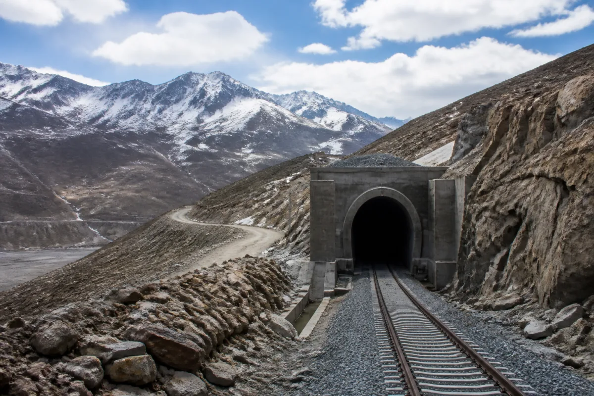
India’s proposed Bilaspur-Manali-Leh railway line is being presented through one striking possibility: a station beneath Tanglang La at about 5,256 metres could become the world’s highest railway station if the planned alignment and elevation are completed. But the more consequential story is the infrastructure challenge behind that record. The 489-km broad-gauge corridor would require about 270 km of tunnels, cross difficult Himalayan geology and remain, for now, a project at the Detailed Project Report stage.
According to the railway ministry information cited in the Times of India report, the survey for the corridor has been completed and its DPR prepared. The estimated cost in the DPR is approximately Rs 1.31 lakh crore. The proposed line would connect Bilaspur in Himachal Pradesh with Leh in Ladakh through Sundernagar, Mandi, Manali, Sissu, Darcha, Keylong, Sarchu, Pang, Rumtse, Upshi and Kharu.
That route places the project within two overlapping systems. It is a transport proposal for passengers and goods, but it is also identified as strategically significant by the ministry of defence. The railway would offer an alternative connection towards Ladakh, where movement currently depends largely on road and air links. The Manali-Leh highway is an important route, but high-altitude stretches and severe weather can affect movement, especially during winter. A rail link could add another transport option for civilian travel, supplies and logistical requirements.
The distinction between a completed project and a prepared DPR is central to understanding what has actually happened. A DPR establishes the proposed alignment, technical basis and estimated cost. It does not by itself approve construction, release the full project cost or establish an opening date. The report does not state that construction has begun, nor does it provide a completion deadline.
The proposed Tanglang La station is the project’s most visible engineering feature. At around 5,256 metres above sea level, it would be higher than China’s Tanggula railway station on the Qinghai-Tibet Railway, which is cited at about 5,068 metres. If built as planned, the difference would place the Indian station at the top of the global railway elevation table.
Yet a record altitude does not explain the project’s full difficulty. More than half of the proposed corridor would run underground: around 270 km of tunnels over a total alignment of 489 km. The route would have to negotiate steep gradients, high-altitude terrain, difficult geological formations and extreme weather. The railway ministry has highlighted geological uncertainties and construction challenges associated with the Himalayan stretch.
The tunnel proportion also changes the nature of the project. This is not simply a matter of extending tracks across a mountain highway corridor. It involves creating a long underground railway system in terrain where access, construction logistics and geological conditions can vary sharply along the alignment. The supplied report does not provide a final tunnel-by-tunnel design, construction schedule or detailed breakdown of the estimated cost. Those details would be important for assessing how the DPR could translate into an executable project.
The corridor’s proposed geography shows why the line is both attractive and difficult. From the lower-altitude sections around Bilaspur, Sundernagar and Mandi, the alignment would move towards Manali and then into the high-altitude landscape through Sissu, Darcha, Keylong, Sarchu, Pang and Tanglang La before reaching the Leh region. The railway would therefore have to connect areas with very different terrain and operating conditions within one strategic corridor.
The project also sits within an existing network of incomplete and delayed railway works in Himachal Pradesh. The 63-km Bhanupali-Bilaspur-Beri railway line, which is expected to strengthen connectivity in the state and is linked to the broader proposed expansion towards Leh, has faced delays over land acquisition and the availability of the state’s financial contribution.
In October 2026, the Himachal Pradesh High Court quashed the preliminary land acquisition notification for that project. The court ruled that the government had failed to comply with statutory requirements for extending the deadline to issue the land acquisition declaration. That case does not determine the future of the Bilaspur-Manali-Leh line, but it shows how administrative and legal processes can affect railway construction before major engineering work begins.
For the longer corridor, land acquisition may not be the only institutional challenge. The project would involve the railway ministry, the defence establishment, the Himachal Pradesh government, authorities in Ladakh and agencies responsible for land, environment and local administration. The available report does not specify the final funding arrangement, construction packages, clearances or division of responsibilities. Those elements will determine whether the DPR can progress into sanctioned works.
The estimated cost of Rs 1.31 lakh crore also makes the project a major public investment decision. At this stage, the figure is an anticipated DPR estimate, not a final expenditure. Costs could be affected by the extent of tunnelling, geological conditions, access roads, construction seasons, safety systems, stations and the requirements of operating in extreme altitude. The source material does not provide a financing schedule or an approved budget allocation, so the project’s fiscal pathway remains unspecified.
The numbers nevertheless establish the scale of the proposal. A 489-km railway with approximately 270 km of tunnels would have an underground share of more than half the corridor. The proposed station at 5,256 metres would be around 188 metres higher than the cited Tanggula station. These figures make the project a potential engineering landmark, but they also show why the line cannot be evaluated only through the symbolism of reaching a world record.
Its practical value would depend on how reliably it could operate, what freight and passenger capacity it would provide, and how the railway would integrate with roads and existing settlements along the route. The report identifies possible benefits for passengers, goods and logistical movement, but does not establish projected traffic volumes, journey times, fares, freight capacity or operating frequency. Those questions are likely to become more important if the project advances beyond the DPR stage.
There is also a difference between strategic connectivity and everyday urban mobility. Leh and the settlements along the route are not simply destinations on a national map; they are communities connected by seasonal roads, supply chains and difficult mountain access. A railway could alter the movement of goods and people, but the supplied evidence does not yet establish how stations would be located, how local access would be organised or how the line would serve communities beyond its strategic function.
The proposed Bilaspur-Manali-Leh line therefore represents two stories at once. One is the possibility of India building the world’s highest railway station. The other is a test of whether a very large strategic infrastructure plan can move through surveys, technical design, approvals, land processes, funding and construction in one of the country’s most difficult environments.
What is confirmed is that the survey has been completed, a DPR has been prepared and the proposed cost is approximately Rs 1.31 lakh crore. The planned alignment, including about 270 km of tunnels and a station beneath Tanglang La, remains a proposal rather than an operating railway. The next significant developments will be any decision on project approval, funding, statutory processes, construction packages and implementation timelines.

