


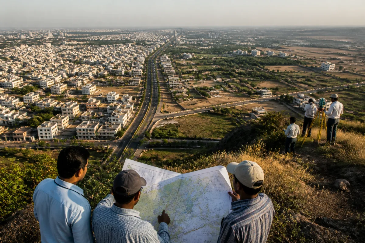
A citizen objection to Bhopal’s draft master plan has exposed a problem that is larger than a disagreement over decimals: the plan appears to use different density assumptions while calculating how much land the city will need by 2047. That matters because the same set of calculations is being used to justify both the city’s future expansion and a proposal to develop around 30,000 hectares over the next 21 years.
The objection, submitted ahead of the October 25 deadline for public suggestions, questions whether the draft has applied a consistent method to population projections, residential density, available land and future development requirements. Prof HM Mishra, former director of the National Institute of Governance and Urban Management, said the figures need to be reconciled and the methodology explained before the plan is finalised.
The issue is not simply whether one number in the document is correct. A master plan converts assumptions about future population and urban form into decisions about land. Once those assumptions influence proposed expansion areas, infrastructure planning and development permissions, a mismatch in the underlying calculations can affect the physical shape of the city for decades.
## The arithmetic behind Bhopal’s draft master plan
The draft calculates that Bhopal will require 16,000 hectares to accommodate an additional 20 lakh people by 2047. That calculation uses a density of 125 persons per hectare. The document then states that 5,252.36 hectares are available, leaving an additional land requirement of 10,747.64 hectares.
The objection focuses on the fact that the draft cites a different residential density of 90.47 persons per hectare elsewhere. A box on the same page gives another figure, 94.7. The concern is not that a master plan cannot use more than one density measure. Different calculations may apply to different land categories or planning purposes. The concern, as presented in the objection, is that the draft does not clearly reconcile the figures or explain how each one is being used.
That distinction is crucial. If the requirement of 16,000 hectares for 20 lakh additional residents is based on 125 persons per hectare, the calculation follows a particular planning assumption. At a lower density, the same population would require more land. At a higher density, it would require less. The document therefore needs to make clear whether 125 persons per hectare is a citywide planning standard, a residential-area assumption, or a figure used for a specific stage of the calculation.
The numerical difference is substantial enough to affect the plan’s land requirement. The draft’s own figures indicate that 5,252.36 hectares have been counted as available. The resulting additional requirement of 10,747.64 hectares depends on the initial 16,000-hectare estimate. If the density or the definition of available land changes, the balance also changes. Without a consolidated explanation, readers and stakeholders cannot easily determine how the land requirement was derived.
## Why density is a planning decision, not just a statistic
Population density is one of the main links between demographic projections and land-use planning. It determines how many people are expected to live within a given area and, indirectly, how much land may be reserved for residential development. It also influences the scale and distribution of roads, public facilities and other urban services, although the supplied material does not establish how the draft accounts for those elements.
The objection compares the draft’s proposed density with the 125–175 persons per hectare range cited in the Urban and Regional Development Plans Formulation and Implementation Guidelines for large cities in plain areas. Mishra has questioned whether the draft sufficiently explains how Bhopal’s geographical constraints translate into its overall land requirement and how the guidelines apply to a city of Bhopal’s population and size.
This is a question of method rather than of automatically selecting the highest or lowest density. A guideline range does not, by itself, determine the correct figure for a particular city. The planning document must show why it has selected a specific assumption, what land is included in the calculation, and whether the figure refers to gross urban land, residential land or another category. The objection indicates that this explanation is not consolidated clearly enough in the draft.
The difference between the density cited in the main calculation and the densities appearing elsewhere also creates a communication problem. A master plan is a long-term public document, and its assumptions need to be understandable to the people asked to comment on it. If a resident, institution or public authority cannot follow the path from population projection to land requirement, meaningful scrutiny becomes more difficult.
## The 30,000-hectare question
The objection also seeks clarity on the proposal to develop around 30,000 hectares over the next 21 years. That figure is larger than the 10,747.64 hectares identified as the additional requirement after accounting for stated available land. The supplied report does not establish whether the 30,000 hectares refers to newly urbanised land, the total area covered by a planning intervention, land reserved for multiple uses, or a broader development boundary.
That distinction must be made explicit. The two figures may serve different purposes, but the draft needs to show how they relate. A plan that identifies 10,747.64 hectares as the additional requirement and separately proposes development over around 30,000 hectares should explain the categories included in each number. It should also state how existing developed land and projected population growth are treated.
This is where the objection moves from a numerical discrepancy to a question about the scale of Bhopal’s future urban footprint. If the 30,000-hectare figure represents the area expected to undergo development, the plan needs to connect it to the projected population and the density standard. If it represents a wider planning area, that should be stated in terms that distinguish land earmarked for urbanisation from land included for administrative or strategic planning purposes.
The absence of that consolidated explanation leaves an important part of the draft open to interpretation. The concern is not necessarily that the proposed expansion is unjustified. Rather, the available information does not show whether the proposal is derived from the same assumptions as the population and density calculations.
## What the objection reveals about public participation
The deadline of October 25 gives the issue an immediate procedural importance. Public suggestions are most useful when the document under review presents its assumptions in a form that citizens can test. In this case, the objection uses figures from the draft itself to ask whether the plan’s internal logic is consistent.
That kind of scrutiny is particularly relevant for a document intended to shape growth until 2047. A master plan is not only a map of proposed land uses. It is also a statement of how a city expects its population, built-up area and development needs to change. If the assumptions are not transparent, public participation risks becoming a response to isolated figures rather than an informed assessment of the complete growth strategy.
The objection seeks a consolidated statement reconciling population projections, density standards, available land and future development requirements before the plan is finalised. Such a statement would allow the public to understand whether the 16,000-hectare requirement, the 5,252.36 hectares identified as available, the resulting 10,747.64-hectare balance and the proposed 30,000-hectare development figure belong to one calculation or to separate planning frameworks.
The supplied material does not indicate how the authorities have responded to the objection or whether the draft will be revised. It therefore cannot establish whether the figures are errors, different measures used for different purposes, or elements that require further explanation. What it does establish is that the current presentation has generated a material question about the plan’s internal consistency.
## The larger urban planning issue
Bhopal’s draft master plan brings into focus a recurring challenge in long-term urban planning: the city’s future land requirement depends as much on definitions and assumptions as on population projections. A plan may present precise figures, but precision does not resolve uncertainty unless the basis of each figure is clear.
In this case, the central questions are identifiable. How many additional residents are expected by 2047? Which density standard is used to translate that population into land? What does the draft count as available land? Why does the plan refer to both a 10,747.64-hectare additional requirement and development of around 30,000 hectares? And how are geographical constraints incorporated into the calculation?
The objection does not settle those questions. It establishes why they need to be answered before the plan is finalised. The next stage is therefore not simply a choice between expansion and densification. It is a test of whether the draft can present one traceable chain from population projections to density assumptions, land availability and the proposed development area.
Bhopal’s 2047 growth strategy will ultimately be judged not only by the land it identifies, but by the clarity with which it explains that land requirement. The October 25 public-suggestion deadline is the immediate milestone. The authority’s response to the objection, and any consolidated clarification or revision to the draft, will determine whether the disputed figures become an unresolved ambiguity or a transparent basis for the city’s long-term planning.

