


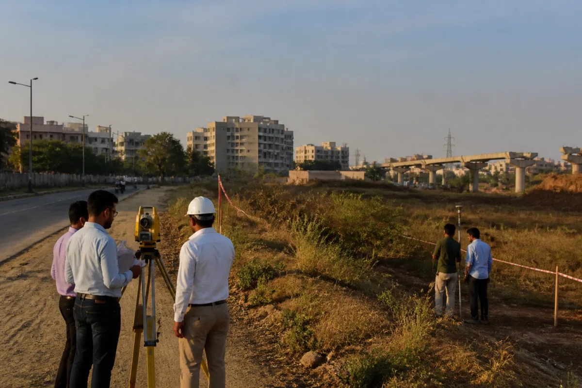
The proposed 7-km Thaltej-Godhavi Metro route has triggered a land-planning adjustment in Godhavi, where the Ahmedabad Urban Development Authority has approved a variation to Town Planning Scheme No. 457 to protect landholders affected by the proposed station and alignment. The decision is important not only because it clears an administrative hurdle for the metro project, but also because it shows how urban authorities are attempting to fit large transport infrastructure into already-planned land parcels without leaving affected institutions to absorb the loss.
According to a report by The Times of India, the AUDA board approved the first variation of TP Scheme No. 457 under Section 71 of the Gujarat Town Planning and Urban Development Act. The variation is intended to compensate the South West Ahmedabad Sports Arena, known as Swasa, if the final plot allotted to it is reduced because of the proposed metro route or station. Any reduction is to be offset by an equivalent area elsewhere within the same town-planning scheme.
The proposal places the Godhavi station at the centre of the land adjustment. The proposed station is planned on Final Plot No. 112/1, measuring 18,341 square metres. The plot is currently earmarked for social infrastructure under TP Scheme No. 457. The final plots allotted to Swasa and the Vidyavihar Education Society are adjacent to the proposed station site, meaning that the station and its alignment could affect land that has already been assigned within the scheme.
This is the central planning problem revealed by the decision: a metro project may serve a wider urban population, but its physical footprint is experienced through specific plots, institutions and property boundaries. A station cannot be built only as a line on a transport map. It requires land for the station structure, access, circulation and associated works. When that land overlaps with existing final plots, the project must negotiate with the planning framework that created those plots in the first place.
Town-planning schemes are designed to reorganise land ownership and infrastructure provision within a defined area. In this case, however, the source material does not describe a complete land acquisition process or a transfer of ownership. It describes a variation to an approved scheme so that land lost by affected institutions can be compensated with plots of equal size elsewhere in the same scheme. The distinction matters because the administrative solution is based on reallocation within the planning area rather than simply treating the affected institutions as obstacles to construction.
The AUDA board’s approval therefore performs two functions. First, it recognises that the metro alignment or station may reduce the area available to Swasa. Second, it establishes the principle that such a reduction should not result in a net loss of land for the institution. The same principle has been agreed for the Vidyavihar Education Society. The report says stakeholders agreed that any land lost by either organisation would be compensated through equal-sized plots elsewhere in TP Scheme No. 457.
The mechanism also illustrates the importance of coordination between transport agencies and urban-development authorities. The decision followed a meeting chaired by the AUDA chairman to review a proposal from the Gujarat Metro Rail Corporation Limited. Officials from AUDA and GMRCL attended the meeting, along with representatives of Swasa, the Vidyavihar Education Society and Tradelink Agency. The presence of these different parties indicates that the land issue required more than a technical alignment decision by the metro agency.
For GMRCL, the immediate objective is to secure a site on which the proposed Godhavi station can be constructed. For AUDA, the task is to modify the town-planning arrangement while preserving the stated land entitlement of affected institutions. For Swasa and Vidyavihar, the key issue is whether the final plots they receive after the variation remain equivalent in area. The agreement recorded in the report brings these interests into a single administrative process.
The case also highlights a recurring challenge in metro expansion: the difference between corridor-level planning and plot-level implementation. At the corridor level, the Thaltej-Godhavi extension is a 7-km transport proposal. At the plot level, its delivery depends on the treatment of a specific 18,341-square-metre site and the neighbouring final plots of two institutions. A project can be publicly accepted in principle while still requiring detailed decisions on land, access and compensation before construction can proceed.
The use of a TP scheme variation is significant because it keeps the adjustment within the same planning framework. The report does not state that the authorities are abandoning the existing scheme, acquiring new land outside it or paying monetary compensation. Instead, the approved approach is to modify the scheme and provide equivalent land elsewhere within its boundaries. This makes the planning instrument itself part of the metro-delivery process.
At the same time, the available information leaves several implementation details open. It does not identify the alternative plots that would be offered to Swasa or Vidyavihar. It does not state the precise area that may be lost by either institution, the revised boundaries of the affected final plots, or the timeline for completing the variation. It also does not specify whether the station footprint will require the entire social-infrastructure plot or only a portion of it.
Those details will determine how smoothly the agreement translates into construction readiness. An equal-sized replacement plot may preserve area, but the practical value of a plot can also depend on location, access, shape and permitted use. The supplied report establishes the commitment to equal-area compensation, but it does not provide enough information to assess the equivalence of the replacement land beyond its size.
The approval nevertheless reduces one identifiable source of uncertainty for the project. Without an agreed method of addressing the potential reduction in Swasa’s final plot and the impact on Vidyavihar, the proposed station could face an unresolved planning conflict. The AUDA decision creates an administrative route for modifying the scheme and allows the metro agency and urban authority to proceed towards a station site that has already been identified.
The case is also a reminder that public infrastructure projects operate through several layers of authority. GMRCL is responsible for the metro proposal, while AUDA controls the relevant urban-development and town-planning framework. The landholders affected by the alignment are not passive participants: their plots and institutional uses must be incorporated into the final arrangement. The meeting described in the report brought these institutional responsibilities together before the scheme variation was approved.
For Ahmedabad’s suburban growth areas, this type of coordination may become increasingly important as transport infrastructure enters locations where land has already been reorganised through town-planning schemes. The source material does not establish a broader pattern across the city, but the Godhavi case clearly shows that metro expansion and land-use planning cannot be handled as separate processes. A station changes the requirements of a plot, while the existing plot structure determines how the station can be delivered.
The decision also puts the legal and procedural basis of the project in view. Approval under Section 71 of the Gujarat Town Planning and Urban Development Act gives the proposed adjustment a formal statutory route. The report does not provide the text of the approval or describe any further permissions required, so the precise sequence of future steps remains unclear. What is established is that AUDA has approved the first variation and intends to modify the plan to facilitate station construction.
The most important question now is not whether the land issue has been recognised, but whether the approved compensation arrangement can be converted into a completed TP scheme variation and a workable station site. The next milestones will include identifying the replacement plots, finalising the revised scheme provisions and confirming the land requirements of the proposed Godhavi station. Until those details are documented, the decision should be understood as an important planning clearance rather than evidence that all land-related work has been completed.
The Thaltej-Godhavi Metro project therefore offers a focused example of how urban transport expansion depends on administrative instruments that are less visible than the metro line itself. The AUDA board’s decision protects the principle of equal-area compensation for Swasa and Vidyavihar while allowing the proposed station to be accommodated within TP Scheme No. 457. Its wider significance will depend on how the variation is executed and whether the replacement plots preserve the affected institutions’ land position in practice.

